Menu
  • Über uns
    • Unternehmen
    • Team
    • Karriere
    • Referenzen
    • Partner
    • Kontakt
  • Produkte
    • Erdbeobachtungsmetadatenoptimierer
    • Temperaturdaten
    • LST-Daten Client
    • Schulungen
  • Services
    • actinia – Geoprozessierung in der Cloud
    • Analyse von raumbezogenen Daten und Erdbeobachtungsdaten
    • CORONA Spionagesatellitendaten
    • maps.mundialis
    • Web Kartendienste
    • GIS Entwicklung
    • Open Source GIS
  • Märkte
    • Fernerkundung für die Landwirtschaft
    • Satellitenbilder für die Wiederherstellung von Wald- und Bodenbedeckung
    • Glasfaser-Trassenplanung – FTTH
    • Copernicus und Sentinel
  • News & Blog
    • News
    • Blog
    • Satellitenbild des Monats
  • English English
  • Deutsch Deutsch

HERMOSA Bulletin: Making sure that HERMOSA can interact with other platforms


27. April 2021 | Category General

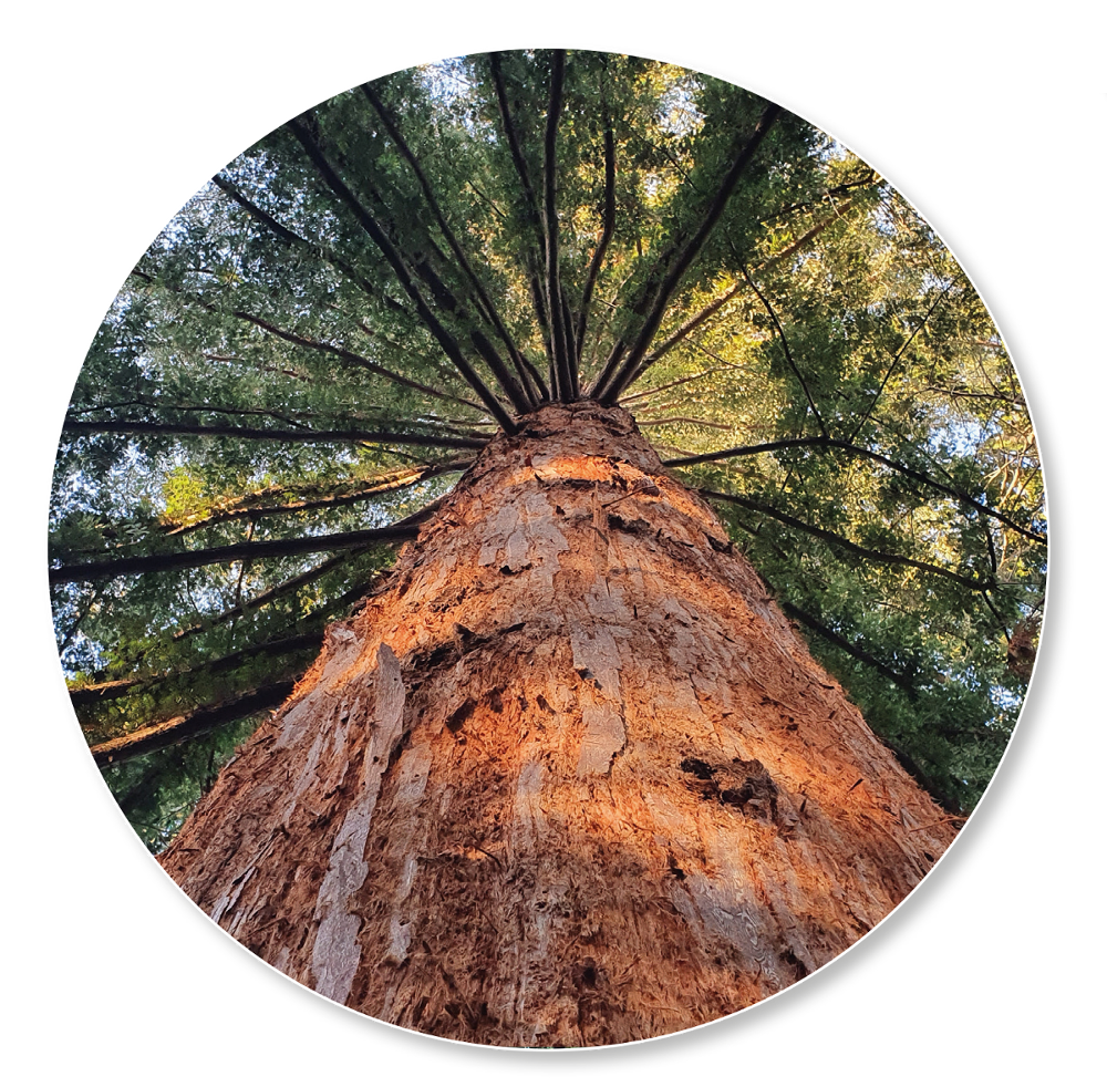
Not only the recent Earth Day of 2021 has made it clear once again that our planet is in a very poor condition. The atmosphere is heating up at an alarming rate, the forests are being cut down with ever increasing speed and the loss of biodiversity is something that humankind has never seen happening at this scale before. The scope of these problems are daunting and HERMOSA is setting out to provide projects with the much needed software support and transparency through the analysis of Earth observation data. In this context there are two questions regarding the role of HERMOSA:

  1. Is HERMOSA able to cater to all the projects engaged in every aspect of complex ecosystem restoration? The clear answer is no, you would have guessed that. The scope of the problem is just too large for one platform alone. But HERMOSA does what is possible to be helpful nonetheless.
  2. Is there some feature of the platform that increases the impact and scope of HERMOSA? Yes, there is: adhering to international standards and thus being able to interact with other systems is a big plus here.

The technical term for this interaction is called interoperability and is facilitated by a number of standards. These are issued, for example, by the Open Geospatial Consortium (OGC), the International Organisation for Standardisation (ISO) and the World Wide Web Consortium (W3C). In practice the following happens: There are any number of organisations who provide (global) datasets as a so-called Web Map Service (WMS). This means that the data resides on a server somewhere. This server runs a standardized service which is able to tell another server what kind of data is available, where and how. HERMOSA, being based on these same standards, is able to ingest this service and display the data to its’ user, even though the data is not physically located in the HERMOSA cloud.

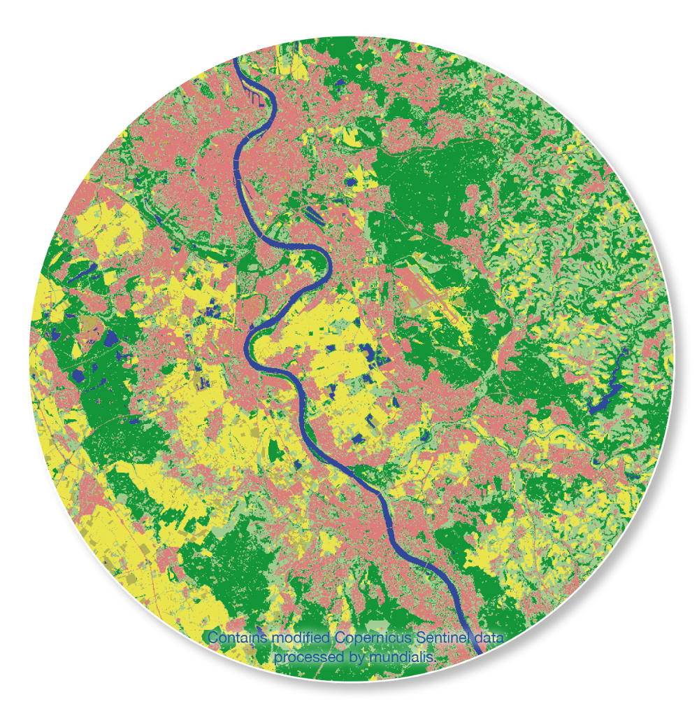
At the same time HERMOSA is able to analyse Earth observation and GIS data through the powerful geoprocessing engine actinia it contains. The resulting datasets are automatically published in a standardized format so that other platforms can in turn easily incorporate this data and display it to their users. This bidirectional interoperability – i.e. being able to use services from other parties and publish services to be used by others – helps everyone; only together the big challenges can be addressed.

The process outlined above enables all platforms that adhere to the standards to benefit from data and processing capabilities. And this means that the users engaged in ecosystem restoration benefit from platforms that can exchange data in an easy-to-use fashion. And if the users benefit, then this is also good for the planet because efficiency is increased and the time and money spent just go the extra, desperately needed mile.

Please contact sales@hermosa.earth to get started today!

reposted from: https://hermosa.mundialis.de/news/bulletin-kw-17/

Comments are currently closed.

Folgen Sie uns hier

Kontakt

mundialis GmbH & Co. KG
Kölnstrasse 99
53111 Bonn

Telefon: +49 (0)228 / 387 580 80
Fax: +49 (0)228 / 962 899 57

E-Mail: info [at] mundialis [dot] de

Letzte Beiträge

  • Die FOSSGIS 2023 – diesmal wieder in Berlin!

    Dienstag, der 21. Februar 2023
  • ++ Eine neue Heimat für Actinia ++

    Dienstag, der 24. Januar 2023
  • Positiv in die Zukunft – Änderungen in der Geschäftsführung bei mundialis

    Dienstag, der 4. Oktober 2022
  • Zusammenfassung von der FOSS4G 2022 in Florenz

    Freitag, der 16. September 2022
  • FOSS4G 2022 in „La Bella“ – Florenz lässt grüßen!

    Donnerstag, der 14. Juli 2022
Alle Beiträge ansehen

Blog

  • Satellitenbild des Monats – März – Berlin (Deutschland) 7. März 2023
    Berlin – Deutschland, aufgenommen vom Sentinel-2B Satelliten am 30.09.2022 Das Satellitenbild ...
  • Satellitenbild des Monats – Februar – Amazonas-Regenwald (Brasilien und Bolivien) 7. Februar 2023
    Amazonas-Regenwald – Brasilien und Bolivien, aufgenommen vom Sentinel-2A Satelliten am ...
  • Satellitenbild des Monats – Januar – Yalu (Volksrepublik China und Demokratische Volksrepublik Korea) 2. Januar 2023
    Yalu – Volksrepublik China und Demokratische Volksrepublik Korea, aufgenommen ...
Alle Blog-Beiträge ansehen

Copyright © 2015-2023 mundialis GmbH & Co. KG

Impressum Datenschutzerklärung

Theme created by PWT. Powered by WordPress.org