Skip to content
Services
Products
Software
References
News
About us
Services
Products
Software
References
News
About us
English
German
English
German
Contact
News
An overview of all news.
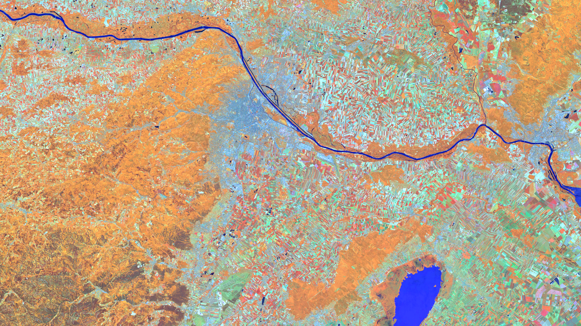
Satellite image of the month – July – Vienna (Austria)
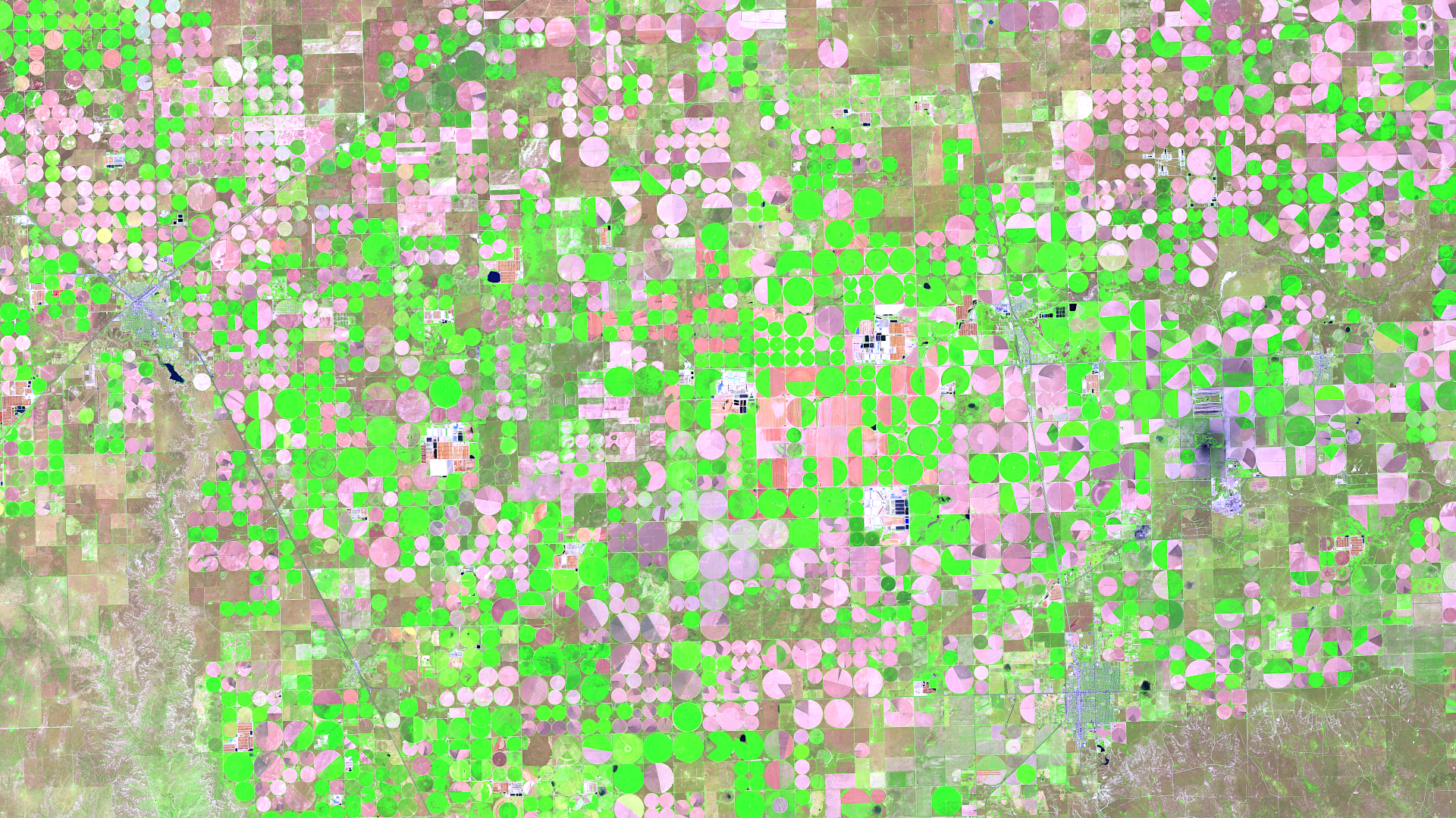
Satellite image of the month – June – Dalhart (Texas, USA)
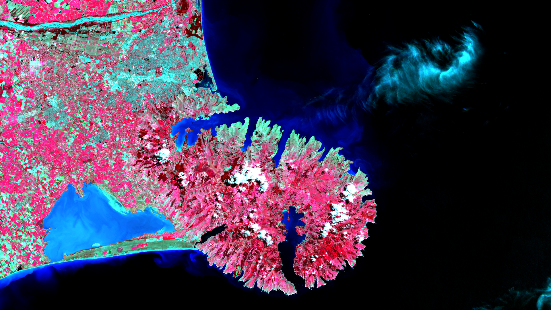
Satellite image of the month – May – Banks Peninsula (New Zealand)
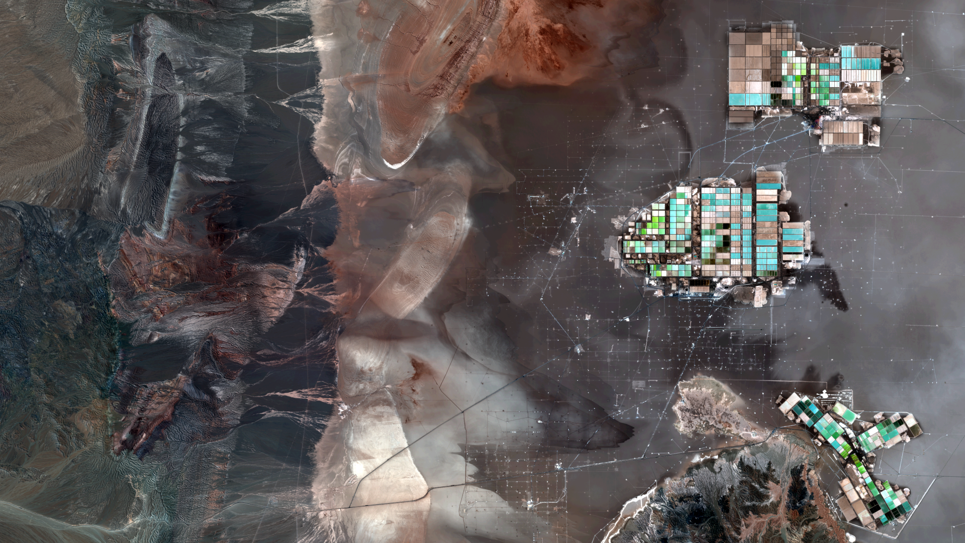
Satellite image of the month – April – Atacama Desert (Chile)
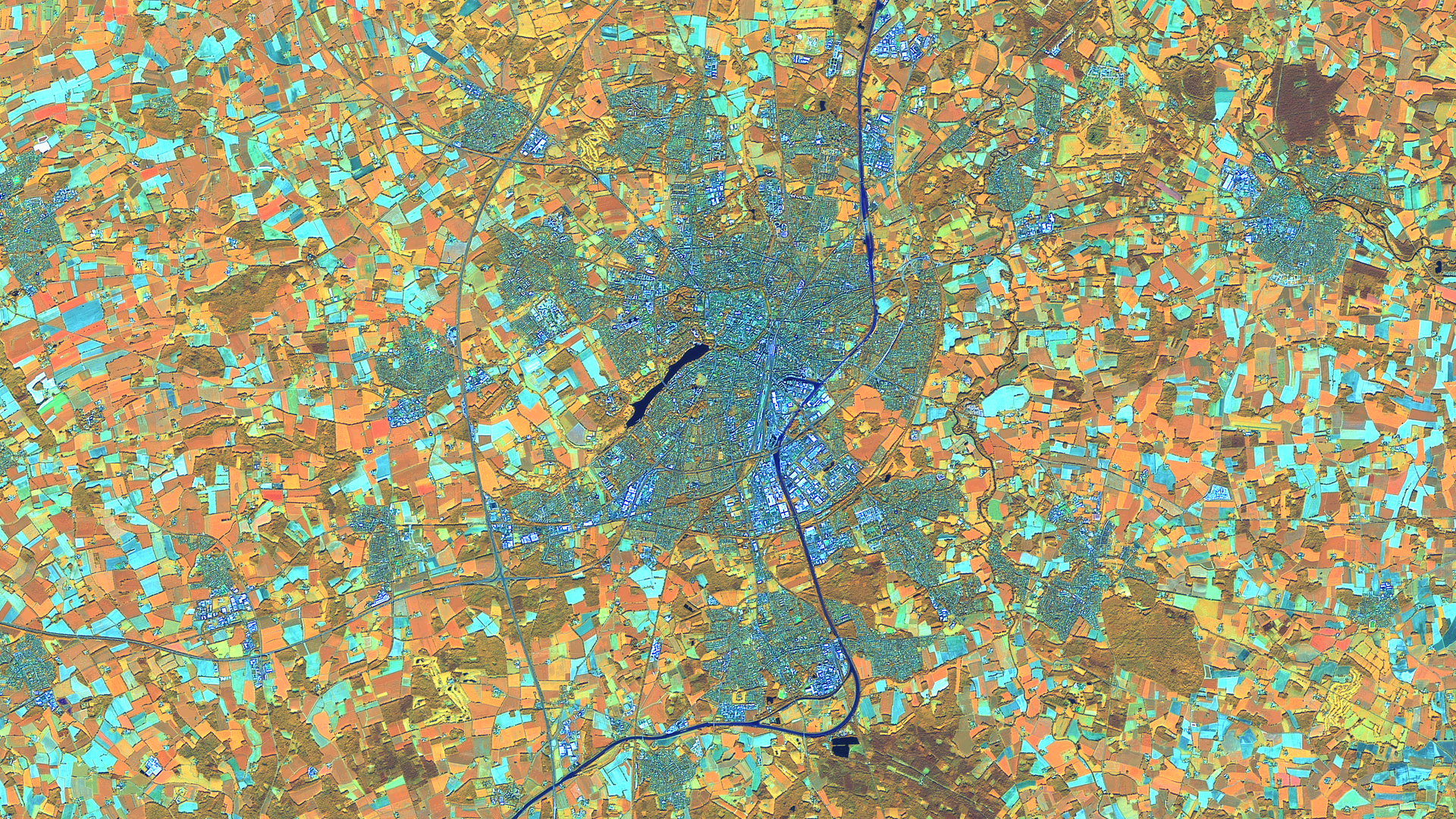
Satellite image of the month – March – Münster (Germany)
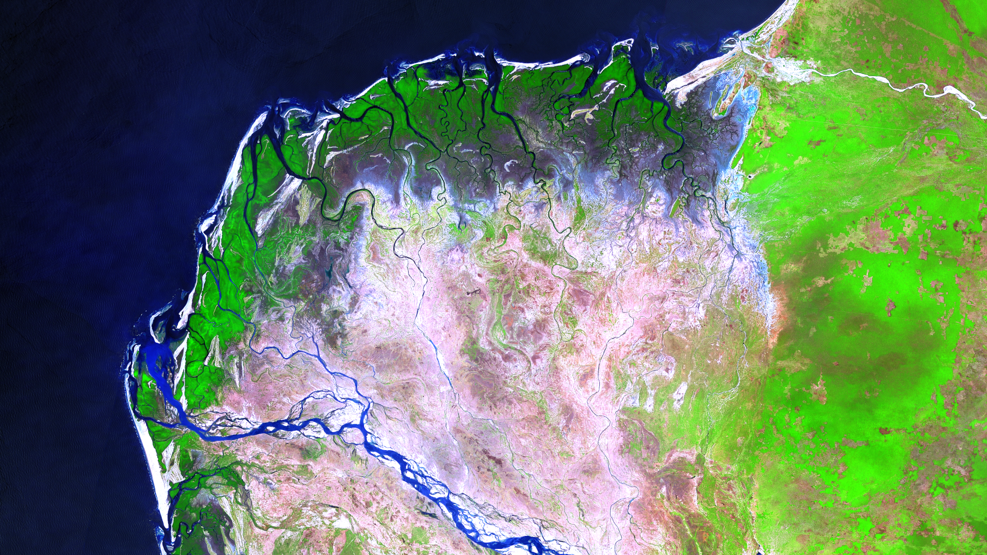
Satellite Image of the Month – February – Mangoky Delta (Madagascar)
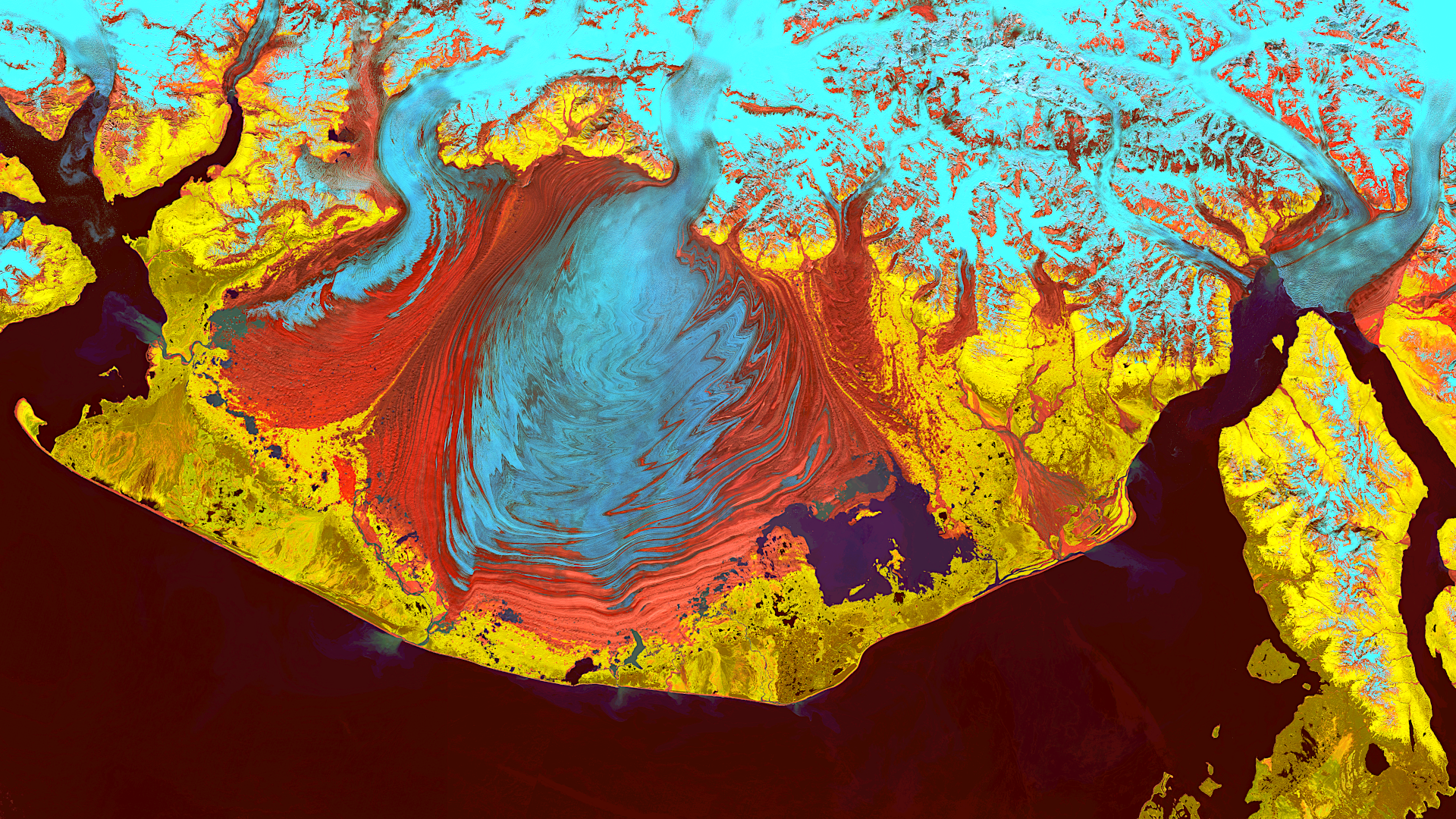
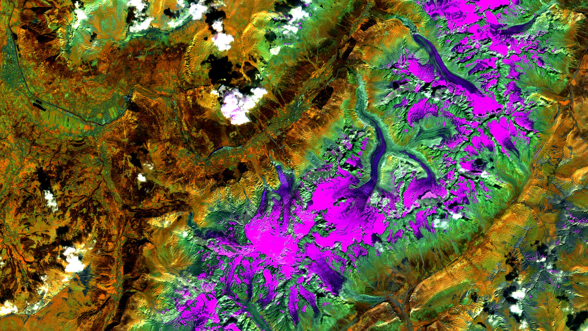
Satellite Image of the Month – January – Malaspina Glacier (Alaska, USA)
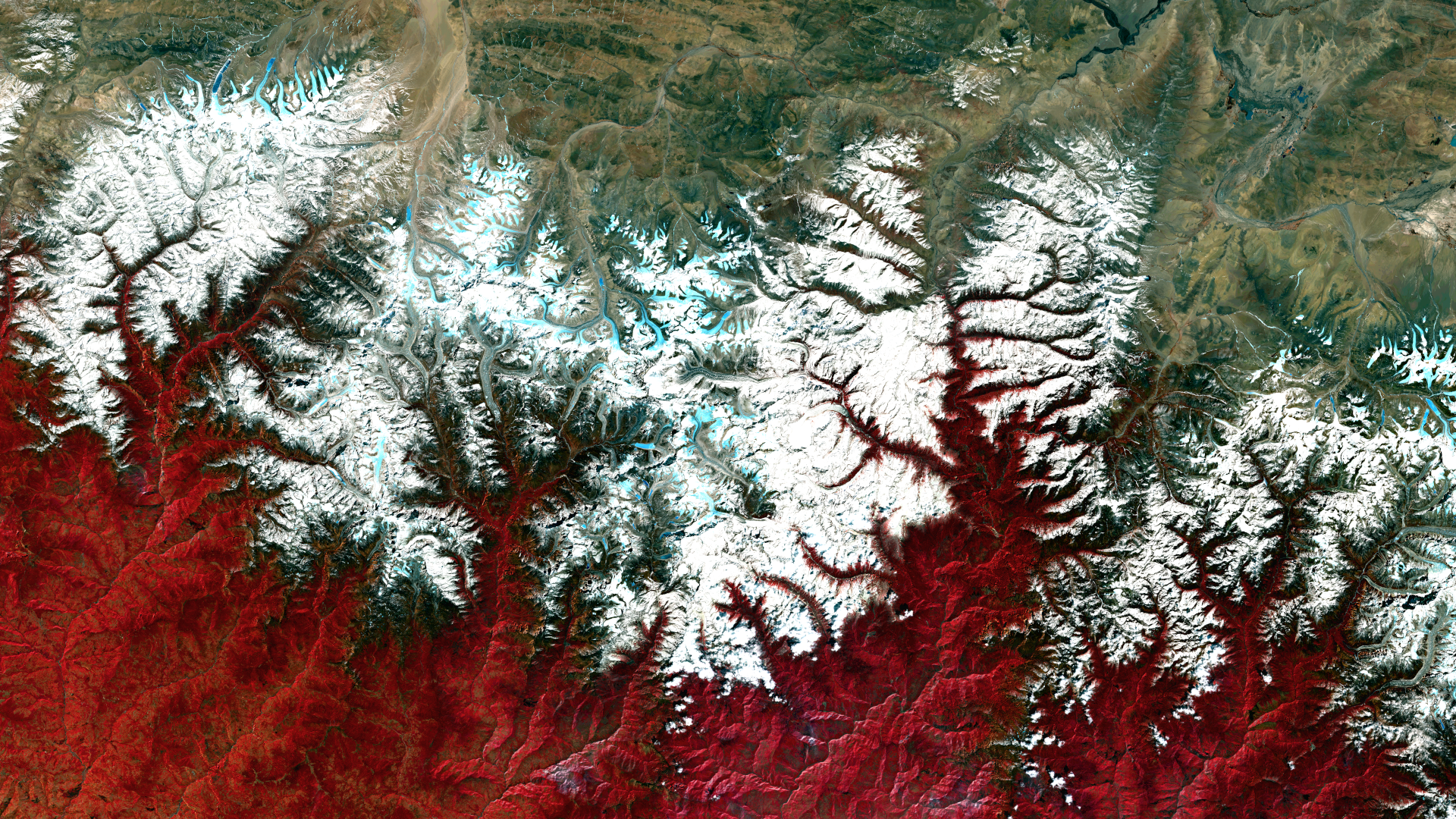
Satellite image of the month – December – Mahalangur Himal (Nepal/China)
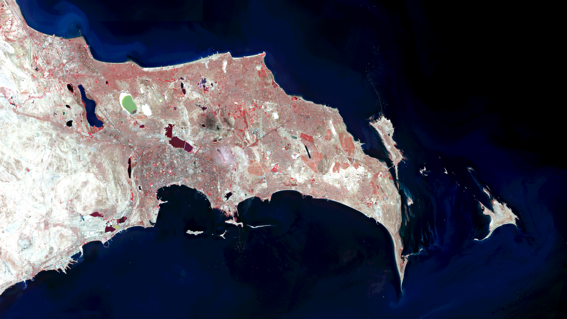
Satellite image of the month – November – Baku (Azerbaijan)
Satellite image of the month – October – Mont Blanc (France & Italy)
Show more
Categories
General
Knowledge
Satellite image of the month
All
English
German
English
German
Services
Products
Software
References
News
About us
Services
Products
Software
References
News
About us
Kontakt
Github
Linkedin
Xing
Twitter
Mastodon Logo
Imprint
Imprint
English
German
English
German
Services
Products
Software
References
News
About us
Services
Products
Software
References
News
About us
Contact
Github
Linkedin
Xing
Twitter
Mastodon Logo
Imprint
Imprint