Menu
  • About us
    • Company
    • Team
    • Career
    • References
    • Partners
    • Contact
  • Products
    • Earth Observation metadata enhancer
    • Temperaturdaten
    • LST-Data Client
    • Trainings
  • Services
    • actinia – geoprocessing in the cloud
    • Geospatial and EO data analysis
    • CORONA spy satellite data
    • maps.mundialis
    • Web Map Services
    • GIS Development
    • Open Source GIS
  • Markets
    • Remote Sensing for Agriculture
    • Satellite Images for Forest and Land Cover Restoration
    • Glass fibre route planning – FTTH
    • Copernicus and Sentinel
  • News & Blog
    • News
    • Blog
    • Satellite image of the month
  • English English
  • Deutsch Deutsch

FOSS4G 2021 Videos from and with mundialis online


13. December 2021 | Category General

This year, for the first time, the annual FOSS4G conference was held on the South American continent from Sept 27th – Oct 02nd, 2021 in Buenos Aires. Due to the Corona pandemic, the conference was held as an online conference. Our presentations are now available as videos.

The following contributions by and with mundialis employees could be heard and seen at the conference:


Videos of the presentations:

  • State of GRASS GIS: The Dawn of a New Era: The GRASS GIS Development Team (abstract)
  • Cold war reconnaissance imagery reloaded: orthorectifying the 1960s in high resolution: Julia Haas, Guido Riembauer, Markus Metz and Markus Neteler (abstract)
  • HERMOSA: Supporting the UN dacade in ecosystem restoration utilizing geo- and earth observation technologies: Till Adams and Hinrich Paulsen: (abstract)
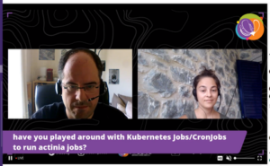
  • News from actinia: Carmen Tawalika, Anika Weimann, Guido Riembauer and Markus Neteler: (abstract)

  • Sentinel processing in GRASS GIS: A growing toolset for downloading, preprocessing and multitemporal analysis of Copernicus Sentinel data: Guido Riembauer, Anika Weinmann, Carmen Tawalika, Veronica Andreo, Luca Delucchi and Roberta Fagandini: (abstract)


Workshop (no video available, but detailed workshop material):

  • A gentle introduction to actinia: geoprocessing in the cloud: Carmen Tawalika and Markus Neteler


Comments are currently closed.

Follow Us

Contact

mundialis GmbH & Co. KG
Kölnstrasse 99
53111 Bonn

Phone: +49 (0)228 / 387 580 80
Fax: +49 (0)228 / 962 899 57

E-Mail: info [at] mundialis [dot] de

Latest News

  • Presenting at the ESA Living Planet Symposium 2022

    Tuesday April 19th, 2022
  • Le Kollektiv – Meeting in Bonn

    Monday March 28th, 2022
  • MOOD Science Webinar on COVID-19 Scatterplots

    Thursday March 24th, 2022
  • Update of actinia.mundialis.de to new API version 3

    Tuesday March 22nd, 2022
  • (Deutsch) Ein Rückblick auf die FOSSGIS 2022

    Tuesday March 22nd, 2022
View all News

Blog

  • Satellite image of the month – May – Bonn (Germany) 2. May 2022
    Bonn – Germany, recorded by the Sentinel-2A satellite on March ...
  • Satellite image of the month – April – Grand Canyon (USA) 1. April 2022
    Grand Canyon – USA, recorded by the Sentinel-2B satellite on ...
  • Satellite image of the month – March – Marburg (Germany) 2. March 2022
    Marburg – Germany, recorded by the Sentinel-2B satellite on June ...
View all Blog Posts

Copyright © 2015-2021 mundialis GmbH & Co. KG

Imprint Privacy

Theme created by PWT. Powered by WordPress.org