We are pleased to share that mundialis contributed to a newly published article in PLOS Neglected Tropical Diseases, titled:
“Local drivers of Rift Valley fever outbreaks in Mauritania: A One Health approach combining ecological, vector, host and livestock movement data”
Barry et al., 2025 – PLOS NTDs | DOI: 10.1371/journal.pntd.0013553
The study takes a One Health approach to understand the environmental, climatic, and biological factors driving Rift Valley fever (RVF) outbreaks in Mauritania. By combining data from human and animal infections, mosquito vectors, satellite-based environmental variables, and livestock movement patterns, the authors developed high-resolution spatiotemporal models identifying where and when RVF outbreaks are most likely to occur.
These findings can support early warning systems, improve risk-based surveillance, and inform targeted response strategies for both animal and public health authorities.
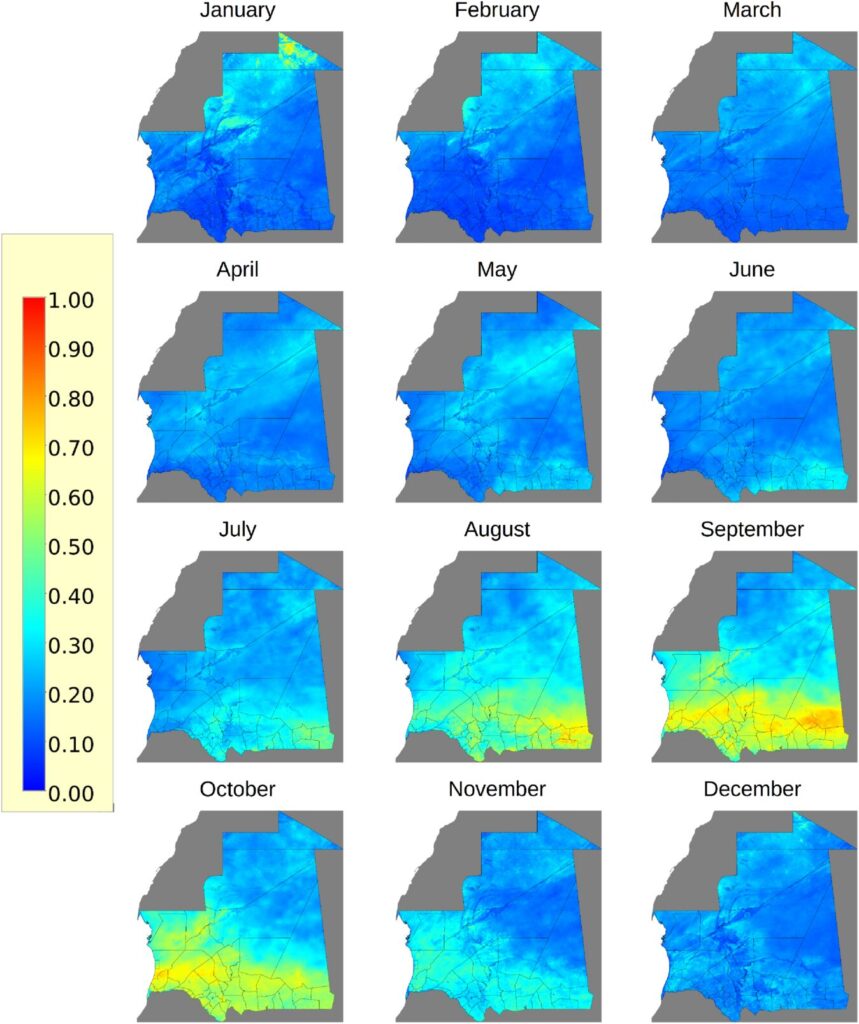
Our team provided core geospatial and remote sensing expertise for the modelling work, including:
- Processing and integration of environmental and climatic covariates (precipitation, land surface temperature, NDVI, NDWI)
- Development of monthly ecological suitability models using MaxEnt at 1 km resolution
- Combination of ecological risk maps with population and livestock movement data to estimate outbreak potential
- Open-source code and data publication to support reproducibility and future research
We are proud to have supported this important work as part of the Horizon 2020 MOOD Project which aims to improve early detection and monitoring of zoonotic and vector-borne diseases.