

Stationary traffic takes up a large proportion of the space in urban areas. Against the backdrop of the enormous increase in land requirements in recent years for housing, workplaces and infrastructure on the one hand, and more public open spaces and local recreation areas on the other, the question arises as to how to deal with the high land consumption of stationary traffic due to large parking areas.
A thorough assessment is crucial for the effective and multifunctional use of urban space. Our parking space analysis offers a powerful tool for this purpose: automated, comprehensive and data-based.
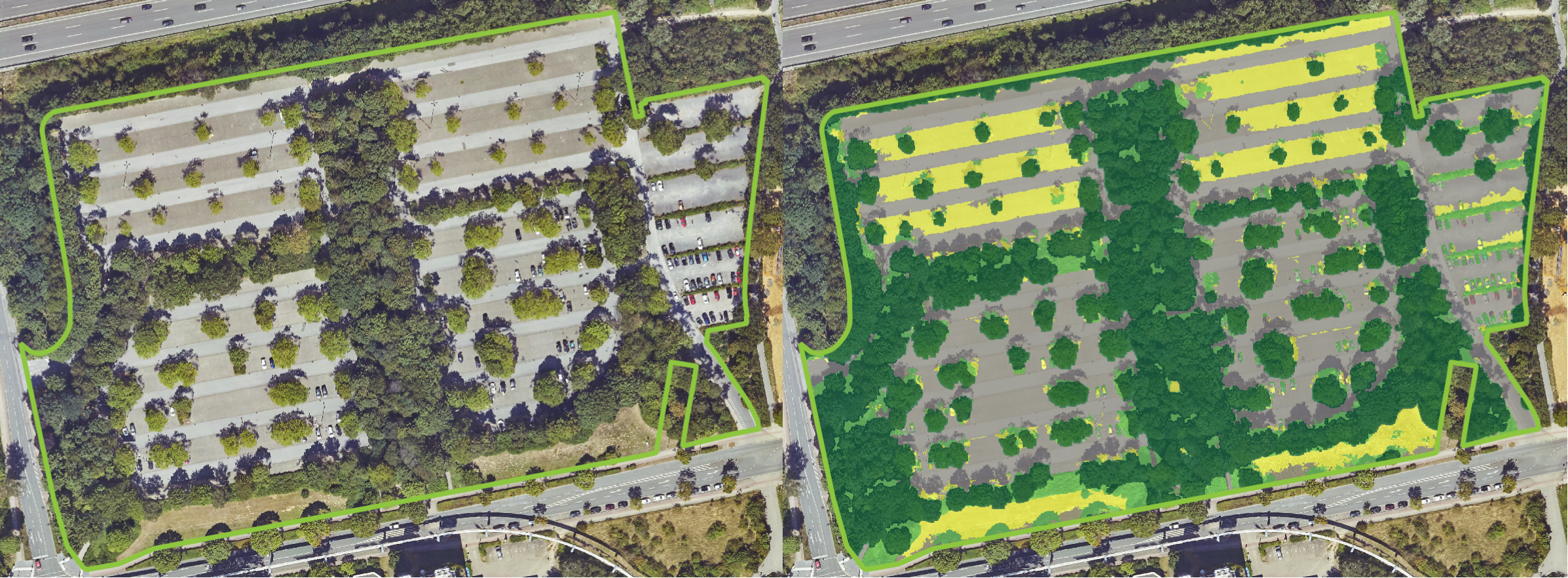
Our ‘Parking Space Analysis’ data package supports your informed decision-making in urban planning and environmental assessment.
The precise and comprehensive data analyses provide our customers with a solid basis for planning and environmental protection measures and enable complex environmental challenges to be tackled more efficiently.
Do you require parking space analyses for your city? Contact us!
Further information and publications on this topic:
FOSSGIS2024 presentation
Informationen from BBSR
Informationen from multiplicities
News from City of Dortmund
Article from stadtvonmorgen.de
Article from welt.de