
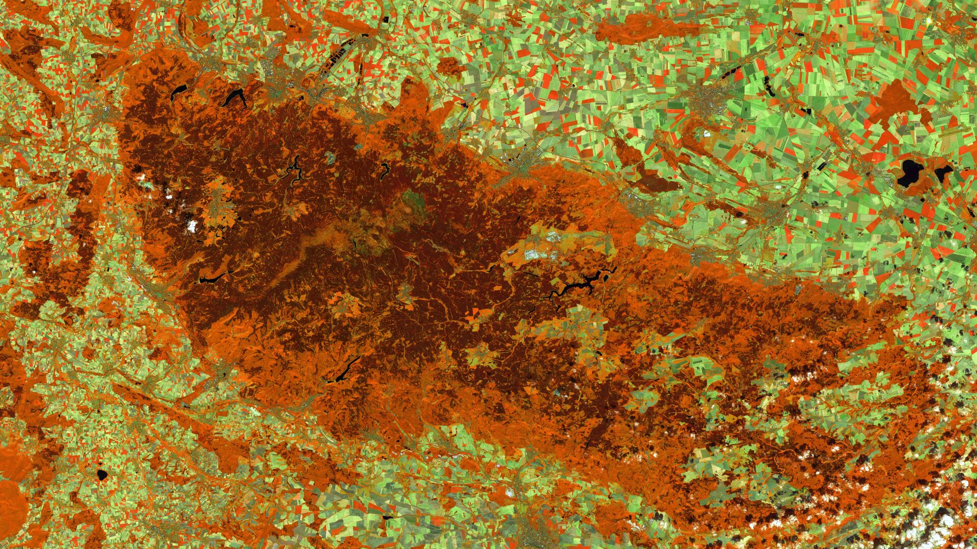
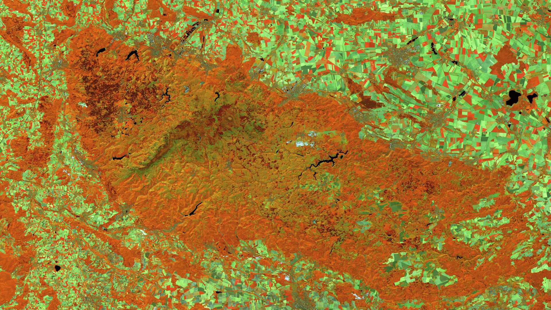
Harz National Park (Lower Saxony/Saxony-Anhalt) – Germany, recorded by the Sentinel-2A and -2C satellites on August 9, 2015 and August 13, 2025
The satellite image of the month April is the fourth image in our twelve-part visual journey and opens the thematic series ‘Traces of Time – Landscapes and Cities in Transition’. Using satellite images, we document and illustrate slower, more gradual changes to the Earth’s surface.
The image shows the German low mountain range Harz on the border between Lower Saxony and Saxony-Anhalt. The data is provided by the Sentinel-2A and -2C satellites. The false-colour composite is based on bands 8A (near-infrared), 11 (short-wave infrared) and 4 (red). Detailed information on satellite image processing and the Sentinel-2 composite used can be found here.
Image Composition
The massif of the Harz National Park forms the centre of the image. The false-colour composite allows the clear distinction of the different vegetation zones. The centre of the image is dominated by a continuous forest area and appears in shades ranging from deep red and dark brown to bright orange, depending on the condition or species of the trees. The Harz is surrounded by its agricultural foothills, which are recognisable as a mosaic of light green, yellowish and light red or orange fields.
At the edges of the mountains, settlements such as Wernigerode and Blankenburg in the north or Osterode am Harz in the south-west stand out as blue-grey areas. In the centre of the park, the Felswerke opencast mine can be made out as a white-greyish structure. Also striking are several reservoirs, including the Granestausee and the Innerstestausee at the top left of the image, as well as the Rappbode in the centre of the image, whose water surfaces stand out as deep black structures.
Spruce dieback and bark beetles
Between 2015 and 2025, the Harz region underwent a significant ecological change. Prolonged drought and the resulting bark beetle infestation led to the widespread dieback of the dominant spruce monocultures. A comparison of the two images from 2015 and 2025 clearly illustrates the extent of this forest dieback. Whilst the Upper Harz was still characterised by dense coniferous forest in 2015 – visible in the images as a deep dark-brown area – the spruce population has almost entirely disappeared by 2025, particularly in the central to southern regions. The once dark areas are now light orange and green in colour. This contrast illustrates the transformation of spruce forests into bare patches and their colonisation by pioneer plants.
Analyzing using Satellite Data
In addition to the traditional before-and-after comparison, multispectral satellite images provide a reliable basis for automated, large-scale and continuous forest monitoring. Through the regular analysis of forest cover and forest condition – for example, using the NDVI and EVI vegetation indices as well as long-term trends – changes and damage can be detected at an early stage and affected areas can be quantified precisely.
Thanks to our extensive expertise in the analysis and processing of remote sensing and geodata, we are opening up new perspectives for precise and efficient forest management. By utilising modern AI technologies and automated processes, we develop bespoke solutions – ranging from forest monitoring and early warning systems to the identification of reforestation potential.
Find out more about our forest and tree mapping, as well as our ‘Forest Monitoring’ product and the accompanying webinar (only available in German).
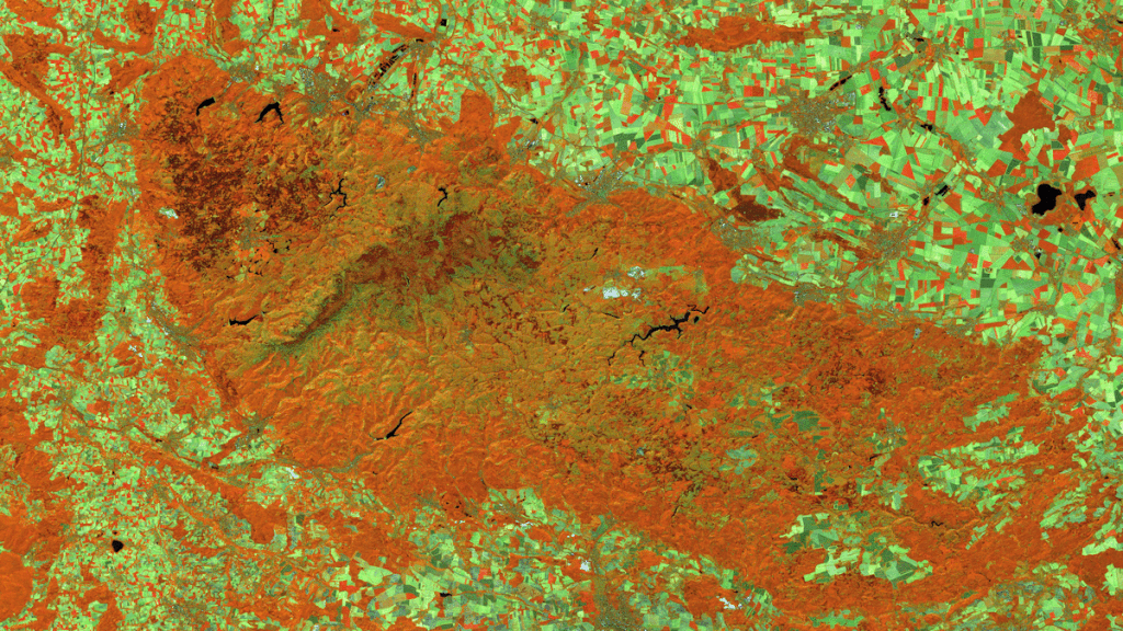
A different view of the region
The following animation shows an overlay with OSM data. The map visualization was created using the terrestris OpenStreetMap premium service.
Contains modified Copernicus Sentinel data (2015/2025)/ESA – created by mundialis
Satellite images for your wall are available at https://art-from-space.de