
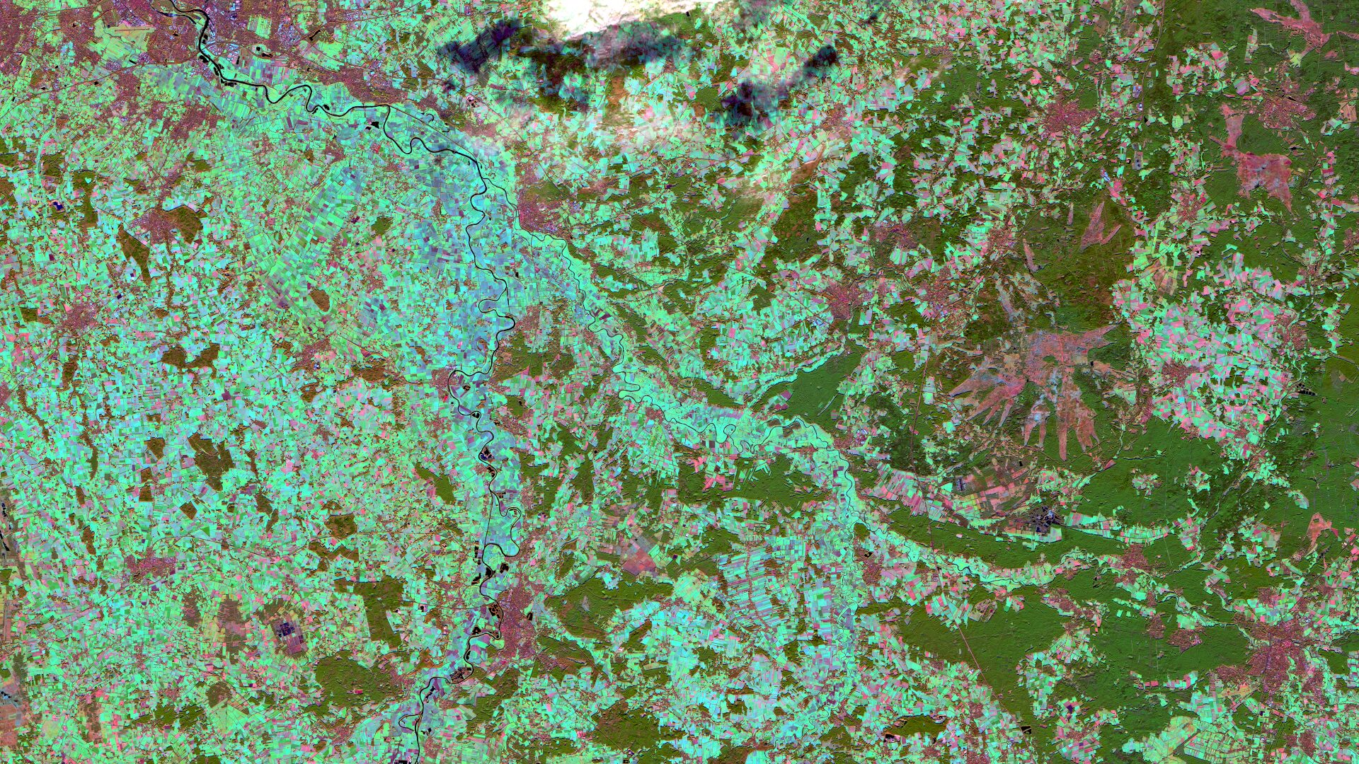
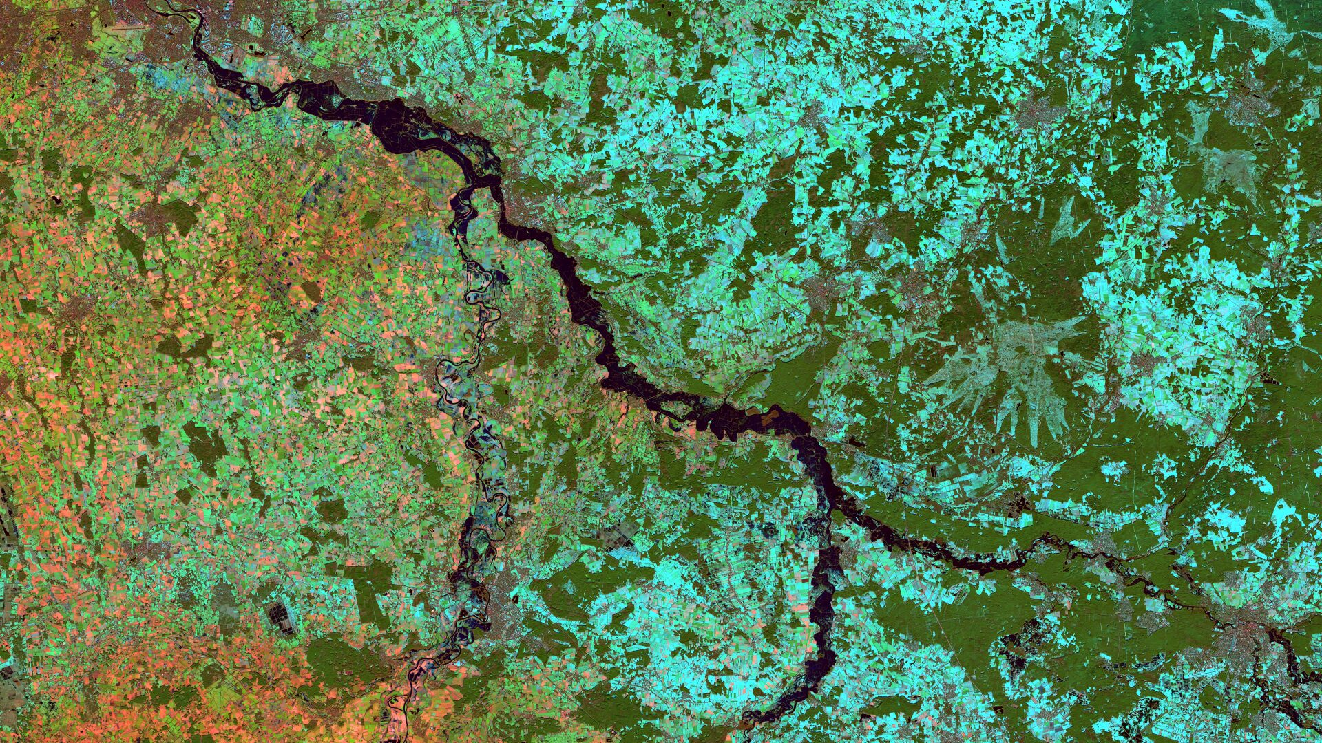
Lower Saxony – Germany, recordedby the Sentinel-2B satellite on December 15, 2022 and January 09, 2024
The satellite image of the month February is the second part of our twelve-part visual journey. It continues the theme of “Acute hazards – visible from space”, dealing with natural hazards, their visible effects and the possibilities of satellite-based analysis.
The image shows part of the northern German state of Lower Saxony. A false-colour composite based on spectral bands 11, 8A and 4 of the Sentinel-2B satellite was used for display. Detailed information on satellite image processing and the ‘vegetation analysis’ composite used can be found here.
Structure of the image
The image shows the two rivers Aller and Weser, which converge near the city of Verden and appear in black. Parts of Bremen are also visible at the northern edge of the image. Like the other settlement areas, it appears in greyish colours. The false colour representation allows for a clear distinction between different types of land use. The dark green areas in the east indicate forested areas. Agricultural areas, on the other hand, appear partly turquoise when they are covered with snow. Snow-free fields appear in light brown or red tones (open ground) or light green tones (vegetated).
Christmas Flood of 2023/24
The Christmas Flood of 2023/24 was severe flooding in northern Germany, caused by prolonged rainfall and saturated soil. The region along the Aller River near Verden was particularly affected. Water levels rose significantly, damaging dykes and flooding the dykes’ forelands. A campsite was evacuated and some districts were temporarily cut off from the surrounding area. The situation persisted over Christmas and into January, requiring extensive operations by the fire brigade and technical emergency services.
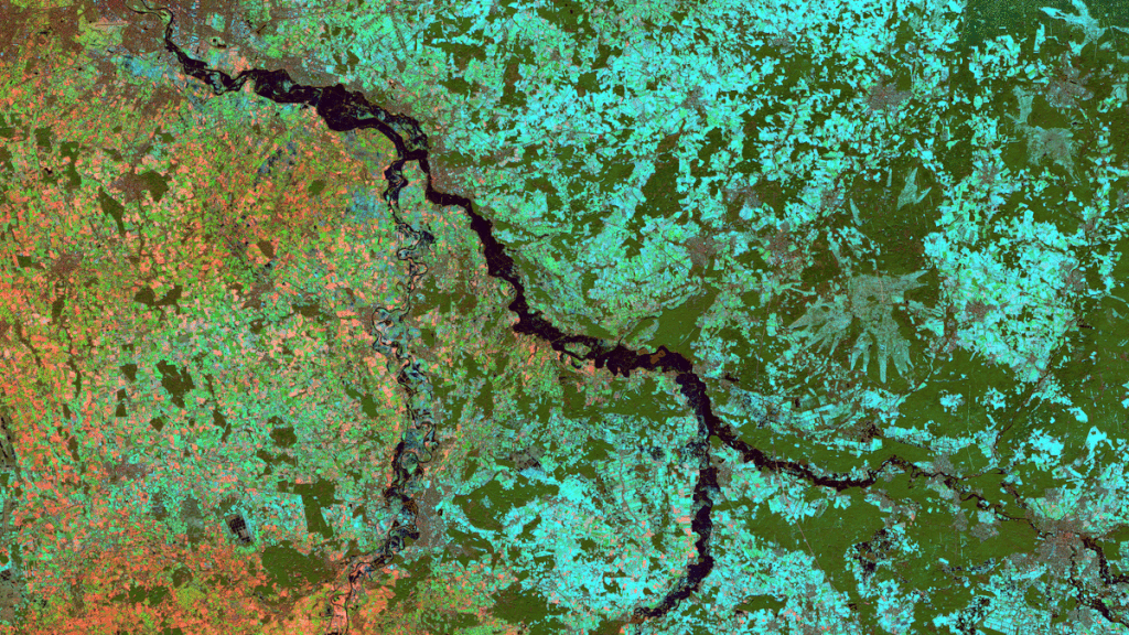
Comparing the two Sentinel-2 images from the year of the flood and the previous year clearly shows the extent of the flooding along the Aller.
Analysis using satellite data
Flood events like this can be analysed using satellite and aerial image data, together with other geodata. For example, before-and-after images can be compared and flooded areas can be calculated. This allows the extent of the damage to be quantified and provides an important basis for effective disaster management.
At mundialis, we specialise in the efficient processing and analysis of geodata.
Among other things, we offer training courses on water runoff simulation. These simulations provide insights into water runoff on the surface during and after rainfall, as well as identifying potential flood risk areas.
Additionally, our product “Impervious surfaces for water management” provides water management associations and urban drainage utilities with vital information on the impact of sealed surfaces on drainage systems. This analysis is becoming increasingly important, especially in light of more frequent extreme rainfall events. Further information can also be found in our free webinar.
A different view of the region
The following animation shows an overlay with OSM data. The map visualisations were created using the terrestris OpenStreetMap Premium service.
Contains modified Copernicus Sentinel data (2022)/ESA – created by mundialis
Satellite Images for your wall are available at https://art-from-space.de