
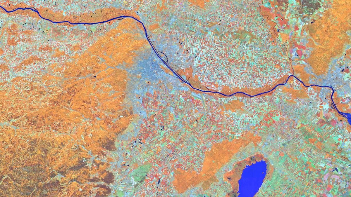
Vienna – Austria – recorded by the Sentinel-2A satellite on June 13, 2025

Our satellite image of the month for July shows the Austrian capital Vienna and the surrounding region. In the last week of June, the Living Planet Symposium 2025, one of the largest conferences on Earth observation, took place there.
Structure of the image
The image is based on Sentinel-2 data from the EU Copernicus Programme. Sentinel-2 data consists of freely available multispectral satellite images. Multiple scenes were merged after download and atmospherically corrected using open-source software. Subsequently, a color composition was computed using three different bands.
This band combination is a False color composite useful for discriminating land and water. In this composite the bands 8A (visible and near infrared), 11 (short-wave infrared) and 4 (visible red) were used which provide a spatial resolution of 20 meters. With this composite healthy vegetation appears in orange and older vegetation appears in green. Soil and clouds appear in shades of green as well. Water is painted in blue and shades of purple while ice appears in vibrant magenta.
About Vienna
Vienna is the capital of Austria and, with a population of around 2 million, is also the country’s largest city. It is located in the east of Austria on the Danube and is also one of the nine federal states. Vienna is considered the cultural, political and economic centre of Austria. The city has a long history dating back to Roman times. Vienna is particularly famous for its magnificent architecture from the Habsburg era, including the Hofburg Palace, Schönbrunn Palace and St Stephen’s Cathedral. Vienna is also an important music metropolis, where composers such as Mozart and Beethoven have worked. Today, the city regularly tops international rankings for quality of life.
In the picture, the Danube is clearly recognisable by its blue colours. It flows from the left to the right edge of the picture. The city of Vienna is located in the middle of the Danube and is coloured in shades of grey and blue. While the area to the east of Vienna is mainly agricultural, as can be seen from the blue and orange coloured fields, the area to the south-west is mainly forest and is therefore coloured orange.
The Living Planet Symposium
The Living Planet Symposium (LPS25) of the European Space Agency ESA took place this year from 23 to 27 June 2025 at the Austria Center Vienna. Under the motto ‘From Observation to Climate Action and Sustainability for Earth’, more than 6,000 participants from over 90 countries took part in more than 250 sessions. Topics included the latest developments in earth observation, climate protection initiatives and innovative applications of satellite-based data – with panel discussions, workshops and an accompanying exhibition.
Mundialis was represented at the Living Planet Symposium 2025 with two co-presentations – on cloud-native EO platforms (ESA KNeo) and the use of Earth observation in the health sector (ESA GDA Health). In addition, we presented a poster on biodiversity and nature finance (BioDiveR).
A different view of the region
The following animations help understanding the geographical location of the image. They show the location of the satellite image of the month at various scales and an overlay with OSM data. The map visualisations were created using the terrestris OpenStreetMap Premium service.
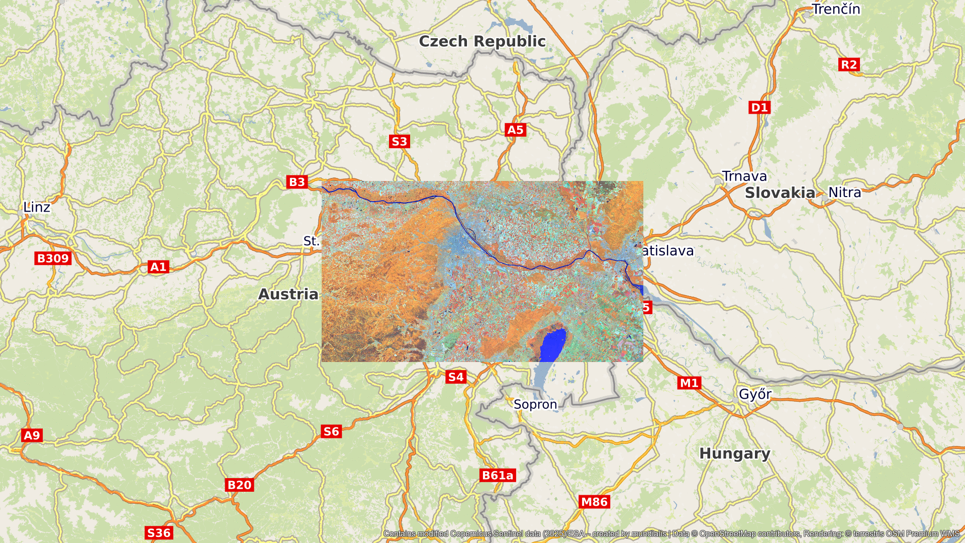
Contains modified Copernicus Sentinel data (2025)/ESA – created by mundialis
Satellite images for your wall available at: https://art-from-space.de