
Dalhart – Texas, USA, captured by the Sentinel-2A satellite on May 16, 2025.
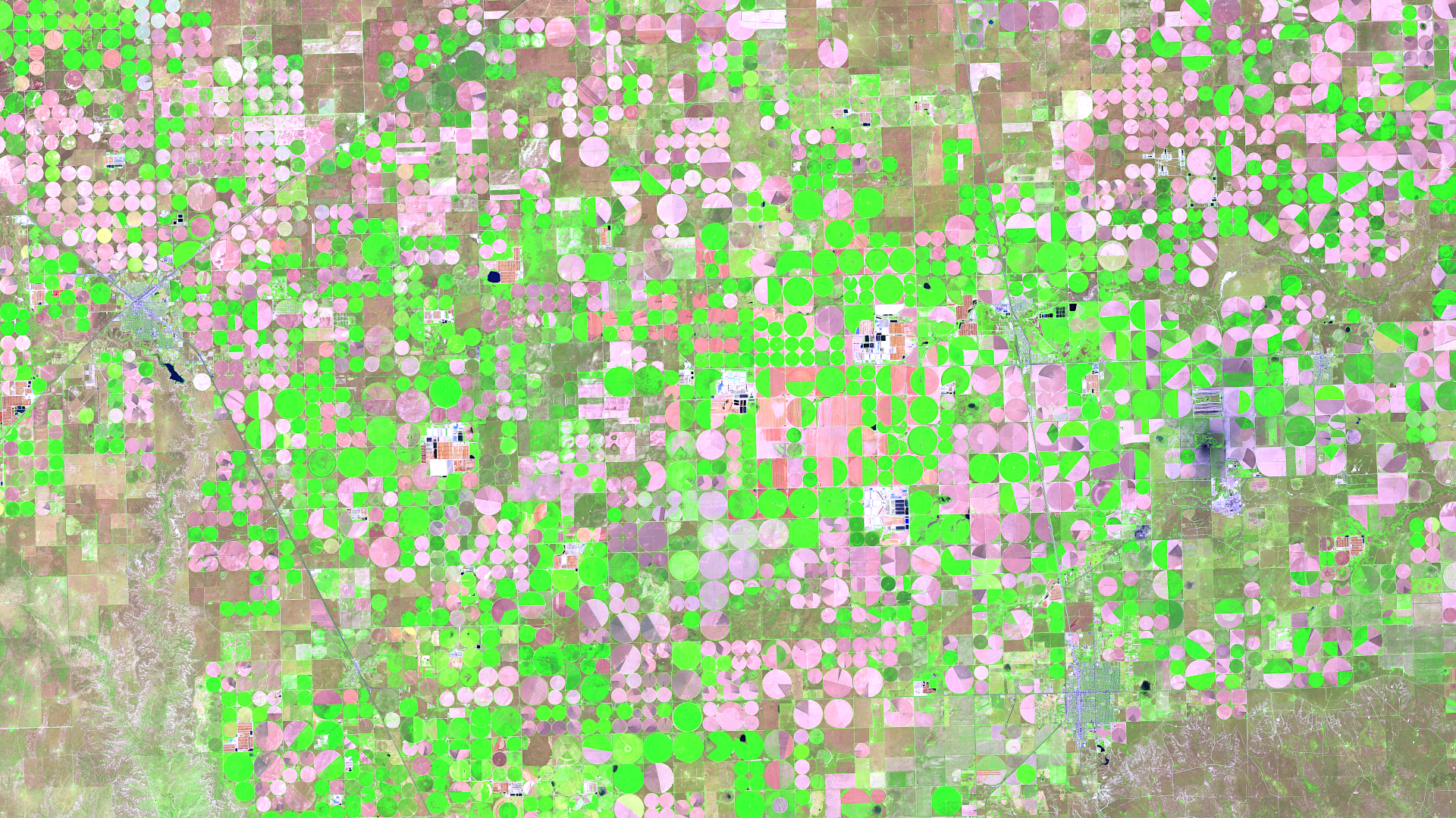
Our satellite image of the month of June shows the area surrounding Dalhart in Texas, which is characterised by agriculture and a special irrigation technique.
Structure of the image
The image is based on Sentinel-2 data from the EU Copernicus Programme. Sentinel-2 data consists of freely available multispectral satellite images. After downloading, multiple scenes were merged and atmospherically corrected using open-source software. Subsequently, a colour composition was computed using three different bands.
The resulting band combination is a false colour composite that is useful for carrying out vegetation analysis. This composite uses the bands 11 (short-wave infrared), 8A (visible and near infrared) and 4 (visible red), providing a spatial resolution of 20 metres. In this composite, healthy vegetation appears in vibrant shades of green, making it easy to distinguish from soil, which ranges in colour from light pink (e.g. harvested fields) to vibrant pink (e.g. deforested rainforest). Clouds appear white, water appears dark blue to black and cities appear light grey to light pink.
About Dalhart
Dalhart is a town located in north-west Texas in the heart of the semi-arid High Plains, a region characterised by low rainfall and hot summers. Despite these challenging climatic conditions, Dalhart has developed into an important agricultural centre, largely thanks to the use of innovative irrigation technologies. Centre-pivot irrigation is a system that has become increasingly widespread in the region since its introduction in 1949. In this method, water is distributed evenly from a central point to surrounding fields via long, rotating pipes with sprinklers. The rotation of the sprinkler arms creates the distinctive circular patterns in the fields, which are clearly visible from the air.
About centre-pivot irrigation
The introduction of centre-pivot irrigation has significantly increased agricultural productivity in Dalhart. The efficient distribution of water minimises evaporation losses and enables the cultivation of crops such as maize, wheat and sorghum, even on the regions’s sandy and slightly hilly soils. The system is also less labour-intensive than traditional irrigation methods and can be used on a wide variety of terrains. However, intensive use of centre-pivot irrigation also presentschallenges. The high water demand puts a strain on the Ogallala Aquifer, one of the largest groundwater reservoirs in North America. Its water level is falling due to excessive abstraction. This raises questions about the long-term sustainability of current agricultural practices in the region.
Dalhart is located in the top left-hand corner of the image and can be easily identified thanks to its predominantly grey and blue colour tones. The numerous circular fields are particularly striking due to the irrigation systems used there. The colouring of the fields indicates their current state: those that have already been harvested or are lying fallow appear in delicate shades of pink, while intensively overgrown areas stand out in a bright green.
A different view of the region
The following animations help understanding the geographical location of the image. They show the location of the satellite image of the month at various scales and an overlay with OSM data. The map visualisations were created using the terrestris OpenStreetMap Premium service.
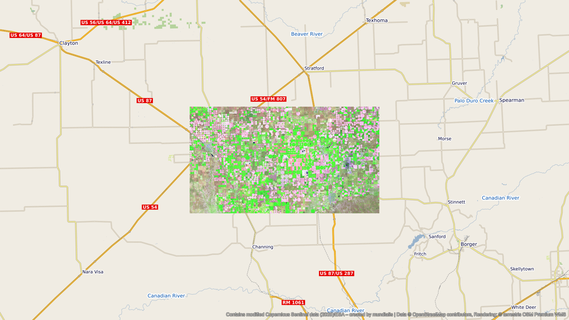
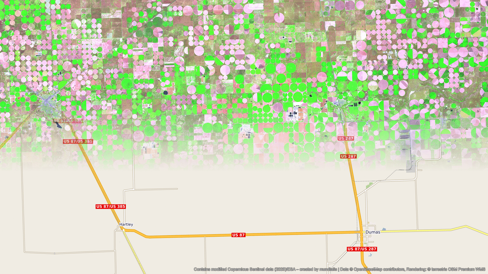
Contains modified Copernicus Sentinel data (2025)/ESA – created by mundialis
Satellite images for your wall available at: https://art-from-space.de