
Banks Peninsula – New Zealand, imaged by the Sentinel-2C satellite on 22.01.2025
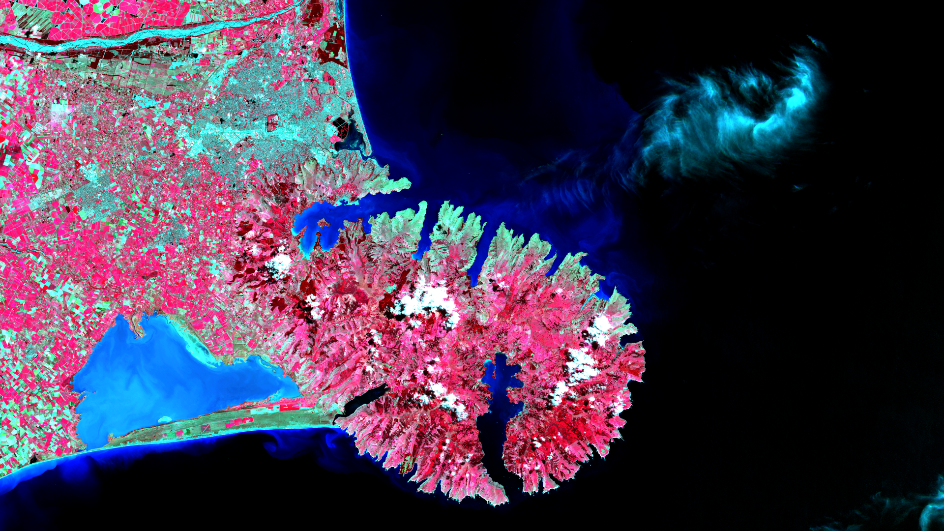
Our satellite image of the month of May shows the Banks Peninsula and the city of Christchurch on the east coast of New Zealand’s South Island.
Structure of the Image
The image is based on Sentinel-2 data from the EU’s Copernicus program. Sentinel-2 data are freely available multispectral satellite images. After downloading, several scenes were merged using free software, corrected for atmospheric conditions and then a color composition with bands 8 (near infrared), 4 (red) and 3 (green) was calculated.
The selected color infrared representation is particularly suitable for detecting vegetation. Vegetation appears in various shades of red, older vegetation in green, soil in shades of brown and green, urban regions in blue-grey, clouds are light turquoise or white.
About the Peninsula
The Banks Peninsula is a large peninsula on the east coast of New Zealand’s South Island, south-east of the city of Christchurch in the Canterbury region. It was formed by the eruptions of several large shield volcanoes around 8 to 11 million years ago. The peninsula stretches some 30 kilometers into the sea and includes numerous bays and sheltered harbors, including the harbors of Akaroa and Lyttelton. The landscape is characterized by volcanic rock, green hills, coastal cliffs and sheltered bays. The latter are also clearly visible on the satellite image. Lyttelton is located in the largest bay on the northern side, Arakoa in the largest southern bay.
The peninsula was named after the British naturalist Joseph Banks, who accompanied James Cook on his first voyage. Before European settlement, the region was inhabited by Māori tribes for centuries. Today, the Banks Peninsula is an important area for tourism and nature conservation, including the Hinewai Reserve. Natural reforestation with indigenous plant species is taking place here. The false color composition makes almost the entire peninsula appear red, suggesting continuous vegetation.
About Christchurch and the Surrounding Area
To the north of the peninsula, the city of Christchurch, founded in 1850 and the largest city on the South Island with a population of over 340,000, can be seen in shades of grey and blue. To the north of the city lies the Waimakariri River, whose riverbed is turquoise-blue in color. The area around Christchurch is dominated by agriculture, which is also reflected in the color scheme. The fields are characterized by rectangular shapes. While fields that are still overgrown appear red, harvested fields are turquoise-green.
South of Christchurch and west of the Banks Peninsula lies Lake Ellesmere or Tw Waihor, the fourth largest lake in New Zealand. The lake is only separated from the Pacific Ocean by a 28-kilometer spit of land.
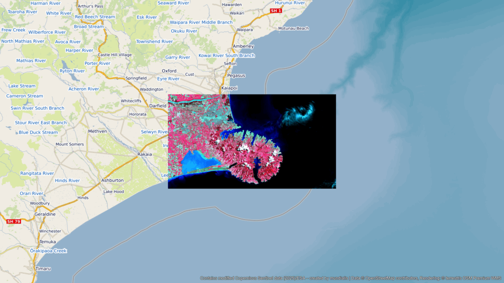
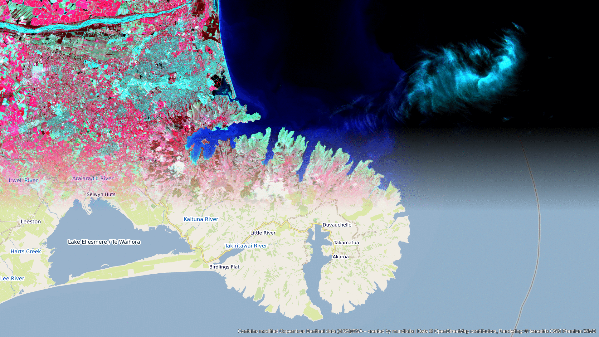
A Different View of the Region
The following maps facilitate the geographical classification of the image, which provide the location of the satellite image of the month as well as an overlay with OSM data. The maps were created using the terrestris OpenStreetMap service.
Contains modified Copernicus Sentinel data (2025)/ESA – created by mundialis
Satellite images for your wall are available at https://art-from-space.de