
Macizo Central Orensano – Spain, recorded by the Sentinel-2B satellite on August 16, 2025
Our satellite image of the month shows the border region between Spain and Portugal in the northwest of the Iberian Peninsula, specifically parts of the Spanish regions of Castile and León as well as Galicia, and parts of the Portuguese district of Bragança. In August 2025, this area was severely affected by wildfires.
The image is based on Sentinel-2 data from the EU Copernicus Programme. Sentinel-2 data are freely available multispectral satellite images. After downloading, several scenes were mosaicked using open-source software, atmospherically corrected, and then combined into a colour composite using three different bands. A sharpening method was then applied to enhance the spectral bands with an original spatial resolution of 20 metres to 10 metres.
Structure of the Image
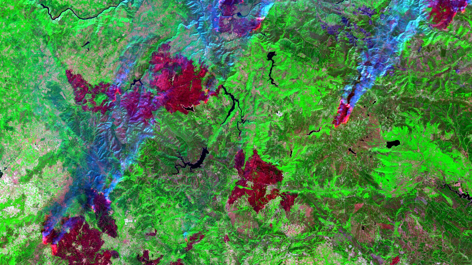
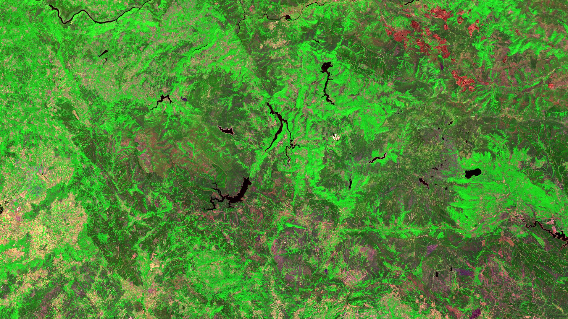
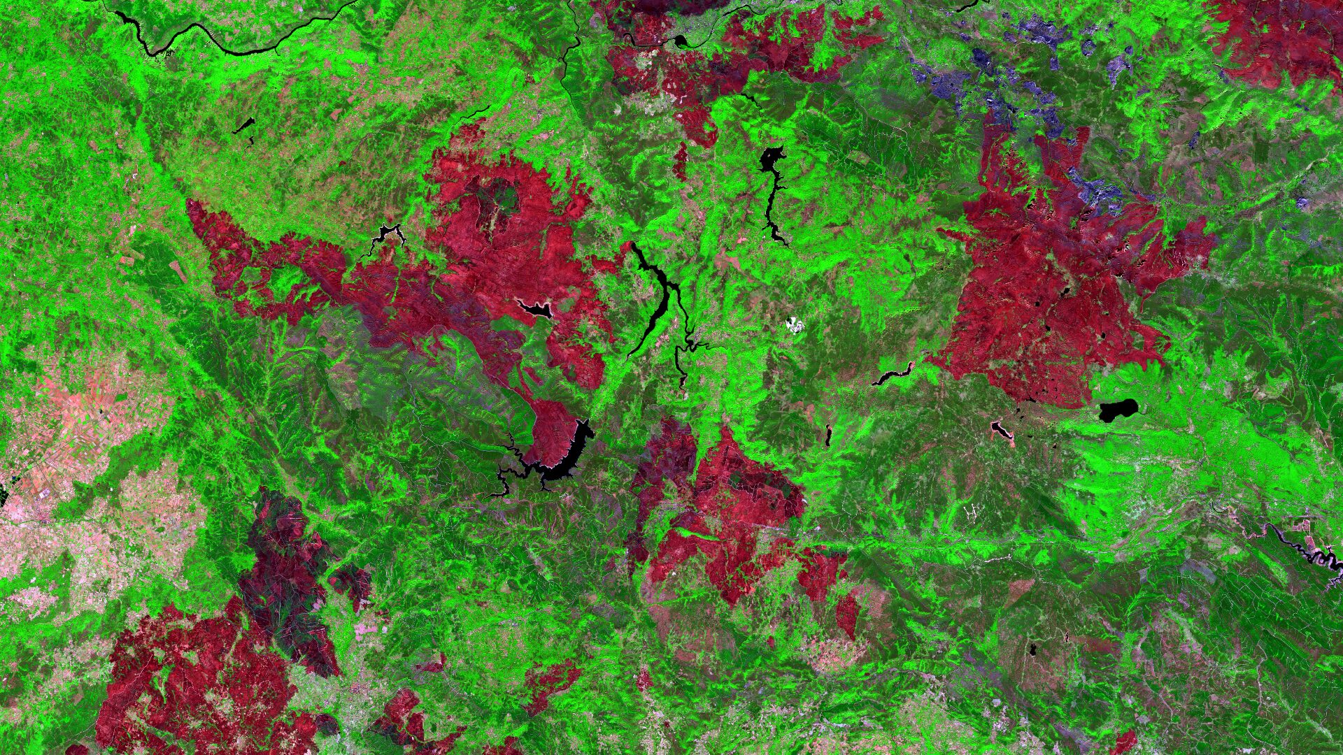
To create the presented images, a false-colour composite was calculated using two shortwave infrared channels (bands 12 and 8A) and the red channel (band 4). This so-called SWIR (Short Wave Infrared) RGB composite is particularly useful for estimating the water content of vegetation and soil, providing valuable information for vegetation analysis and fire damage mapping. In an SWIR RGB composite, vegetation appears in shades of green, water surfaces appear black, and soils and built-up areas appear in various shades of brown. Recently burned areas reflect strongly in the shortwave infrared range, making these areas visible in different shades of red and thus easily distinguishable.
The satellite images show three different acquisition dates. The first image was taken before the fires, on July 25, 2025, showing the region’s vegetation predominantly in green tones. The second image, from August 16, 2025, was captured during the devastating fire events. By this time, many areas had already been destroyed by fire (appearing in dark red tones). Numerous active fires can still be observed, identifiable by their bright red colouring and bluish smoke plumes. The final image, taken on September 25, 2025, illustrates the full extent of the burned area, which in some places extends into protected natural areas.
About the region
The sparsely populated region is traversed by the Macizo Central, which is part of the Galician-Leonese mountain range. The highest peak, Peña Trevinca, rises to 2,127 metres above sea level and is located in the north-eastern part of the image, near the border with the Spanish regions of Castile and León. The rivers Tera, Cabreira, and Bibei flow through valleys that were once shaped by glaciers, creating picturesque landscapes. Several protected natural reserves are located within the area, such as the Parque Natural O Invernadoiro. Characteristic vegetation types in this region are mainly extensive grasslands and some coniferous forests. The few agricultural areas can be identified in clusters along the western edge of the image.
Record year for wildfires
During the summer of 2025, a prolonged period of heat and drought in the Mediterranean region of Europe led to widespread and intense wildfire activity. Spain and Portugal were among the most severely affected countries, especially in the north-west of the Iberian Peninsula. In Spain alone, approximately 390,000 hectares have burned by this point in the year – the highest total in more than 30 years. Of these, around 320,000 hectares (an area roughly equivalent to the size of the island of Mallorca) were destroyed within just two weeks in August (5 – 19 August).
By 30 September 2025, wildfires in Spain had released around 19 megatonnes of CO₂. The previous record since measurements began in 2003 was nearly 11 megatonnes, with the long-term average being about 4 megatonnes. In response to the fires, Spain deployed the military and received international assistance in the form of personnel and firefighting aircraft. In its recently published report on greenhouse gas emissions, the World Meteorological Organization (WMO) highlighted the growing significance of large wildfire events in the context of increasing atmospheric CO₂ levels.
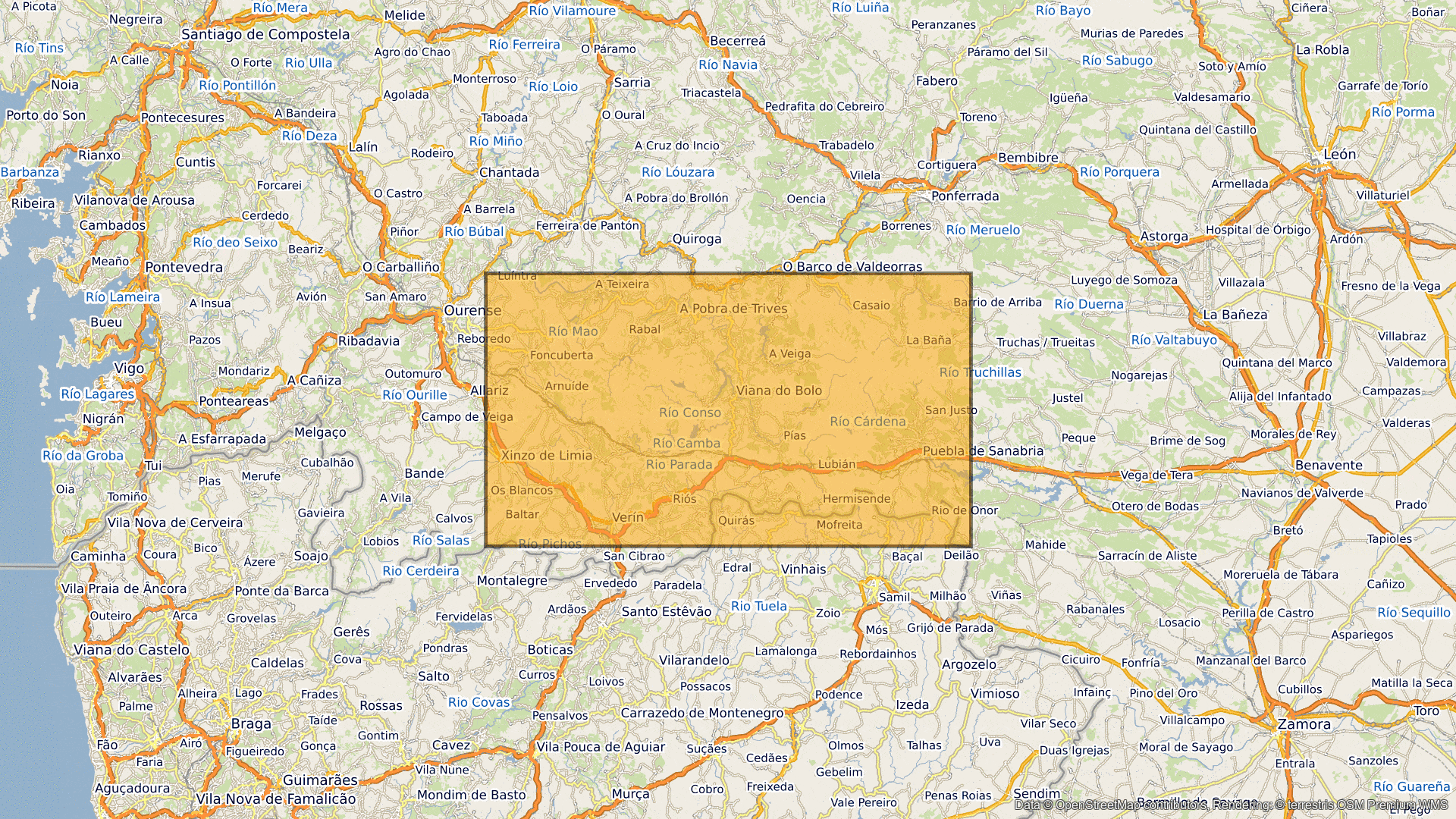
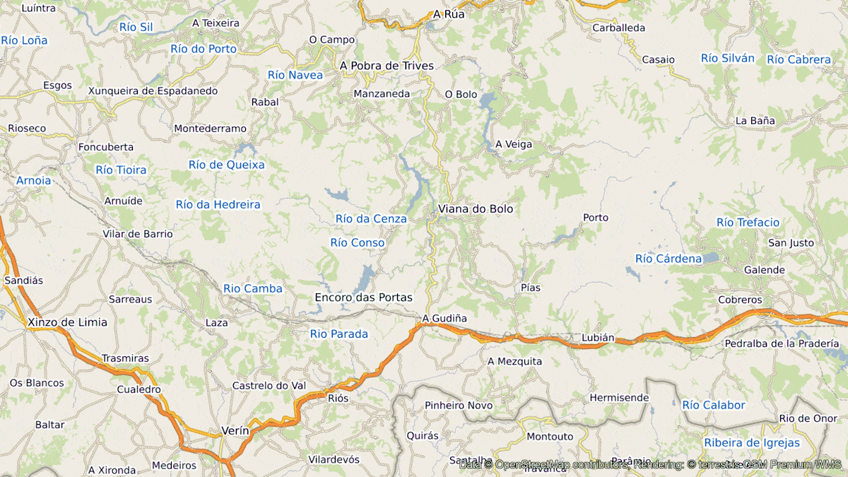
A different view of the region
The following animations help understanding the geographical location of the image. They show the location of the satellite image of the month at various scales and an overlay with OSM data and the images in the course of time. The map visualisations were created using the terrestris OpenStreetMap Premium service.
Contains modified Copernicus Sentinel data (2025)/ESA – created by mundialis
Satellite images for your wall are available at https://art-from-space.de