
Aachen/Maastricht – Germany/Netherlands– recorded by the Sentinel-2A satellite on August 11, 2025
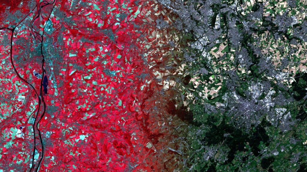
Our satellite image of the month for October shows the border region between the Netherlands, Germany and Belgium around the cities of Aachen and Maastricht.
The image is based on Sentinel-2 data from the EU Copernicus Programme. Sentinel-2 data consists of freely available multispectral satellite images. Multiple scenes were merged after download and atmospherically corrected using open-source software. Subsequently, a color composition was computed using three different bands. A sharpening method also allows the spectral bands with an original spatial resolution of 20 meters to be resampled to 10 meters.
Structure of the image
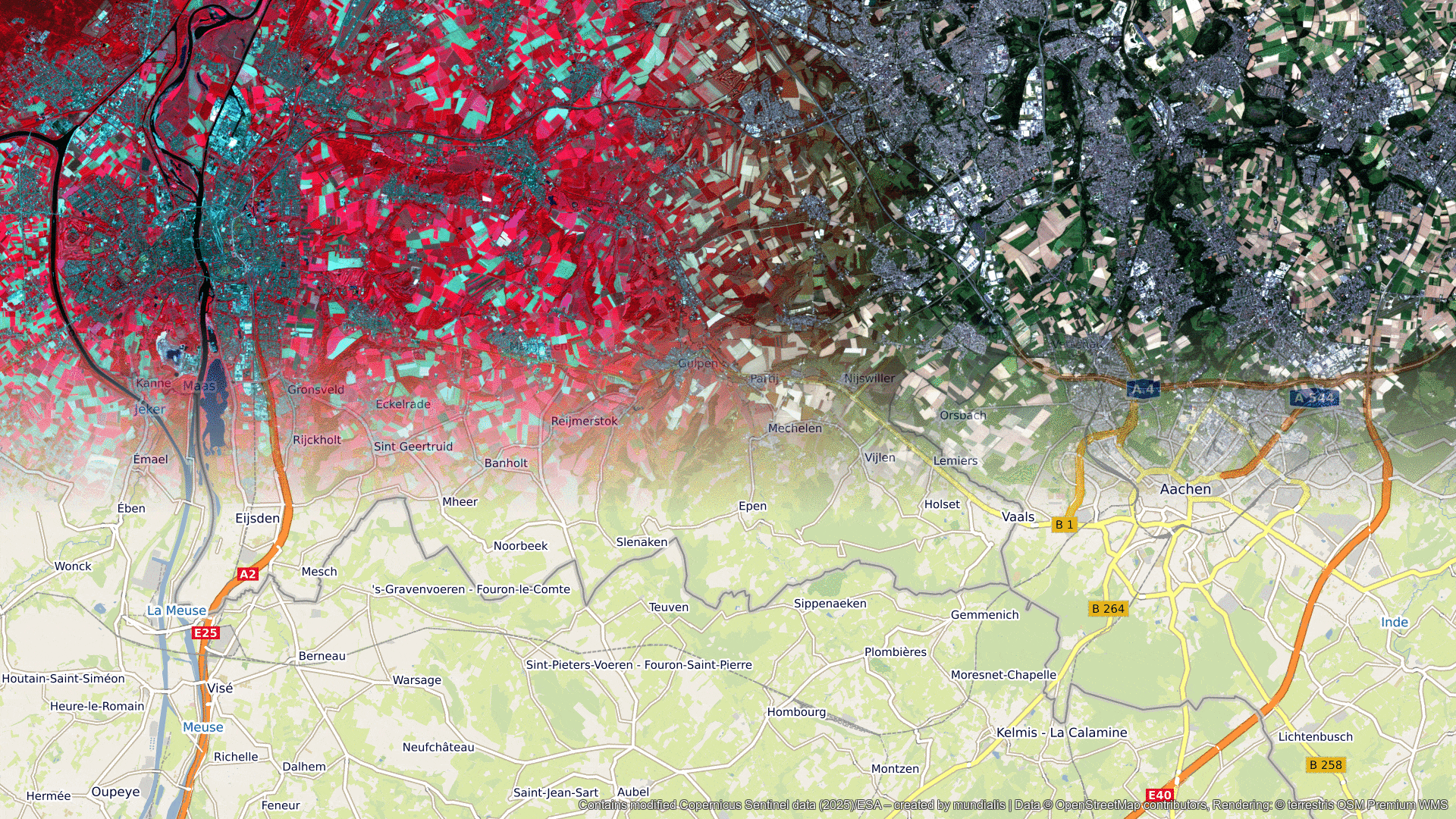
In addition to a true color composite from the red, green, and blue spectral channels, which reproduces the image in natural colors, a false color composite was also calculated. The color infrared image, which combines the near-infrared channel with the red and blue channels, is particularly well suited for detecting vegetation: this appears in various shades of red, while older vegetation is shown in green. Land areas are visible in shades of brown and green, urban areas in shades of blue to gray. Clouds, snow, and ice appear light turquoise or white. For illustration purposes, both composites were superimposed on each other in a gradient: the true-color composite can be seen in the right section of the image, while the false-color composite is shown on the left.
About the region
The region between Aachen and Maastricht lies in the border triangle of Germany, Belgium, and the Netherlands. It is known for its cultural diversity, which results from the close interconnection of the three countries. Geographically, the area belongs to the Eifel, the Ardennes foothills, and the Heuvelland. The border triangle near Vaals is a tourist attraction and marks the exact border point. Aachen is of particular importance as the former coronation city of German kings and residence of Charlemagne. Maastricht is considered one of the oldest cities in the Netherlands and is internationally known for the Maastricht Treaty (1992). This treaty was a milestone for the European Union (EU) and paved the way for the introduction of the euro, among other things.
On the Belgian side are smaller towns such as Kelmis, which are characterized by the former Neutral Moresnet, a unique microstate of the 19th century. Economically, the border region is characterized by trade, services, and close cross-border cooperation. Universities such as RWTH Aachen University and Maastricht University contribute to its international orientation. Numerous commuters travel between the three countries every day, which shapes the labor market and infrastructure. Today, the area is considered an example of European integration in action and a model region in the heart of the EU.
Maastricht can be recognized by its blue-gray colors in the left part of the image. The black-colored Meuse River, which flows from south to north through the image and the city, is also clearly visible. Aachen can be seen in gray colors in the lower right corner. South of the city lies the wooded Vaalserberg, which is shown in dark green. This is where the aforementioned border triangle is located. The region between the cities is characterized by agriculture, which can be seen in the differently colored fields.
At the end of September, the mundialis team will spend a week in the region together with the terrestris team to explore exciting topics related to our field of work in a relaxed atmosphere, develop new ideas, and enjoy an enriching time together.
A different view of the region
The following animations help understanding the geographical location of the image. They show the location of the satellite image of the month at various scales and an overlay with OSM data. The map visualisations were created using the terrestris OpenStreetMap Premium service.
Contains modified Copernicus Sentinel data (2025)/ESA – created by mundialis
Satellite images for your wall available at: https://art-from-space.de