
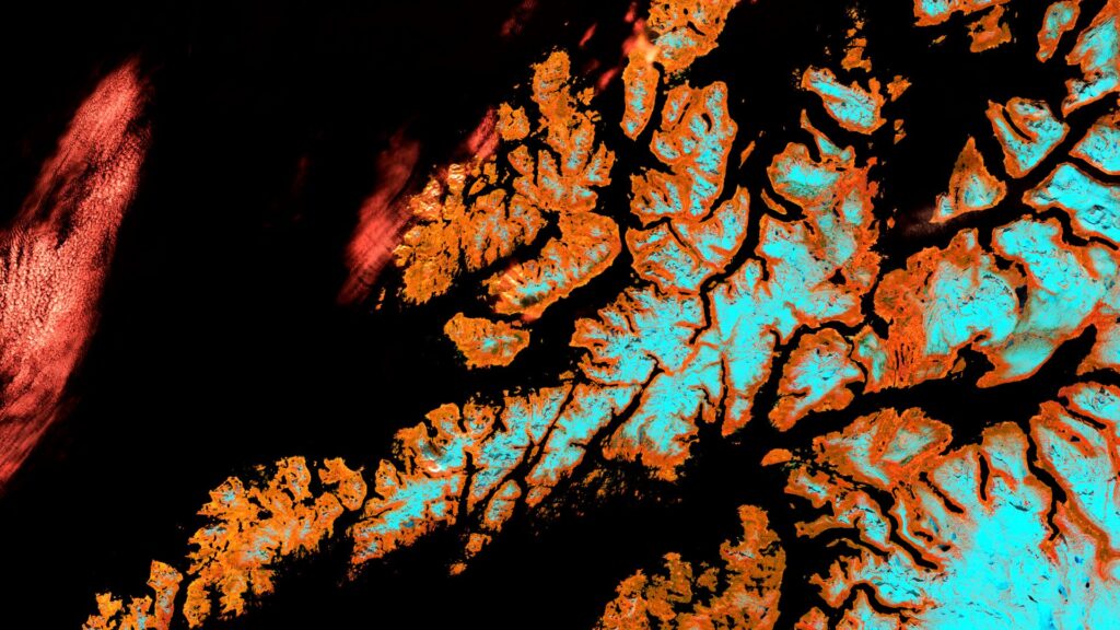
Lofoten – Norway – recorded by the Sentinel-2B satellite on May 17, 2024
Our satellite image of the month for September shows the archipelago Lofoten in Norway.
The image is based on Sentinel-2 data from the EU Copernicus Programme. Sentinel-2 data consists of freely available multispectral satellite images. Multiple scenes were merged after download and atmospherically corrected using open-source software. Subsequently, a color composition was computed using three different bands. A sharpening method enables a spatial resolution of 10 meters across all bands.
Structure of the image
This band combination is a False color composite useful for carrying out a vegetation analysis. In this composite the bands 11 (short-wave infrared), 8A (visible and near infrared) and 4 (visible red) were used. Healthy vegetation appears in shades of green and can be easily distinguished from soil, which is colored in shades of brown. Water is painted in dark blue to black tones, while ice appears in dynamic blue.
About the islands
The Lofoten Islands are an archipelago in northern Norway, located in the North Atlantic off the coast of Nordland province. They consist of several larger main islands such as Austvågøya, Vestvågøya, Flakstadøya, Moskenesøya, and other smaller islands. Most of the islands are connected by bridges and tunnels, forming a continuous transport route known as the E10.
Geographically, the Lofoten Islands are characterized by a striking mountain range whose steep cliffs rise directly from the sea. The mountains reach heights of up to 1,200 meters. The coastline is rugged and includes numerous fjords, bays, and beaches. Despite its northern location above the Arctic Circle, the Gulf Stream ensures a comparatively mild climate.
Culturally and historically, the Lofoten Islands play an important role in Norwegian fishing, especially for cod, which has been caught here for centuries during the winter season and dried as stockfish. This tradition still shapes the landscape today with the typical wooden racks used to dry the fish.
The Lofoten Islands are known among tourists for their nature and special light. In summer, the midnight sun is visible, while in winter the northern lights can be observed. The picturesque fishing villages with red “rorbuer” (traditional fishermen’s huts) are also among the characteristic features of the region.
Location on the satellite image
The satellite image clearly shows that the mountains in the interior of the individual islands were covered with snow at the time the image was taken. They are shown in light blue or cyan on the image. The lower elevations immediately adjacent to the coast, on the other hand, are already snow-free. The predominantly orange color suggests sparse vegetation consisting of shrubs, bushes, and heathland. Only a few very small areas, which are probably mainly used for agriculture, are colored green. A red cloud can be seen on the left edge of the image.
A different view of the region
The following animations help understanding the geographical location of the image. They show the location of the satellite image of the month at various scales and an overlay with OSM data. The map visualisations were created using the terrestris OpenStreetMap Premium service.
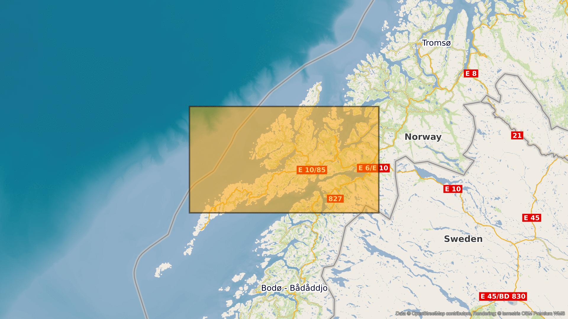
Contains modified Copernicus Sentinel data (2023)/ESA – created by mundialis
Satellite images for your wall available at: https://art-from-space.de