
Analysis Ready Data – Webinar-recording now online
Sentinel-1 and Sentinel-2 data offer enormous potential for environmental monitoring, land cover analysis, and municipal applications. However, getting started can often seem complex—especially due to preprocessing steps and the variety of data products. In this webinar, we show how Analysis Ready Data (ARD) significantly simplifies access. We provide a practical overview of available ARD offerings […]
Analysis Ready Data with Sentinel-1 & Sentinel-2 – Invitation to our Webinar
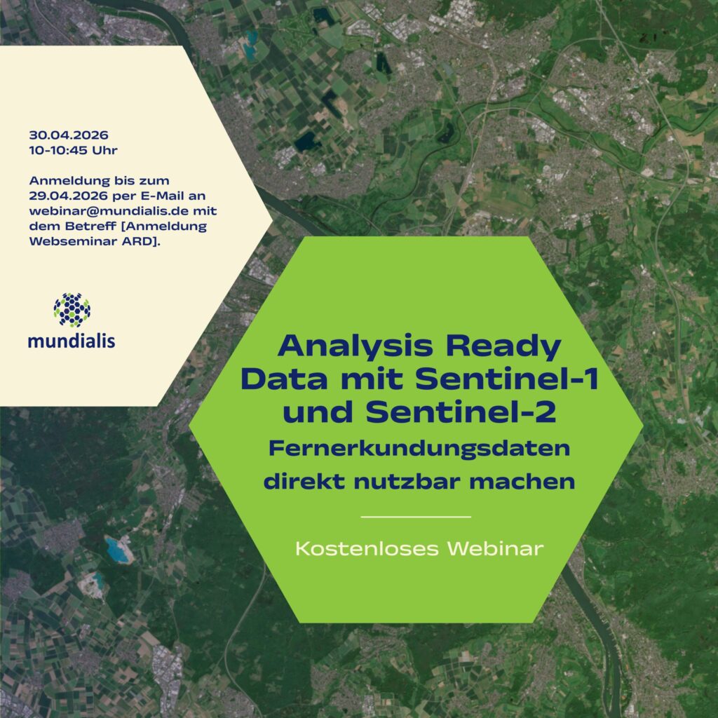
[The Webinar will be held in German]On 30 April 2026, in our webinar, we will show how remote sensing data can be made directly usable with Analysis Ready Data – we warmly invite you to join us. What it’s about: Sentinel-1 and Sentinel-2 data offer enormous potential for environmental monitoring, land cover analysis, and municipal […]
Heat Stress Maps – Webinar-recording now online
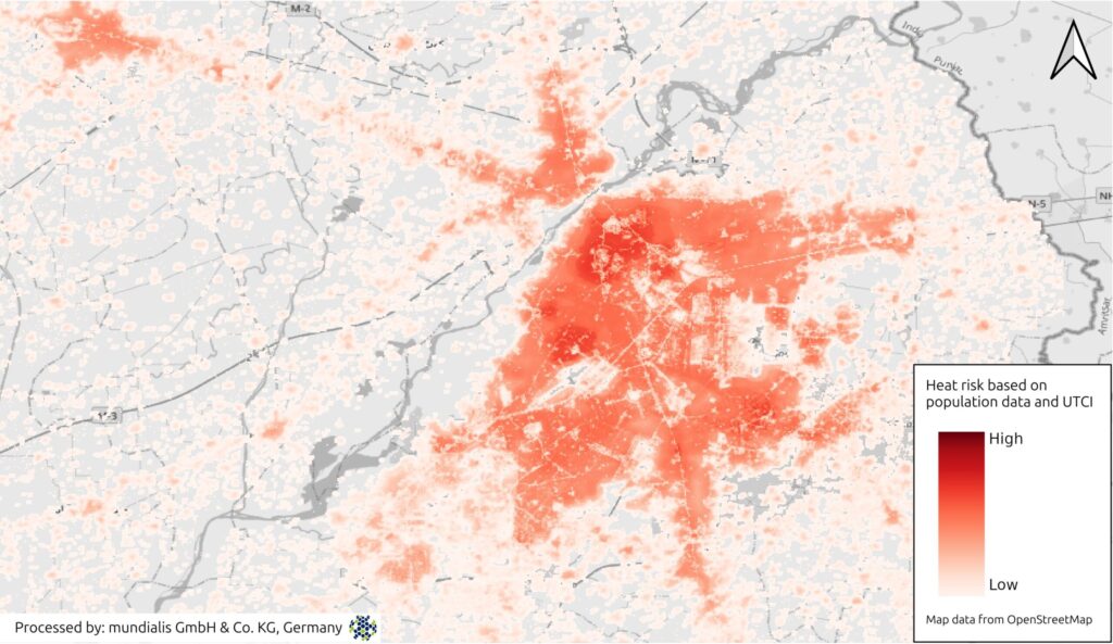
Extreme heat is becoming an increasing challenge for cities and regions worldwide. In this webinar, we demonstrate how Earth observation (EO) and remote sensing data can be used to systematically assess heat-related risks. Participants will receive a concise overview of relevant data sources, remote sensing methods, and commonly used heat and heat stress indices. Using […]
A Look Back on 2025
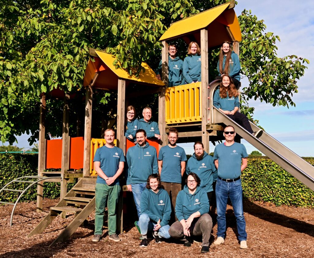
2025 has been a special year for us in many ways—not least because we are celebrating our 10th anniversary. Over this time, our team has grown considerably. Our group photo was taken in September during our retreat in Slenaken—on a playground. And that suits us well: play fosters creativity, collaboration, and well-being, all of which […]
Heat Stress Maps – Webinar Invitation
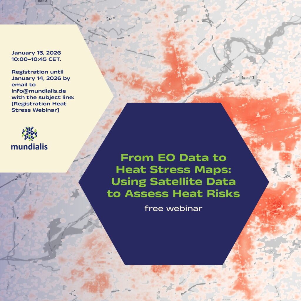
We are pleased to invite you to the online webinar “From EO Data to Heat Stress Maps: Using Satellite Data to Assess Heat Risks” on 15 January 2026, 10:00–10:45 CET. What the webinar is about Extreme heat is becoming an increasing challenge for cities and regions worldwide. In this webinar, we demonstrate how Earth observation (EO) and […]
Satellite Image of the month – December – Berry Islands (Bahamas)
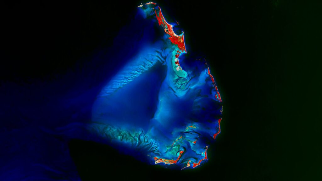
Berry Islands – Bahamas, recorded by the Sentinel-2A satellite on August 1st, 2025 Our Satellite Image of the Month shows the Berry Islands, an island chain belonging to the Bahamas. The chain is located in the northwestern part of the country, specifically north of New Providence Island, which is home to the capital, Nassau. The […]
Waldmonitoring mit Sentinel-2 – Einladung zum Webinar
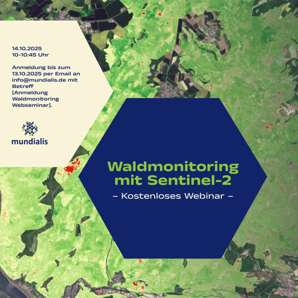
Wir laden Sie und Euch herzlich zum kostenlosen Webseminar „Waldmonitoring mit Sentinel-2“ am 14.10.2025 von 10-10:45 Uhr ein! Darum geht’s: In diesem Webseminar erläutern wir, wie aktuelle Satellitendaten modernes Waldmanagement unterstützen können. Wir zeigen, wie aus Sentinel-2-Daten nutzbare Informationen entstehen, erläutern unsere Analyseverfahren und stellen die eingesetzten Tools vor. Anhand praxisnaher Beispiele erfahren Sie, wie […]
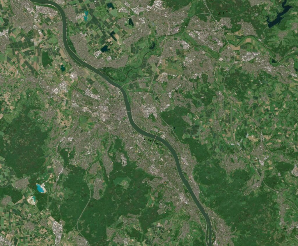
Satellite image of the month – July – Vienna (Austria)
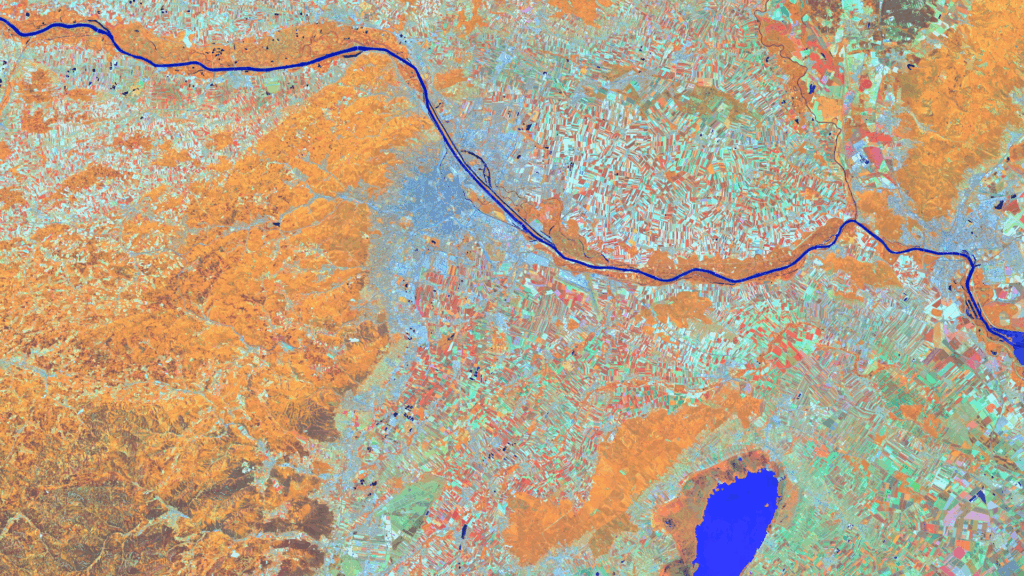
Vienna – Austria – recorded by the Sentinel-2A satellite on June 13, 2025 Our satellite image of the month for July shows the Austrian capital Vienna and the surrounding region. In the last week of June, the Living Planet Symposium 2025, one of the largest conferences on Earth observation, took place there. Structure of the image The image is based on Sentinel-2 data from […]
Satellite image of the month – June – Dalhart (Texas, USA)
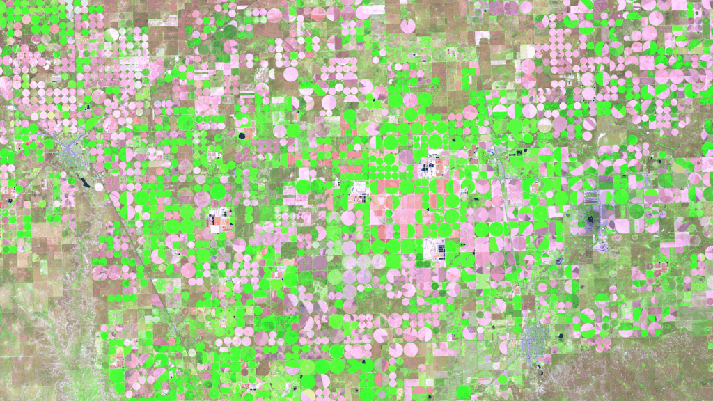
Dalhart – Texas, USA, captured by the Sentinel-2A satellite on May 16, 2025. Our satellite image of the month of June shows the area surrounding Dalhart in Texas, which is characterised by agriculture and a special irrigation technique. Structure of the image The image is based on Sentinel-2 data from the EU Copernicus Programme. Sentinel-2 […]
Satellite image of the month – May – Banks Peninsula (New Zealand)
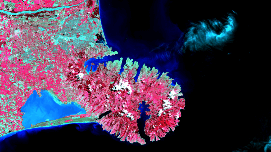
Banks Peninsula – New Zealand, imaged by the Sentinel-2C satellite on 22.01.2025 Our satellite image of the month of May shows the Banks Peninsula and the city of Christchurch on the east coast of New Zealand’s South Island. Structure of the Image The image is based on Sentinel-2 data from the EU’s Copernicus program. Sentinel-2 […]