Das Unternehmen mundialis zeigt im Foyer vom 12. bis 30. Juni Satellitenbilder
Der Blick aus dem All in Form von Satellitenbildern ist meistens ein echter Hingucker. Davon können sich Besucher des Bonner Stadthauses ab 12. Juni selbst überzeugen. Denn das Bonner Unternehmen mundialis präsentiert dort bis Ende des Monats einen Ausschnitt seiner Arbeit: Satellitenbilder mit Regionen aus aller Welt, die in dieser Aufbereitung vor allem als spektakulärer Wandschmuck dienen. Dennoch ist jedes Bild eine nach wissenschaftlichen Kriterien bearbeitete Darstellung von Bilddaten, die von den erst seit kurzem in der Umlaufbahn kreisenden sogenannten Sentinel-Satelliten der Europäischen Union stammen.
Die Analyse und Aufbereitung von Satellitenbilddaten für wissenschaftliche und kommerzielle Zwecke wie zum Beispiel für die Land- und Forstwirtschaft ist das Kerngeschäft des Start-Up- Unternehmens mundialis. Mit diesen Daten können z.B. Vegetationszustände, Wassergehalt von Böden, Oberflächentemperaturen und vieles mehr bestimmt werden.
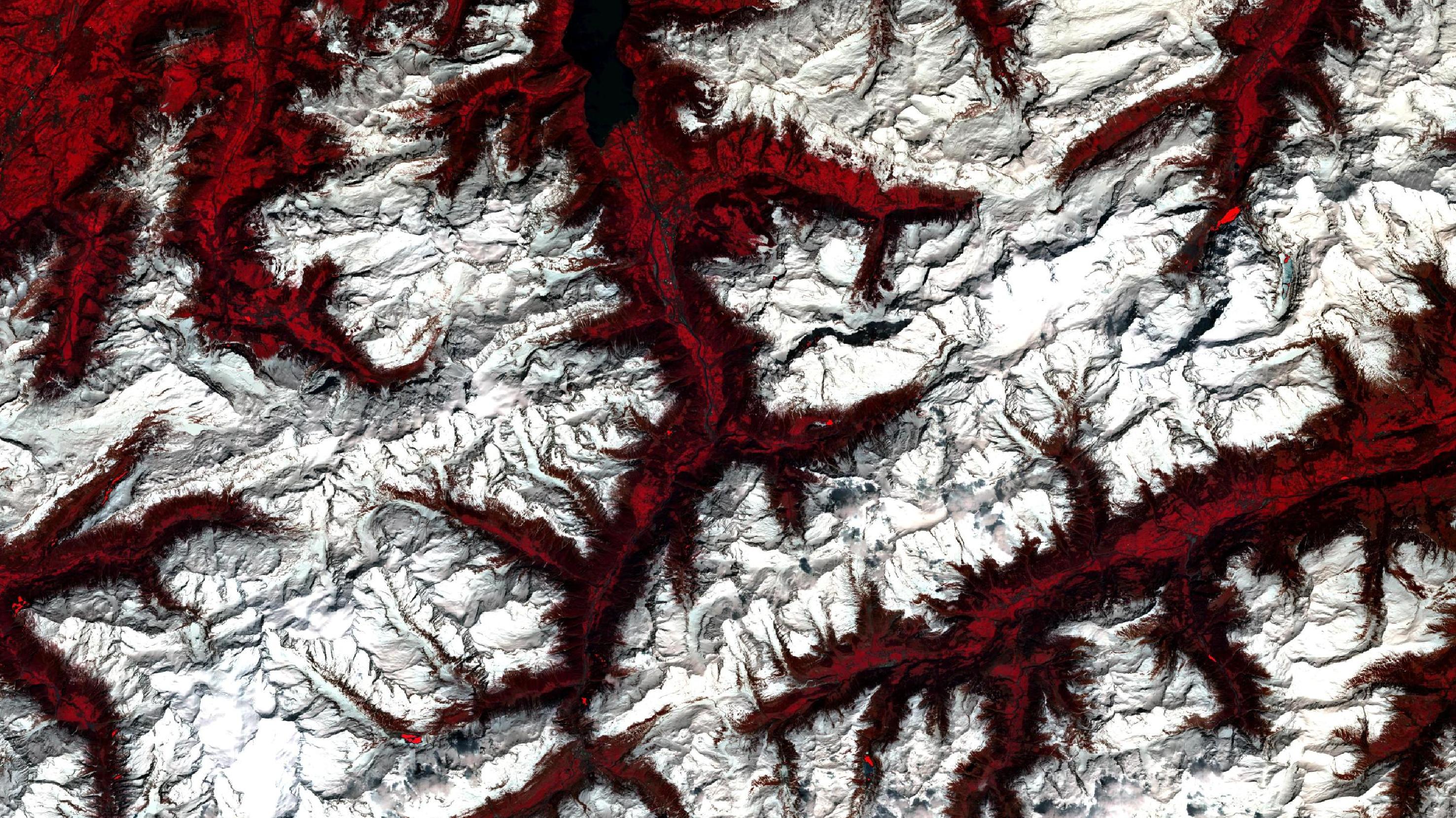
Zu sehen ist in der Ausstellung beispielsweise eine Infrarot-Falschfarben Komposition der Grenze der Urner und Glarner Alpen in der Schweiz (siehe Bild). Der Vorteil: Pflanzen und Bäume erscheinen in unterschiedlichen Rottönen, die sogar Hinweise auf das Alter der Pflanzen geben: Frische Vegetation erscheint in grellen Rottönen, während ältere Pflanzen in dunkleren oder blasseren Rottönen erscheinen. Wasser ist in einer solchen Darstellung in dunklen Blau- bis Schwarztönen gemalt, während Städte grau bis bräunlich eingefärbt sind.
Gezeigt werden dieses und weitere Bilder aber vor allem wegen ihrer ästhetischen Qualitäten, die all diese Aufnahmen jenseits ihrer analytischen Funktion aufweisen. Denn je nach Untersuchungszweck entstehen dabei immer wieder geradezu dramatisch spektakuläre Bildkompositionen, in denen die Farben und Formen der Erde regelrecht zu abstrakten Gemälden werden. Aber auch Aufnahmen in natürlicher Optik, in denen etwa Bonn und das Siebengebirge erkennbar sind, haben ihren Reiz und laden dazu ein, einen neuen Blick auf bekannte Landschaften zu werfen. Vor allem Inseln und Küstenlandschaften wie Sylt oder auch das Kap der Guten Hoffnung in Südafrika sorgen beim Betrachter für Wiedererkennungswert oder gar Urlaubsstimmung. Geheimnisvoller wird es beim Etosha Nationalpark in Namibia, denn aus dem All betrachtet wirkt die Landschaft des berühmten Kalahari-Becken fast wie ein abstraktes Gemälde von Gerhard Richter.
Unter der Adresse art.mundialis.de kann man sich zusätzlich zur Ausstellung inspirieren lassen, welche Bilder eventuell auch für den eigenen Bedarf von Interesse sind. Formate, Größen Erdregionen, Bildausschnitte und Art der Bildaufbereitung sind frei wählbar.
Für interessierte Gruppen besteht die Möglichkeit, die Ausstellung unter fachkundiger Führung von Mitarbeitern der Firma mundialis zu besuchen. Dafür ist eine individuelle Terminvereinbarung notwendig.