
Die österreichischen Hochalpen – Hohe Tauern Nationalpark
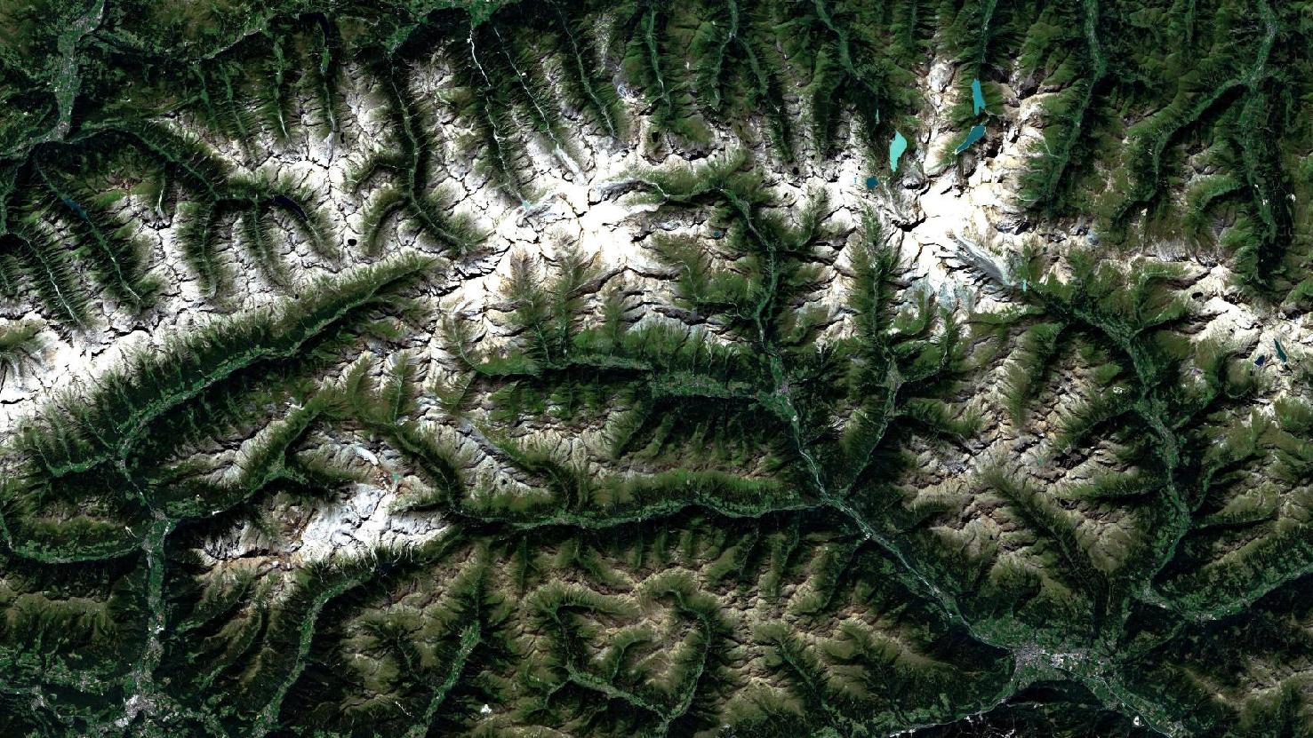
Das Satellitenbild des Monats Dezember zeigt Teile des Nationalparks bzw. des Hochgebirges “Hohe Tauern” in Österreich. Das Bild ist eine Echtfarbenaufnahme und wurde vom europäischen Sentinel 2A Satelliten aufgenommen. Im mittleren Bereich des Satellitenfotos sind deutlich die weißen, schneebedeckten Berge des Hochgebirges Hohe Tauern zu erkennen. Hohe Tauern besteht aus insgesamt neun Gebirgsgruppen wie beispielsweise der Glocknergruppe im Osten des Satellitenbildes oder auch der Venedigergruppe im Westen.
Der Nationalpark zählt mit 1856 km² Fläche zu den größten Nationalparks Europas und beherbergt mit die höchsten Berge der Alpenregion, unter Anderem auch den höchsten Berg Österreichs, den Großglockner mit 3798 Metern über dem Meeresspiegel. Dieser ist auf dem Satellitenbild in der östlichen Glocknergruppe zu lokalisieren und durch die sehr weißen, schneebedeckten Berggipfel zu erkennen. Auch die nördlich des Großglockners gelegenen Seen wie etwa den türkisgrünen Tauernmoossee oder auch den etwas östlich gelegenen Stausee Mooserboden, helfen bei der Lokalisierung des Großglockners. Der nur geringfügig kleinere “Großvenediger” (3657 m) lässt sich ebenfalls durch die nach wie vor schneebedeckten Bergmassive im Westen des Bildes erkennen.
Besonders bei Touristen ist der Hohe Tauern Nationalpark sowohl im Sommer als auch im Winter beliebt. Zwar sind die höchsten Gipfel noch im Hochsommer schneebedeckt, jedoch kommen zu dieser Zeit hauptsächlich Wanderer oder Radsportler in diese Region. Ab Mitte November beginnt der Ski-oder auch Snowboardtourismus, aber auch zahlreiche Schneewanderer zieht es in den Park. Bereits Mitte Dezember kann mit stark verschneiten Wanderwegen gerechnet werden.
Zwischen den Bergmassiven der österreichischen Zentralalpen liegen die in hell- und dunkelgrün gefärbten Täler. Gut zu erkennen sind einige städtische Siedlungen im südlichen Teil des Satellitenbildes: Links liegt das italienische Dorf “Niederrasen” und im rechten Teil liegt die tiroler Stadt Lienz. Beide Dörfer werden häufig von Sporttouristen aufgesucht um tagsüber Hohe Tauern zu besuchen.
Contains modified Copernicus Sentinel data (2016-2017)/ESA – created by mundialis
Weitere Satellitenbilder gibt es unter https://maps.mundialis.de
Die Erde als Kunstwerk: https://art.mundialis.de