
In der vergangenen Woche, am 10. September, fand das jährliche globale Treffen der Open Geospatial Foundation (OSGeo) Community statt. Normalerweise findet dieses Meeting seinen Platz im Rahmen des regulären Programms der alljährlichen FOSS4G, aber was ist in diesem Jahr schon normal? Folglich gab es also ein Online-Event, das zeitgleich auch auf YouTube gestreamt wurde. Damit waren die Rahmenbedingungen geschaffen, einen großen Kreis an Teilnehmern weltweit zu erreichen und tatsächlich haben einige der Redner festgestellt, dass sie in diesem Jahr das erste Mal am Jahrestreffen teilnehmen konnten.
Inhaltlich wurde die gesamte Palette der OSGeo-Inhalte abdeckt und vorgestellt. Nach einführenden Worten des Präsidenten Angelos Tzotsos mit einer generellen Einführung zur OSGeo folgten Zahlen zu Mitgliedern, Projekten und Events, der alljährliche Kassenbericht und ein vom gesamten Board of Directors vorgetragener Bericht über deren Arbeit. Berichtenswert sind sicher die sich anbahnende Kooperation der OSGeo mit ISO/TC 211, dem technische Komitee der ISO, welches sich mit Geografischen Informationen und Geomatik beschäftigt sowie die Vertiefung der bestehenden Kooperation mit dem OGC, welche auf die Unterstützung von Projekten im OGC-Zertifizerungsprozess ausgeweitet wurde.
Anschließend kam das Organisations-Komittee (BALOC) der kommenden globalen FOSS4G in Buenos Aires zu Wort. Stand heute wird die Konferenz zweigleisig geplant, einmal als On-Site- und parallel als Online Event. Wir hoffen natürlich alle, dass es im September 2021 möglich sein wird, sich wieder persönlich zu treffen und drücken dem BALOC alle Daumen! Der dann folgende Bericht über stattgefundene Konferenzen und Codesprints fiel allerdings sehr ernüchternd aus, da die meisten geplanten Veranstaltungen nicht stattfinden konnten. Die im März in Freiburg veranstaltete FOSSGIS-Konferenz des deutschsprachigen Local Chapters FOSSGIS e.V. war somit die letzte OSGeo-Präsenzveranstaltung vor dem weltweiten Einstellen solcher Aktivitäten. Dennoch zeigt sich auch hier die Findigkeit unserer Community, durchaus einige Events fanden Online statt, so beispielsweise der sonst alljährlich stattfindenden Bolsena-Codesprint, der eben diesmal vom Homeoffice aus stattgefunden hat. Verweisen möchten wir auch auf „de Grote GeoShow“, ein monatlich veranstaltetes Online Web-Seminar des niederländischen Local OSGeo Chapters.
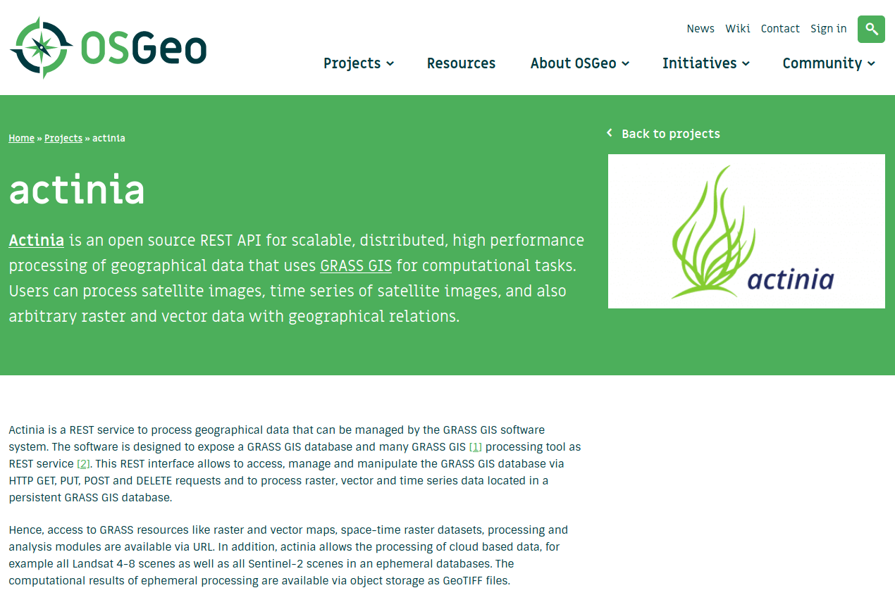
Schlussendlich kamen die OSGeo-Komittees, Projekte und die lokalen Chapter selbst zu Wort und stellten Ihre Aktivitäten des vergangenen Jahres vor. Bei den Community-Projekten konnte sich damit auch bereits zum zweiten mal actinia, an dem wir als mundialis maßgeblich beteiligt sind, der gesamten Community präsentieren.
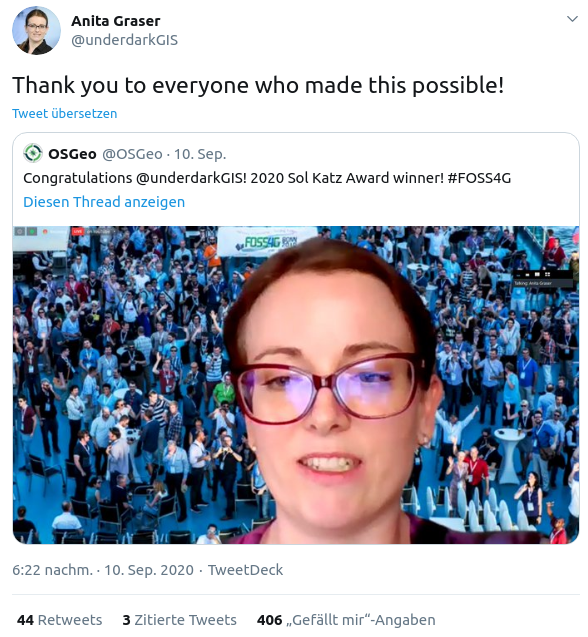
Abgeschlossen wurde das Treffen mit der Veröffentlichung des diesjährigen Gewinners des Sol Katz Awards, einer Auszeichnung, die für besondere Verdienste an unserer Community alljährlich verliehen wird. Die diesjährige Preisträgerin ist Anita Graser (@underdarkGIS), die sich insbesondere mit viel persönlichem Einsatz um das QGIS Projekt verdient gemacht hat. Von uns an dieser Stelle nochmal herzlichen Glückwunsch zu dieser sehr verdienten Auszeichnung!
Wer sich künftig rund um alle Aktivitäten der OSGeo oder auch nur speziell zu einigen Projekten informieren möchte, dem sei das AGM der OSGeo empfohlen. Alle Links zum Programm und zu den präsentierten Folien sowie auch zum YouTube-Kanal, mit der diesjährigen Aufzeichnung, finden sich auf der Wikiseite zum AGM.
Als ein Fazit kann man anmerken, dass einem der Wert einer Präsenzveranstaltung erst dann bewusst wird, wenn man aufgrund äußerer Umstände keine haben kann. Es bleibt jedoch festzustellen, dass der einfache Zugang per Web-Seminar oder Live-Stream mit hoher Wahrscheinlichkeit Bestand haben wird, auch um die Schwelle der Teilnahme an dieser sehr informativen Veranstaltung für möglichst viele Interessierte möglichst niedrig zu halten.