
Heat Stress Maps – Webinar Invitation
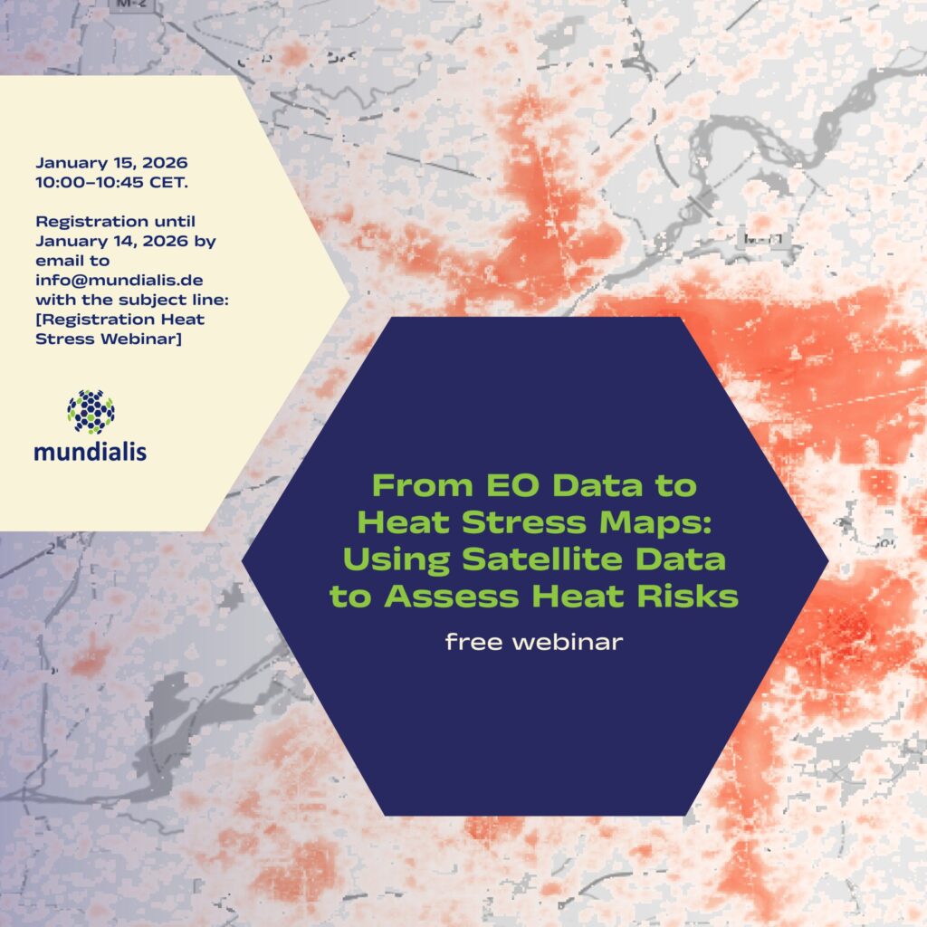
We are pleased to invite you to the online webinar “From EO Data to Heat Stress Maps: Using Satellite Data to Assess Heat Risks” on 15 January 2026, 10:00–10:45 CET. What the webinar is about Extreme heat is becoming an increasing challenge for cities and regions worldwide. In this webinar, we demonstrate how Earth observation (EO) and […]
Our CO₂e compensation for 2024
As in previous years, we have recorded the emissions from our business travel for 2024 and documented how we compensated for them. For 2024, our emissions from business travel totaled 3.172 tonnes of CO₂e. This figure consists of 2.799 tonnes from the current year and 0.373 tonnes carried over from 2023. For compensation purposes, the value was rounded to 3 tonnes. […]
AI-supported sealing analysis – webinar recording now available
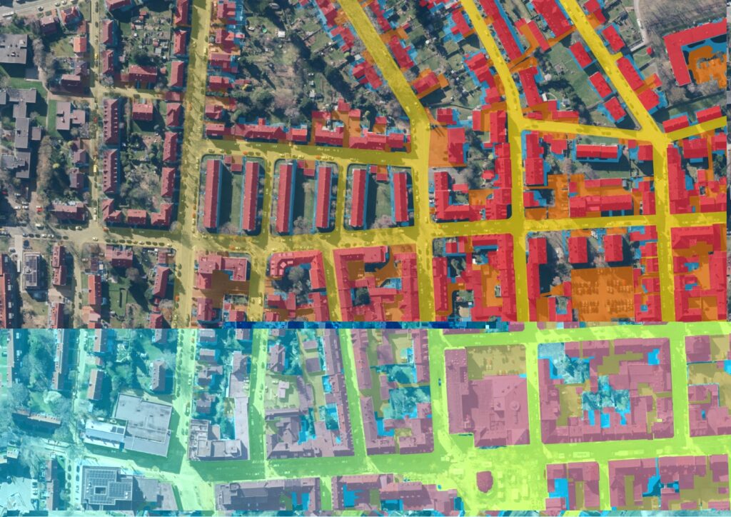
mundialis has developed a flexible AI framework for differentiating surface classes from freely available aerial images, which we will present in two webinars. This first part highlights a practical example from wastewater management: we explain our approach, from the preparation of training data and the selection of a suitable AI architecture to the development of […]
Looking Back on Our Team Retreat in Slenaken
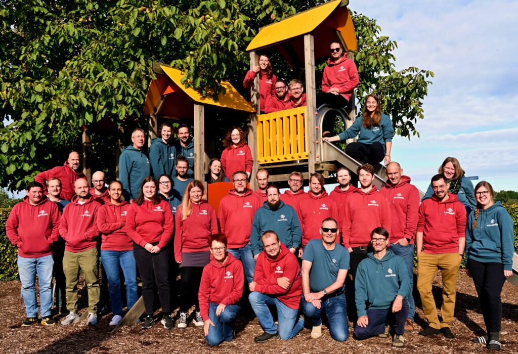
At the end of September, our team went on a retreat together with terrestris in Slenaken (NL). Many of us traveled there by bike – a communal, relaxed, and climate-friendly journey. Once there, shared cooking, good food, and many conversations were just as much a part of it as focused working sessions. Free from the pressure of appointments, […]
mundialis is now a member of the Open Source Business Alliance!
We are pleased to announce that mundialis is now a member of the Open Source Business Alliance (OSBA). The OSBA is Germany’s largest network of companies and organizations committed to Free and Open Source Software (FOSS). As a company specializing in Earth observation, we work daily with satellite and geospatial data and consistently rely on open-source technologies—out of […]
Einladung zum Webseminar „KI-gestützte Versiegelungsanalyse”
Wir laden Sie und Euch herzlich zum Webseminar „KI-gestützte Versiegelungsanalyse – Flächenversiegelung für die Abwasserwirtschaft“ am 20.11.2025 von 10-10:45 Uhr ein! Darum geht’s: mundialis hat ein flexibles KI-Framework zur Differenzierung von Oberflächenklassen aus frei verfügbaren Luftbildern entwickelt, das wir in zwei Webseminaren vorstellen. Dieser erste Teil beleuchtet ein Praxisbeispiel aus der Abwasserwirtschaft: Wir erläutern unser Vorgehen […]
10 Years of mundialis – Looking Back on Open Paths
In 2015, we started with the conviction that there are better ways to work with data. Without licensing barriers. Without black boxes. Instead: openness, transparency, and shared learning. We work with data from space, but we keep both feet firmly on the ground.We develop publicly accessible software because we believe that knowledge should be shared. […]
Waldmonitoring mit Sentinel-2 – Einladung zum Webinar
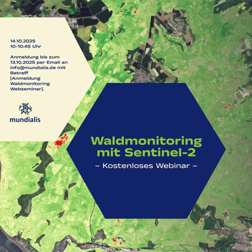
Wir laden Sie und Euch herzlich zum kostenlosen Webseminar „Waldmonitoring mit Sentinel-2“ am 14.10.2025 von 10-10:45 Uhr ein! Darum geht’s: In diesem Webseminar erläutern wir, wie aktuelle Satellitendaten modernes Waldmanagement unterstützen können. Wir zeigen, wie aus Sentinel-2-Daten nutzbare Informationen entstehen, erläutern unsere Analyseverfahren und stellen die eingesetzten Tools vor. Anhand praxisnaher Beispiele erfahren Sie, wie […]
Recap of the Open Day Photogrammetry 2025
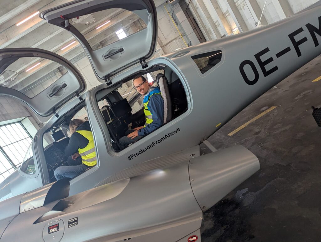
Last week, we had the opportunity to gain fascinating insights into the technology of aerial imaging at this year’s Open Day Photogrammetry at Dortmund Airport – including a close-up look at the specially equipped aircraft regularly used for aerial surveys. As a company that uses aerial imagery as a data foundation, we hosted a workshop […]
We’ve joined the Avalueto Platform
Three of our Earth observation products are now live on Avalueto – the AI-driven platform that’s reshaping how geospatial solutions are shared and applied. Here’s what we’re bringing to the table: ? Single Tree DetectionFor those who need to zoom in – from precision forestry to smart urban greening, this tool helps identify and analyze individual trees. […]