
In recent posts we already spoke about how the HERMOSA platform relies on the successful Copernicus programme operated by the European Commission and managed by the European Space Agency (ESA). We also mentioned that the satellites called Sentinels collect data at high temporal and spatial resolutions and that this data is made available for free to everyone.
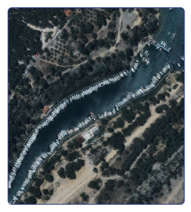
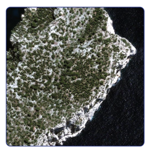
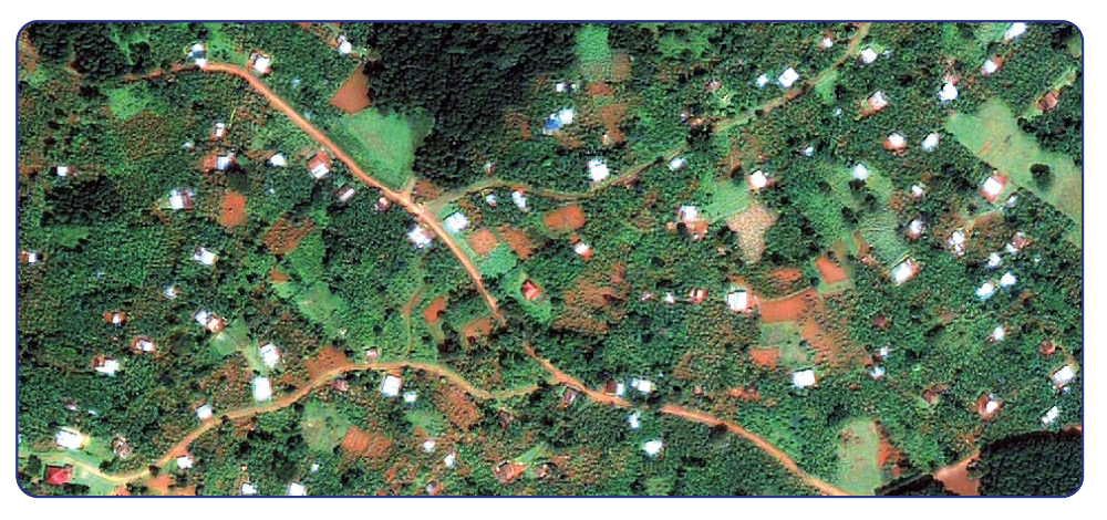
When considering the fact that the data collected by the Sentinels has a spatial resolution of 10 meters, this is very impressive, especially when you realize that this is done continuously across the globe. The resulting data volumes are just as breathtaking. However, for some practical applications like mapping the status of access to restoration sites, this spatial resolution is often not good enough because a path measuring two to three meters in width will likely not show up in the gathered image. Also, if you are interested in individual trees, the very young and small ones can also not be spotted. Many organisations trying to overcome this disadvantage utilize drones to acquire imagery with a much higher spatial resolution. This is a valid approach but also has some drawbacks: (1) you need to buy the drone which can run into the thousands of dollars (2) the drone pilot needs to get to the area in question and back again (3) the data collected usually only features the spectral bands red (R), green (G) and blue (B) which provide limited analytical possibilities (4) local data volumes tend to get very large and need to be stored and processed and (5) acquiring imagery with drones is feasible on a few hundred hectares but does not scale well when considering thousands or even hundreds of thousands of hectares.
Enter Very High Resolution (VHR) satellite imagery: It does not have said disadvantages and is easily accessible through HERMOSA. The most obvious differences to Sentinel data are the spatial and temporal resolution and the cost. The spatial resolution goes down to 0.5 meters and images are only acquired on demand. The customer has to pay for this added data option. Depending on the actual vendor and the satellite in question prices vary a lot but are usually not more than a few dollars per hectare when tasking a satellite to take a fresh image. When accessing images from the archives the price drops significantly. In comparison with drone imagery satellite data has a very attractive price from our point of view and will also scale to very large areas.
In HERMOSA the access to this kind of satellite data is just as easy as accessing any other data. The user only needs to define the area of interest by drawing a bounding box on the map, decide on the desired time range and state the amount of acceptable cloud cover. The system then accesses the archive of a commercial satellite data vendor and retrieves the imagery which is automatically delivered to the HERMOSA layer tree. Data is automatically georeferenced and – due to the multi-spectral bands of the image – can also be analysed like any other satellite data. The development roadmap of HERMOSA envisions providing access to the tasking of satellites, so that users can acquire new data
sets if the archive does not provide sufficiently detailed or up-to-date data.
Contact sales@hermosa.earth today to get started!
Image data provided by up42.com
reposted from: https://hermosa.mundialis.de/news/feature-of-the-week-kw-19/