
“Warum hat Fernerkundung etwas mit Kunst zu tun?”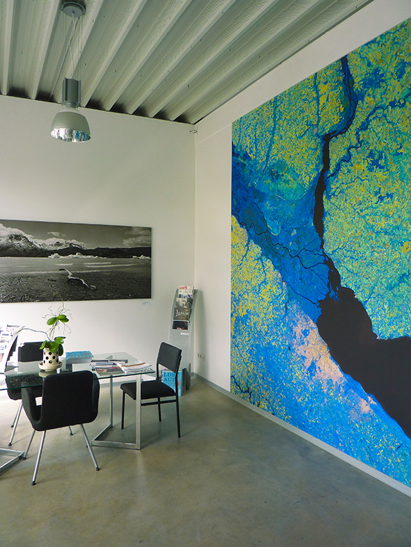
Erfahren Sie die Antwort auf diese Frage am Donnerstag, den 15. September 2016 um 19.30 Uhr im Bettenfachgeschäft Auping Plaza Bonn.
An diesem Abend wird der Geschäftsführer von mundialis, Hinrich Paulsen, einen Vortrag zu dem Titel “Warum hat Fernerkundung etwas mit Kunst zu tun?” halten.
Kommen Sie vorbei und überzeugen Sie sich selbst von den außergewöhnlichen Bildern und sehen Sie wie Wissenschaft und Design Hand in Hand arbeiten. Aktuelle Satellitendaten werden professionell hochauflösend visualisiert. Dabei nutzen wir die gesamte Bandbreite der in den Rohdaten enthaltenen Spektralwellenlängen. Es entstehen anspruchsvolle Bildwerke, die ästhetisch und wissenschaftlich gleichermaßen überzeugen.
Küstenformen mit Wiedererkennungswert oder abstrakte Verdichtungen überraschend bunt anmutender Wüstenlandschaften aus Asien – die ganze Welt liefert die Motivauswahl.
Die Bilder zeigen Kompositionen aus verschiedenen Kanälen basierend auf Sentinel-2 Daten des  Copernicus Programmes. Sentinel-2 Daten sind multispektrale Satellitenaufnahmen, die frei verfügbar sind. Nach dem Download wurden die Szenen von uns mit freier Software atmosphärenkorrigiert und mit jeweils drei verschiedenen Bändern eine Farbkomposition berechnet.
Wir freuen uns darauf Sie am 15. September um 19.30 Uhr im Auping Plaza in Bonn begrüßen zu dürfen!
Informieren Sie sich vorab unter art.mundialis.de und stellen Sie sich Ihr Lieblingsmotiv aus der ganzen Welt zusammen, welches Sie hier in unserem Online-Shop auch direkt erwerben können.