
Westjordanland von Jerusalem bis zum toten Meer, aufgenommen vom Sentinel-2A Satelliten am 22. November 2016
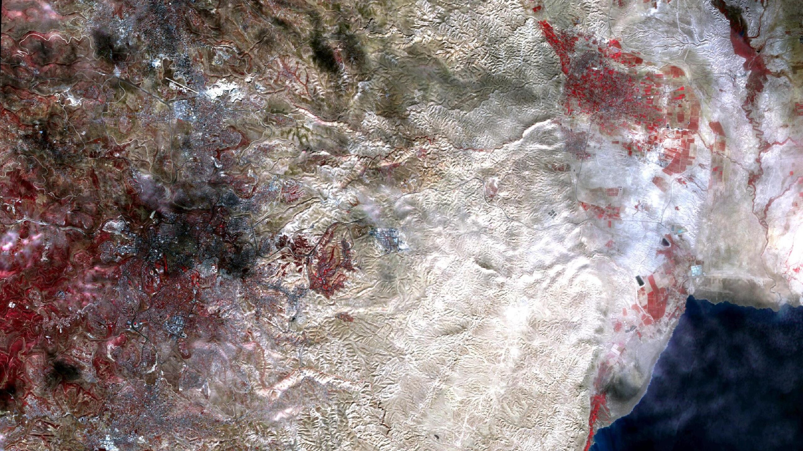
Dieses Bild zeigt eine Infrarot-Falschfarben Komposition vom Westjordanland mit Jerusalem, Bethlehem, Jericho und dem toten Meer. Das Bild wurde aus verschiedenen Bändern, basierend auf Sentinel-2A Daten des EU Copernicus Programms, erstellt. Die verwendete Bandkombination ist nützlich um Vegetation zu erkennen und bietet eine Auflösung von 10 Metern. Vitale Vegetation erscheint in grellen Rottönen während ältere Pflanzen in dunkleren oder blasseren Rottönen erscheinen. Wasser ist in dunklen Blau- bis Schwarztönen gemalt, während Städte Hellgrau bis bräunlich eingefärbt sind.
Im Südwesten des Bildes sieht man Bethlehem und nördlich davon Jerusalem. Aus der Luft unsichtbar verläuft die israelische Grenze zum Westjordanland.
Im Nordosten des Bildes sieht man Jericho, welche nicht unumstritten die älteste Stadt der Welt ist und mit ihrer Lage von 250 Meter unter dem Meeresspiegel auch die tiefstgelegenste Stadt der Welt. Nach ihr ist die Rose von Jericho (auch Wüstenrose) benannt. Sie ist Bestandteil einiger Mythen. Mancherorts wird sie von Generation zu Generation weitergereicht, um Glück und Segen zu übergeben. Im Südosten des Bildes sieht man das Tote Meer, das der am tiefsten gelegene See der Erde ist und für seinen hohen Salzgehalt bekannt ist.
Contains modified Copernicus Sentinel data (2016)/ESA – created by mundialis