
Inarijärvi – Finland, recorded by the Sentinel-2B satellite on May 11, 2018
Our satellite image of the month January shows Lake Inarijärvi in Lapland in northern Finland.
The image is based on Sentinel-2 data from the EU Copernicus Programme. Sentinel-2 data consists of freely available multispectral satellite images. After the download, the scene was atmospherically corrected using open-source software. Subsequently, a color composition was computed using three different bands.
Structure of the image
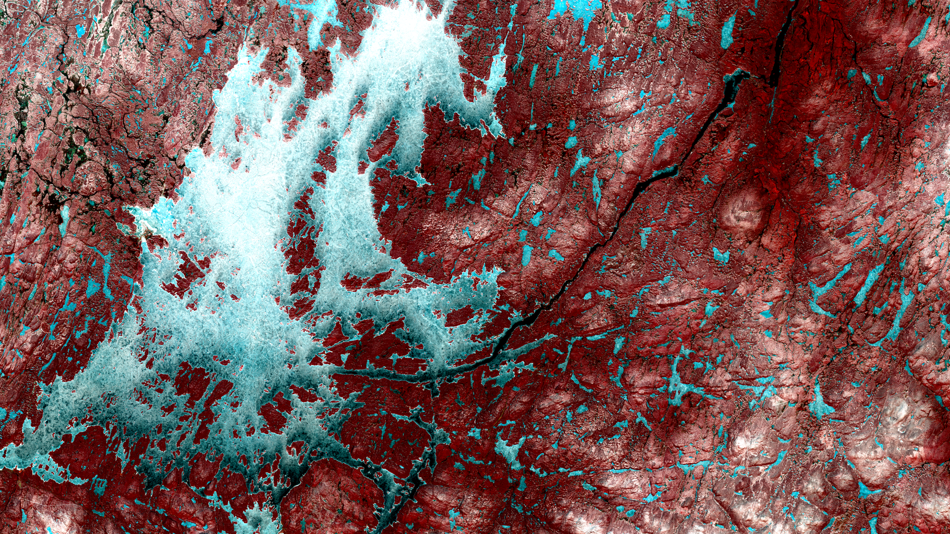
The chosen color infrared composite is particularly well suited for visualizing vegetation. Vegetation appears in various shades of red, older vegetation in green, soil in shades of brown and green, urban areas in blue-gray, clouds, snow and ice are light turquoise or white.
In the selected image section, Lake Inarijärvi is visible in the western part. To the east, the Paatsjoki River can be seen draining the lake into the Arctic Ocean, which is located only about 100 kilometres away. While Inarijärvi lies entirely within Finland, the Russian and Norwegian borders are merely 10 to 30 kilometers from the lake’s eastern shore. They run parallel to or along the Paatsjoki River. The border triangle (Treriksrøysa) between Finland, Norway and Russia lies slightly north-west of the river bends in the top right of the picture.
About Lake Inarijärvi
Lake Inarijärvi, also known as Lake Inari, is situated well north of the Arctic Circle. Covering an area of over 1,100 square kilometers, it is the largest body of water in Lapland and the third largest lake in Finland. It is home to approx. 3,000 islands that form a labyrinth of waterways. Thanks to its rich fish population, including salmon and trout, the Inarijärvi is a popular destination for anglers.
The region also holds significance for tourism, whether for boat trips in summer or for observing the Northern Lights in winter. Inari, a town southwest of the lake, is home to a museum that presents the culture and history of the Sámi, the indigenous people of Lapland. Lapland, a region spanning parts of Norway, Sweden, Finland, and Russia, is also known for its extensive forests, clear rivers and diverse wildlife including reindeer, bears, and various Arctic bird species.
On the satellite image from May 2018, the lake is still covered in ice. The structure of the lake’s surface and its bluish rather than white color suggest that the winter snow has mostly melted. The surrounding area is also only partially covered by snow. Most of the land is coloured in shades of red, indicating a vegetation cover. The Paatsjoki river is ice-free and is shown in black.
Contains modified Copernicus Sentinel data (2018)/ESA – created by mundialis
More satellite images are available at https://maps.mundialis.de