
Prizren – Republic of Kosovo, recorded by the Sentinel-2B satellite on May 06, 2023
Our satellite image of the month June shows the city of Prizren and its surroundings in Kosovo.
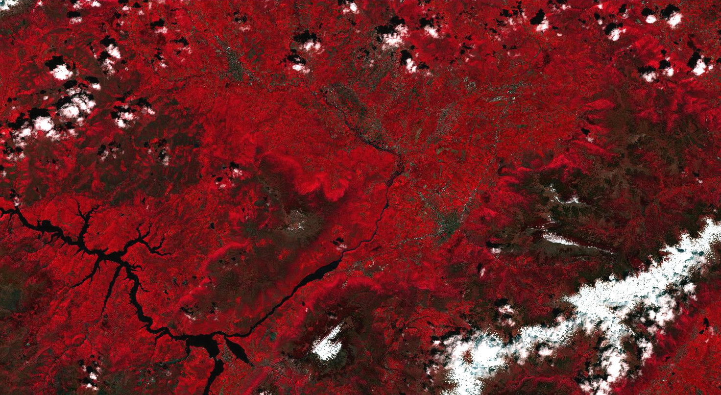
The image is based on Sentinel-2 data of the EU Copernicus program. Sentinel-2 data are freely available multispectral satellite images. After downloading, the scene was atmospherically corrected using free software and a color composition was calculated using three different bands. Bands 8 (visible and near infrared), 4 (visible red), and 3 (visible green) were used, allowing a spatial resolution of 10 meters. This false color composition is particularly suitable for vegetation analysis. The selected color infrared display is particularly well suited for the detection of vegetation. Vegetation appears in different shades of red, older vegetation in green, soil in shades of brown and green, urban regions in blue-grey, clouds, snow and ice are light turquoise or white.
Prizren is a city in the south of Kosovo at the foot of the Šar Planina mountains and not far from the main border crossing with Albania. With more than 85,000 inhabitants, Prizren is – after the Kosovan capital Pristina – the second largest city in the country. It is also an important traffic junction, a cultural center and has touristic importance, especially because of the partially preserved old town and other historical buildings.
In the left part of the picture you can see the Fierza reservoir, which is mostly located on Albanian territory. A 152 meter high dam impounds the two rivers Black Drin and White Drin to the largest reservoir in Albania. The dammed part of the White Drin reaches into Kosovo.
In the lower right corner of the picture, the snow-covered peaks of the Šar Planina mountain range can be seen, which is located in the border region between Kosovo and North Macedonia. The highest mountains of the range rise to over 2,700 meters above sea level. On the Kosovar side lies the Sharr National Park, which spreads over an area of 390 km². There are also several winter sports areas on both sides of the border.
The false color composition chosen for the image makes the vegetation – represented by different shades of red – stand out, especially around the Fierza reservoir, which is easily recognizable by the water shown in black, and is pronounced in the west of Prizren. In contrast to the vegetation-rich areas, are the urban areas, which are shown in shades of gray and green. Moreover, in the Šar Planina mountains, with increasing altitude, a decreasing intensity of red tones can be seen, signifing a decreasing vegetation density,. In May, the peaks were still covered with snow and are therefore shown in white.
This year, from June 26 to July 2, the FOSS4G (Free and Open Source Software for Geospatial) conference will take place in Prizren, organized annually since 2006 by OSGeo (Open Source Geospatial Foundation). OSGeo was founded to promote the development and use of free and open source geospatial software. During the conference, both developers and users of free GIS software will come together in order to discuss and develop projects and software.
Contains modified Copernicus Sentinel data (2023)/ESA – created by mundialis
More satellite images can be found here: https://maps.mundialis.de