
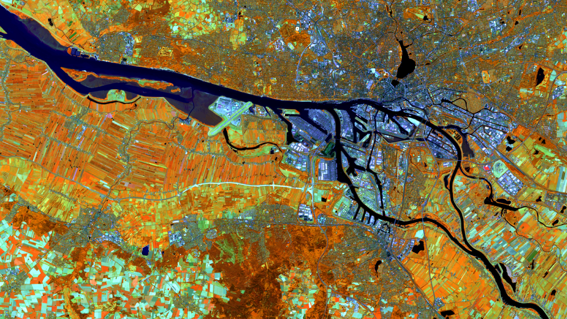
Hamburg – Germany, recorded by the Sentinel-2A satellite on 12 August, 2022
Our satellite image of the month March shows the city of Hamburg in northern Germany and its surroundings.
Structure of the image
The image is based on Sentinel-2 data from the EU Copernicus programme. Sentinel-2 data consists of freely available multispectral satellite images. After the download, the scene was atmospherically corrected using free software, and subsequently, a color composition was calculated using three different bands.
This band combination is a false color composite useful for discriminating land and water. In this composite the bands 8A (visible and near infrared), 11 (short-wave infrared) and 4 (visible red) were used which provide a spatial resolution of 20 meters. With this composite healthy vegetation appears in orange and older vegetation appears in green. Soil and clouds appear in shades of green as well. Water is coloured in dark blue and violet tones, while urban regions are shown in lighter shades of blue.
About the city and its port
Hamburg, the second largest city in Germany, is an important economic, cultural and tourist centre. The city stretches along the River Elbe and has numerous waterways and canals. The Port of Hamburg is one of the largest seaports in the world and plays a central role in the city’s economy. It extends over 7,200 hectares and is an important gateway for international trade. More than 8 million containers pass through the port every year, making it an important transhipment centre for goods from all over the world. Hamburg’s location as a harbour city and its cultural heritage make it a fascinating city that attracts visitors from all over the world.
The satellite image clearly illustrates the port of Hamburg in the inland delta of the Elbe, nestled between the two arms of the Norderelbe and Süderelbe rivers. The extensive, sealed harbour areas are presented in lighter shades of blue and stand out clearly from both the rural surroundings and the rest of Hamburg’s urban area. North of the Norderelbe are the districts of Altona, Eimsbüttel, Hamburg-Nord and Wandsbek (in the upper right part of the image). In contrast to the harbour, orange-coloured areas indicate significantly less sealed surfaces and a greater proportion of vegetation. The district of Harburg extends south-westwards from the harbour area (in the lower middle part of the image) . Agricultural areas are visible here, with harvested areas shown in turquoise and cultivated fields in dark orange.
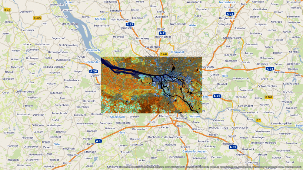
A different view of the region
To facilitate geographical placement, please refer to the following animation, which shows the satellite image of the month at various scales of the terrestris OpenStreetMap service.
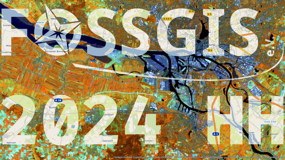
FOSSGIS 2024
From 20th to 23rd March 2024, the FOSSGIS conference will be held in Hamburg . The focus will be on free and open source software for geoinformation systems (FOSSGIS), open data and Open Street Map (OSM). Developers, users and researchers come together to present and discuss the latest developments and projects in these subjects. The venue for this year’s conference is the campus of Hamburg University of Technology, which is located in the district Harburg south of the harbour.
At FOSSGIS 2024, mundialis and terrestris will once again be repcresenting Earth Observation (EO) and GIS. Which image could symbolise this better than the cross-fade between remote sensing data of the satellite image of the month and the corresponding section of a rendering of, primarily, data from the OpenStreetMap project in the corresponding image section? ?
Here you can view the contributions and workshops of mundialis and terrestris as well as the complete programme of FOSSGIS 2024.
Contains modified Copernicus Sentinel data (2022)/ESA – created by mundialis
More satellite images are available at https://maps.mundialis.de