
Almería – Spain, recorded by the Sentinel-2B satellite on September 30 2021
Our satellite image of the month October shows a section of the Spanish south coast, in the province of Almería in Andalusia.
The image is based on multispectral images from the Sentinel-2 satellite of ESA’s Copernicus program. After downloading the freely available data, the scene was atmospherically corrected using free software.
Structure of the image
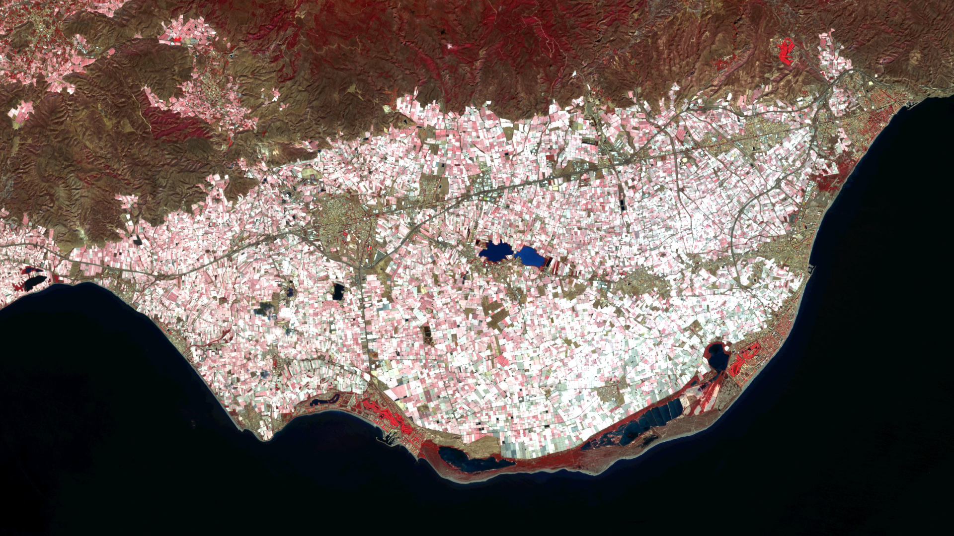
For the false color composition shown here, bands 8 (near infrared), 4 (red) and 3 (green) were used. This color-infrared-composite is particularly well suited for the detection of vegetation. Healthy vegetation appears in various shades of red, older vegetation in green. Soil is shown in shades of brown and green, and urban regions in blue-gray. The selected bands allow a high spatial resolution of 10 meters.
About the region Almería
The picture shows a growing region for fruit and vegetable which is almost completely covered with plastic films. The plastic films are clearly recognizable by their light coloration. Also visible are the towns of El Ejido in the west (center left in the picture) and El Parador de las Hortichuelas and Roquetas de Mar in the east (on the right side in the picture). The city of Almería, on the other hand, lies a little further to the northeast of the picture.
The Almería region is considered Europe’s largest agro-industrial “winter garden” due to its extensive fruit and vegetable production. Millions of tons of vegetables are produced and exported annually, about one third of them to Germany. In the El Ejido region, about 350 square kilometers of land are covered with greenhouses, which is the largest cultivation area covered with film in the world. The greenhouses covered with plastic sheets give the region the nickname “mar del plástico” (plastic sea).
Almería is one of the most mountainous provinces in Spain and a region with low rainfall. The fact that fruit and vegetable cultivation has nevertheless expanded greatly in the desert region is due to the geological situation. Underground lies a system of rivers with groundwater that is thousands of years old, and the meltwater of the Sierra Nevada mountain range supplies the surrounding area with drinking water. The foothills of the Sierra Nevada can be seen at the top of the image in dark red and brown tones. Note, how close the densely cultivated farmland in the plain comes to the mountain ranges.
However, since the water demand in Almería has exceeded the amount replenished from the Sierra Nevada to the underground lakes and rivers by far in the last years, the region’s groundwater supplies are almost completely exhausted. In addition to the high water consumption, the large amount of land used and the pesticides used on a large scale also have a negative impact on the ecological situation.
However, there are also positive trends. Due to the high cost of water, drip irrigation is now used on all sites and water from seawater desalination plants is used for irrigation. Biological pest control is increasingly used in pest management, and organic acreage also continues to increase.
Contains modified Copernicus Sentinel data (2021)/ESA – created by mundialis
More satellite images are available at https://maps.mundialis.de