
Satellite image of the month – January – Coast near Bissau (Guinea-Bissau)
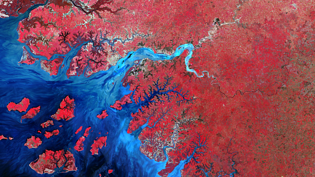
Coast near Bissau – Guinea-Bissau, recorded by the Sentinel-2A satellite on May 10, 2016 The satellite image of the month January shows the highly rugged coastal strip around the city Bissau, the capital of Guinea-Bissau. The Sentinel-2A image shows a colour-infrared composite created from different bands, with a spatial resolution of 10 metres. Sentinel-2 data […]
Satellite image of the month – December – Bethlehem and Jerusalem (West Bank and Israel)
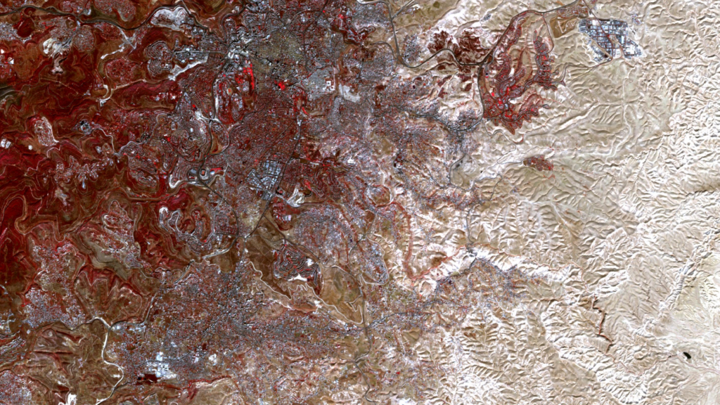
Bethlehem and Jerusalem – West Bank and Israel, recorded by the Sentinel-2A satellite on November 16, 2021 The satellite image of the month of December shows the region around Jerusalem and Bethlehem in the West Bank and Israel. The image is based on Sentinel-2 data from the EU Copernicus programme. The freely available multispectral satellite […]
Satellite image of the month – November – Glasgow (United Kingdom of Great Britain and Northern Ireland)
Glasgow – United Kingdom of Great Britain and Northern Ireland, recorded by the Sentinel-2B satellite on July 21, 2021 Our satellite image of the month November shows the British city Glasgow, where the 26th UN Climate Change Conference (COP26) will be hosted in the beginning of the month. The image is based on Sentinel-2 data […]
Satellite image of the month – October – Peloponnese (Greece)
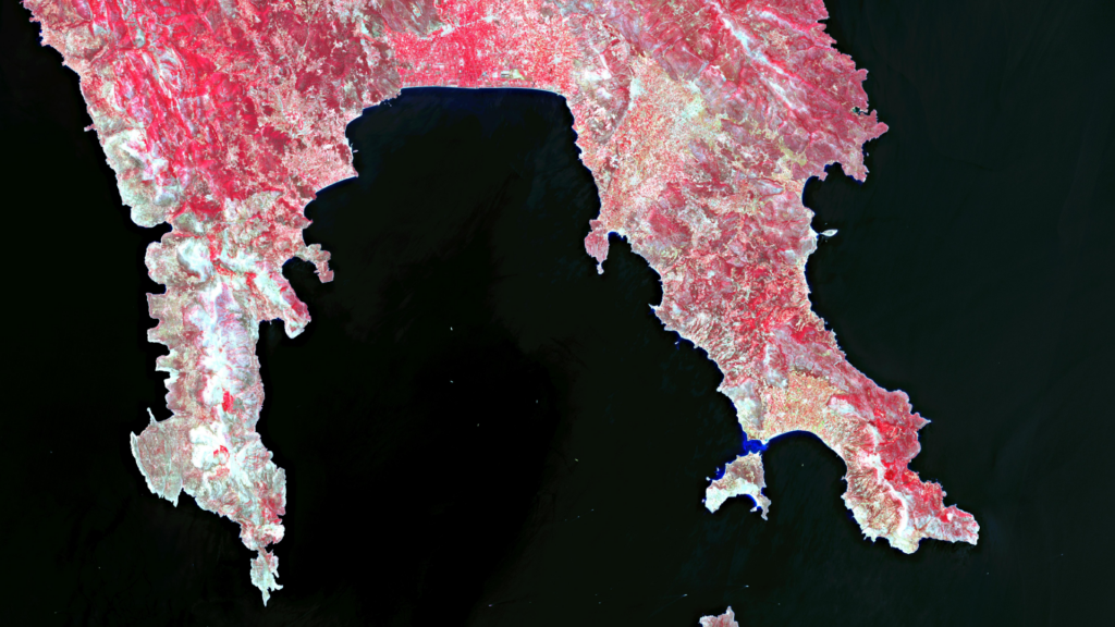
Peloponnese – Greece, recorded by the Sentinel-2B satellite on August 01, 2021 The satellite image of the month October shows the southern part of the Peloponnese peninsula in Greece. The image is based on Sentinel-2B data from the EU Copernicus Programme. Sentinel-2 data are freely available multispectral satellite images. After the download, the scene was […]
Satellite image of the month – September – Buenos Aires (Argentina)
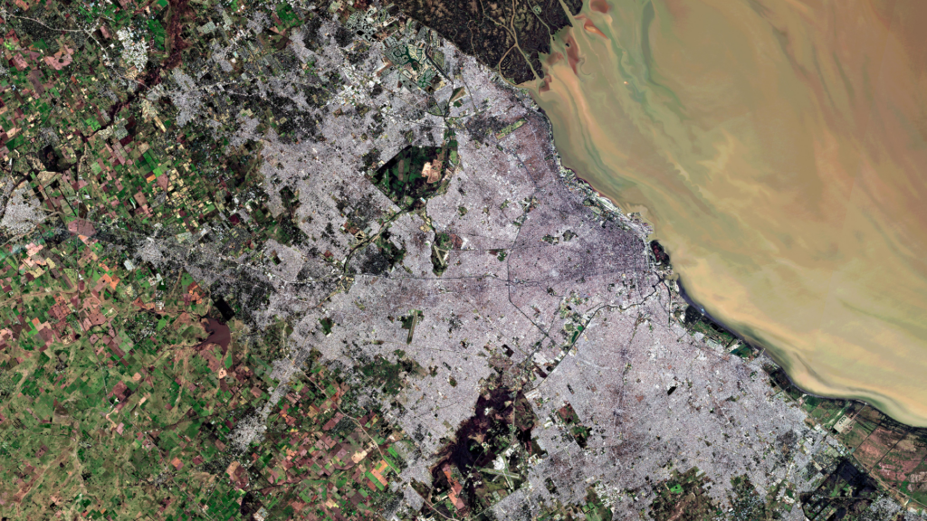
Buenos Aires – Argentina, recorded by the Sentinel-2B satellite on July 17, 2021 Our satellite image of the month September shows the capital of Argentina: Buenos Aires. The image shows a color composite created from different bands based on Sentinel-2B data of the Copernicus Programme. Sentinel-2 data are multispectral satellite images which are free to […]
Satellite image of the month – August – Kamloops (Canada)
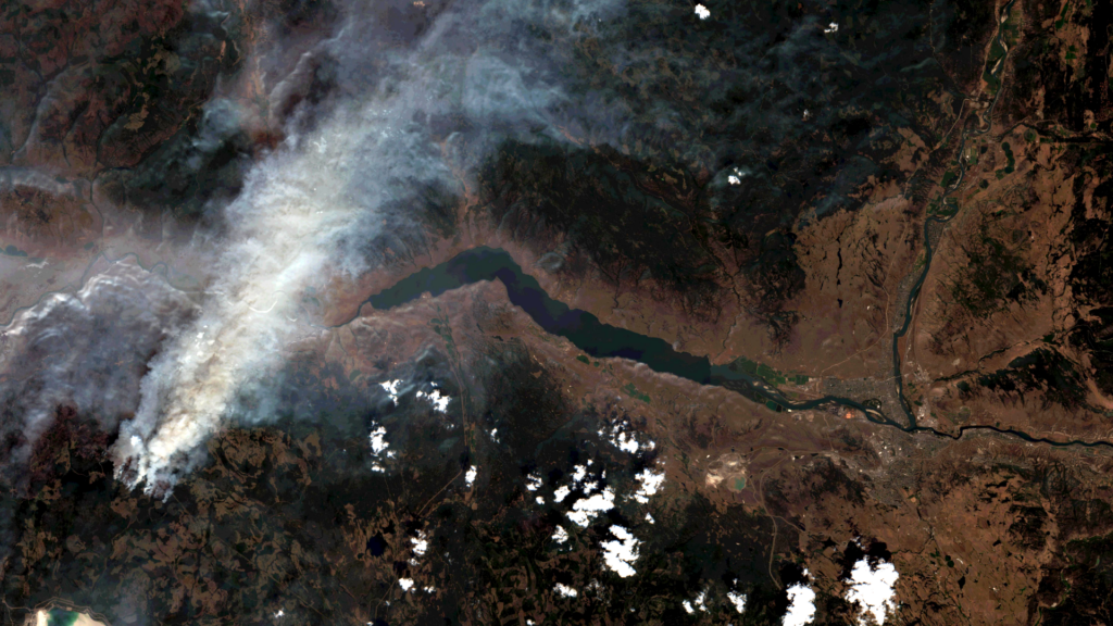
Kamloops – Canada, recorded by the Sentinel-2A satellite on July 26, 2021 The satellite image of the month August shows the city of Kamloops in British Columbia in Canada. The image shows a composite of three different spectral bands based on freely available Sentinel-2 data from the Copernicus programme. After downloading the scene, an atmospheric […]
Satellite image of the month – July – Los Glaciares (Argentina)
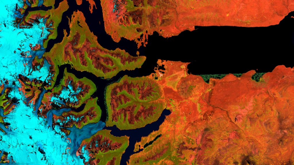
Los Glaciares – Argentina, recorded by the Sentinel-2A satellite on February 26th, 2021 Our satellite image of the month July shows the southern part of the Argentinian Los Glaciares National Park (spanish: The Glaciers National Park). The image is a composite of three different bands and was taken by the European satellite Sentinel 2A. After […]
Satellite image of the month – June – Lake Zürich (Switzerland)
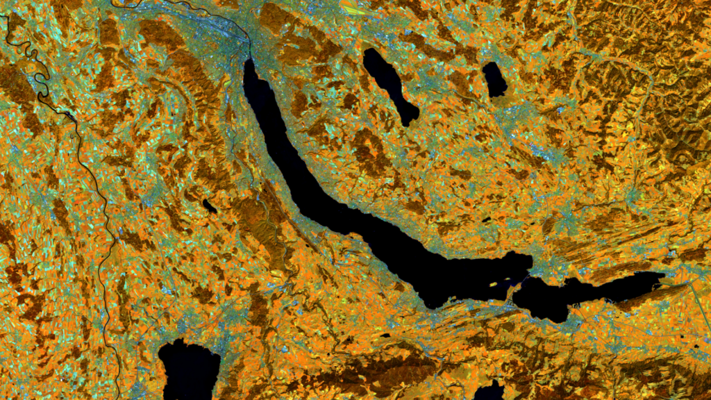
Lake Zürich – Switzerland, recorded by the Sentinel-2A satellite on August 23, 2016 The satellite image of the month June shows Lake Zürich and its surroundings in Switzerland. The image is based on freely available multispectral satellite images from the Sentinel-2 satellite of the Copernicus Programme. After downloading the scene an atmospheric correction was carried […]
Satellite image of the month – May – Fuji (Japan)
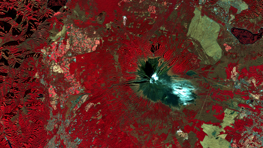
Fuji – Japan, recorded by the Sentinel-2A satellite on December 23, 2020 The satellite image of the month May shows a false colour composition of Mount Fuji in Japan. The image is based on Sentinel-2 data from the Copernicus programme. Sentinel-2 data are multispectral satellite images which are free to obtain. After downloading the scene […]
Satellite image of the month – April – Aswan Dam (Egypt)
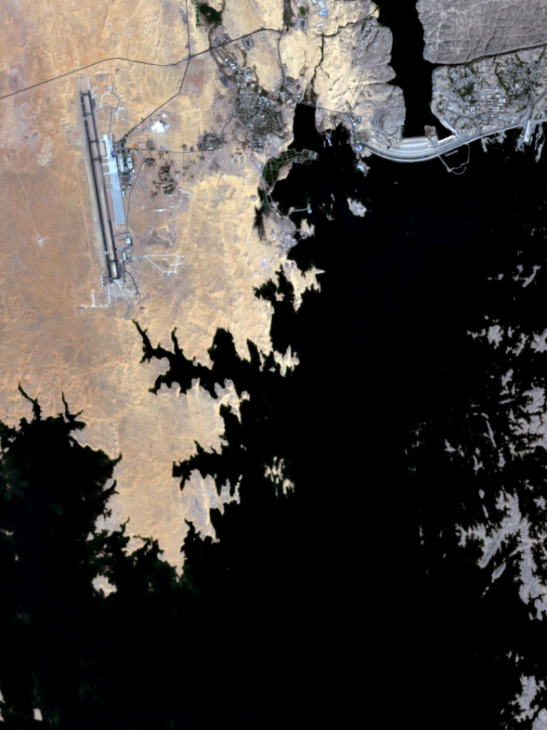
Aswan Dam – Egypt, recorded by the CORONA-KH-4B satellite on May 30, 1968 and by the Sentinel-2A satellite on October 22, 2020 Our satellite image of the month April shows the Aswan Dam in Egypt. The Aswan Dam, also known as the Aswan High Dam, is located in southern Egypt, about 13 kilometers south of […]