
Der Vesuv am Golf von Neapel in Italien
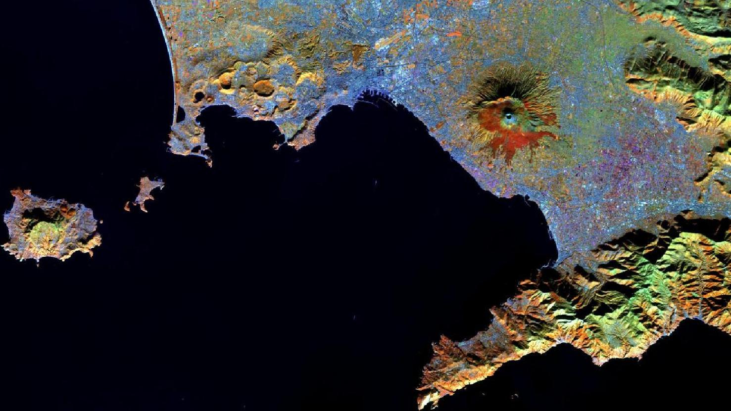
Das Satellitenbild des Monats August zeigt die italienische Küstenstadt Neapel mit dem noch aktiven Vulkan Vesuv in der Mitte, anhand einer Land-Wasser Komposition. Das Bild wurde aus verschiedenen Bändern, basierend auf Sentinel-2A Daten des EU Copernicus Programms erstellt und bietet eine Auflösung von zehn Metern.
Nach dem Download wurde die Szene mit freier Software atmosphärenkorrigiert und mit drei verschiedenen Bändern eine Farbkomposition berechnet.
Die italienische Stadt Neapel ist insbesondere aufgrund des aktiven Vulkans “Vesuv” bekannt, welcher sich etwa neun Kilometer entfernt von ihr befindet. Auf dem Satellitenbild lässt sich Neapel gut anhand seiner blauen Färbung in der oberen Bildhälfte identifizieren. Dabei ist auch der Hafen im Golf von Neapel gut zu erkennen.
Zuletzt brach der Vesuv im Jahr 1944 aus, hierbei mussten 12.000 Menschen evakuiert werden.
Eine der schlimmsten Ausbrüche hingegen stellt die Katastrophe von 79 n. Chr. dar. Bei diesem Ausbruch starben Schätzungen zufolge etwa 16.000 Menschen, mindestens 2000 davon in der antiken Stadt Pompeji. Es folgten darauf noch zahlreiche tragische Eruptionen des Vesuv.
Das ehemalige Pompeji liegt im Süden des Vesuv und nördlich der auf dem Satellitenbild herausragenden bergigen Landzunge und ist eine bekannte antike Ausgrabungsstätte. Im Gegensatz zu anderen antiken Siedlungen die dem Vesuv zum Opfer gefallen sind, war es in Pompeji möglich, Hohlräume, die die Verstorbenen im erkalteten Gestein hinterlassen hatten, mit Gips auszufüllen.
Heute siedeln etwa drei Millionen Menschen in der Gefahrenzone des Vesuv, Neapel als Großstadt mit eingeschlossen.
Ebenfalls auf dem Satellitenbild gut zu erkennen in orange sind die sogenannten Phlegräischen Felder (“Campi Flegrei”) im Westen von Neapel. Das 150 Quadratkilometer große Gelände ist ein aktiver unterirdischer Vulkan in dessen Zentrum sich die 80.000 Einwohnerstadt Pozzuoli befindet. Es wird seit 2005 beobachtet, dass sich die Erde über dem Vulkan jedes Jahr um mehrere Zentimeter hebt – ein deutliches Zeichen für aufsteigendes Magma im Untergrund.
Die große im Westen liegende Insel “Ischia” ist insbesondere bei Urlaubern beliebt und ebenfalls vulkanischen Ursprungs.
Der höchste Berg ist der “Monte Epomeo” mit 789 m. Bekannt ist die Insel unter anderem wegen dem herausragenden Artenreichtum und dem besonders in den Sommermonaten vorkommenden warmen Klimas.
Contains modified Copernicus Sentinel data (2016)/ESA – created by mundialis
Weitere Satellitenbilder gibt es unter https://maps.mundialis.de
Die Erde als Kunstwerk: https://art.mundialis.de