Indien – Telangana
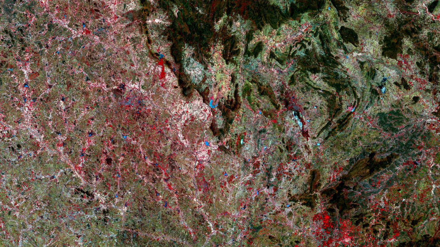
Unser Satellitenbild des Monats Mai zeigt u.a. die Hügelregion um die Stadt Yellandu (östliche Bildmitte), Bhadradri Kothagudem Distrikt im indischen Bundesstaat Telangana.
Bei der Parlamentswahl in Indien 2019 wurde die Lok Sabha, das Unterhaus des indischen Parlaments, gewählt. Die Auszählung der Stimmen erfolgte am 23. Mai 2019. Die Wahl fand zwischen dem 11. April 2019 und dem 19. Mai 2019 an insgesamt 7 Tagen statt. Traditionell finden gesamtindische Wahlen nicht an einem einzigen Tag, sondern immer verteilt auf mehrere Tage statt. Die Zahl der Wahlberechtigten betrug fast 900 Millionen. Die Wahl wurde durch die Regierungspartei Bharatiya Janata Party (BJP) von Premierminister Narendra Modi und der von der BJP angeführten Parteienkoalition National Democratic Alliance (NDA) gewonnen. Bei der aktuellen Parlamentswahl holte die Telangana Rashtra Samithi („Vereinigung für Telangana“) die Mehrheit der Sitze (9 von 17) in dem südindischen Bundesstaat Telangana. Die TRS ist eine politische Regionalpartei.
Der Bundesstaat Telangana liegt im Binnenland im südöstlichen Zentralindien und hat mit 114.840 qm in etwa die Fläche eines Drittels von Deutschland. Telangana grenzt im Südosten an Andhra Pradesh, im Südwesten an Karnataka, im Nordwesten an Maharashtra sowie im Nordosten an Chhattisgarh und Odisha. Das Gebiet Telanganas gehört zum Hochland von Dekkan. Der Dekkan stellt sich als sanft nach Osten abfallendes Plateau dar. Das Klima in Telangana ist heiß und trocken. Fast drei Viertel des Niederschlags fallen während des Sommermonsuns zwischen Juni und September. Große Teile von Telangana sind von Monsunwald bedeckt, der in der Trockenzeit sein Laub abwirft. Von der ursprünglichen Waldfläche sind über 80 % für die Gewinnung landwirtschaftlicher Flächen und von Viehweiden sowie zur Holzgewinnung abgeholzt worden. Das Gebiet rund um Yellandu ist reich an Seen, wovon der Bayyaram cheruvu-See (Bildmitte) der größte ist. Die indische Stadt Khammam, die viertgrößte Stadt des Bundesstaates, ist am linken unteren Rand des Motivs zu erkennen.
Das Motiv basiert auf Sentinel-2A Daten des EU Copernicus Programms und zeigt eine Falschfarbenkomposition erstellt aus verschiedenen Farbbändern. Die verwendete Infrarot-Bandkombination ist z.B. nützlich, um Land und Wasser gut zu unterscheiden und bietet eine Auflösung von 20 Metern. Gesunde Vegetation erscheint in orange und ältere Vegetation in grün. Boden und Wolken erscheinen ebenfalls in verschiedenen Grüntönen. Wasser ist in blau und violetten Farbtönen dargestellt.
Contains modified Copernicus Sentinel data (2019)/ESA – created by mundialis

