
Amazonasgebiet in Brasilien aufgenommen vom Sentinel-2A Satelliten am 30. Juli 2016
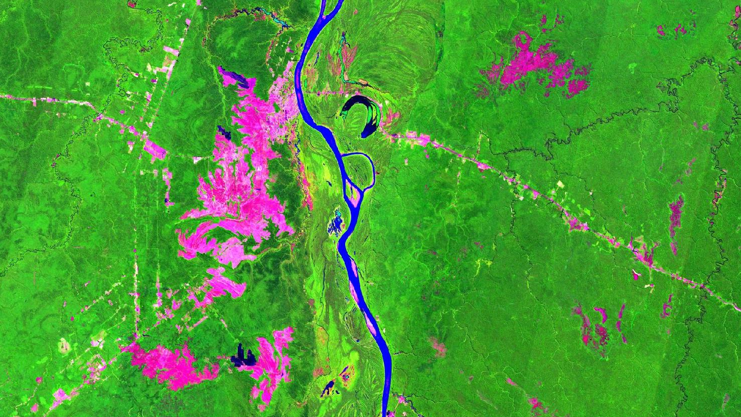
Dieses Bild zeigt eine Falschfarben Komposition von einem Teil des Regenwaldes im Amazonasgebiet in Brasilien.
Das Bild wurde aus verschiedenen Bändern, basierend auf Sentinel-2 Daten des Copernicus Programmes, erstellt. Die verwendete Bandkombination kann für Vegetationsanalysen verwendet werden und bietet eine räumliche Auflösung von 20 Metern. Gesunde Vegetation erscheint in grellen Grüntönen und kann sehr einfach von Boden unterschieden werden, welcher in einem Spektrum von Rosa (z.B. abgeerntete Felder) bis leuchtendem Pink (z.B. gerodeter Regenwald) eingefärbt ist. Wasser ist in dunklen Blau- bis Schwarztönen gemalt, während Städte in Hellgrau bis Hellrosa eingefärbt sind.
Durch die Mitte des Bildes fließt der Rio Madeira, der größte Nebenfluss der Welt. Weiter nördlich wird er in den Amazonas münden. Er führt große Mengen an Schwebstoffen mit sich, die aus niederschlagreichen Randgebieten der Anden erodiert wurden. Im Norden des Bildes am Rio Madeira liegt die Stadt Humaitá, an die sich südlich ein großes gerodetes Gebiet anschließt. Auch die Straßen auf dem Bild sind erkennbar als feine pinke Linien dort, wo keine Vegetation vorhanden ist. Auffällig ist außerdem ein hufeisenförmiger Altarm des Rio Madeira in der Mitte des Bildes. Im Osten sieht man den Rio Maicimirim in den Rio Maici fließen. Weitere gerodete Flächen von Regenwald sind ebenfalls in Pink zu erkennen.
Weitere Satellitenbilder gibt es unter https://maps.mundialis.de
Die Erde als Kunstwerk: https://art.mundialis.de