
Historical Satellite Data for the Protection of Cultural Heritage
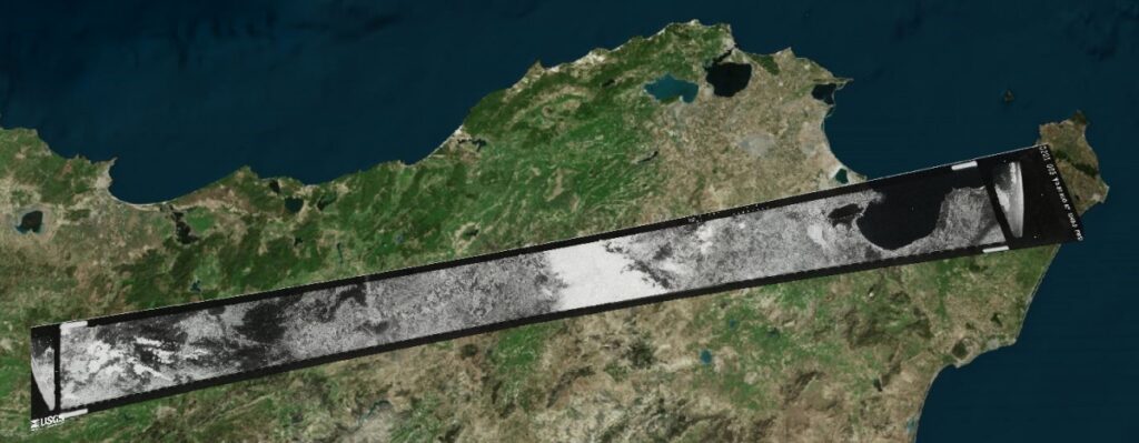
As part of the online lecture series “Spotlight KulturGutSchutz” organized by the Deutsche Gesellschaft für Kulturgutschutz e.V. and Blue Shield Deutschland, we gave a presentation on the use of satellite data in the protection of cultural heritage. The focus was on the question of how historical imagery from U.S. spy satellites from the 1960s can […]
Satellite Image of the month – January – Alberta (Canada)
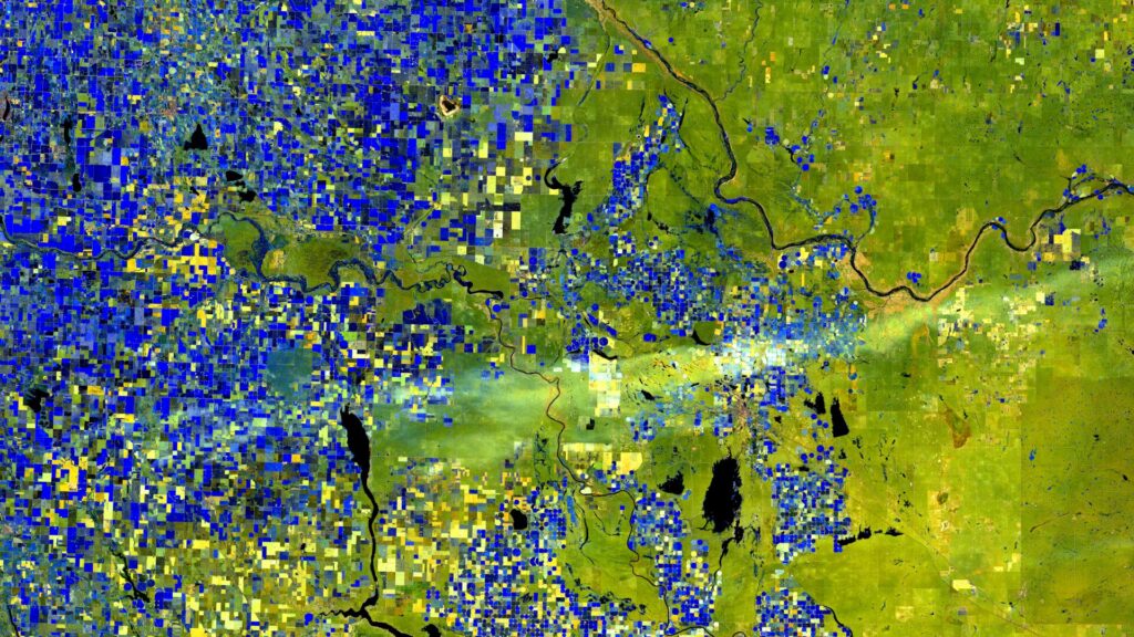
World in Transition — Signs, Traces, Solutions. This year we invite you on a 12-part visual journey: from acute natural events to urban adaptation and on to long-term landscape change. Each image reveals not only a phenomenon but also the data techniques and analyses that make solutions possible — in the spirit of Earth. Data. Solutions. […]
Projektabschluss: Transformationspotenziale großflächiger Parkplätze

Das vom Bundesinstitut für Bau-, Stadt- und Raumforschung (BBSR) initiierte Forschungsprojekt„Transformationspotenziale großflächiger Parkplätze für den nachhaltigen Stadtumbau“ist abgeschlossen und das Team trifft sich zum Nachklapp. Ziel war es, bislang wenig beachtete Parkplatzflächen systematisch zu erfassen und ihr Potenzial für eine nachhaltige Weiterentwicklung sichtbar zu machen – nicht durch pauschalen Stellplatzabbau, sondern durch qualitative Aufwertung in funktionaler, städtebaulicher […]
We’ve joined the Avalueto Platform

Three of our Earth observation products are now live on Avalueto – the AI-driven platform that’s reshaping how geospatial solutions are shared and applied. Here’s what we’re bringing to the table: ? Single Tree DetectionFor those who need to zoom in – from precision forestry to smart urban greening, this tool helps identify and analyze individual trees. […]
Parking Lots as a Resource for Sustainable Urban Transformation – Initial Findings
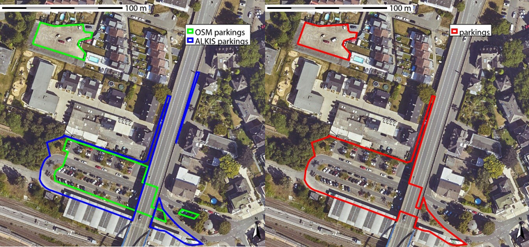
The Federal Office for Building and Regional Planning (BBSR) has published initial results on the transformation of large-scale parking lots – with model cities Dortmund, Görlitz and Ulm. Together with GGR, we have created a data and methodological basis for systematically recording and evaluating parking spaces – with the help of remote sensing, geodata and […]