
Analysis Ready Data – Webinar-recording now online
Sentinel-1 and Sentinel-2 data offer enormous potential for environmental monitoring, land cover analysis, and municipal applications. However, getting started can often seem complex—especially due to preprocessing steps and the variety of data products. In this webinar, we show how Analysis Ready Data (ARD) significantly simplifies access. We provide a practical overview of available ARD offerings […]
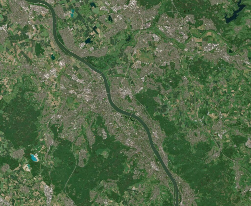
Analysis Ready Data with Sentinel-1 & Sentinel-2 – Invitation to our Webinar
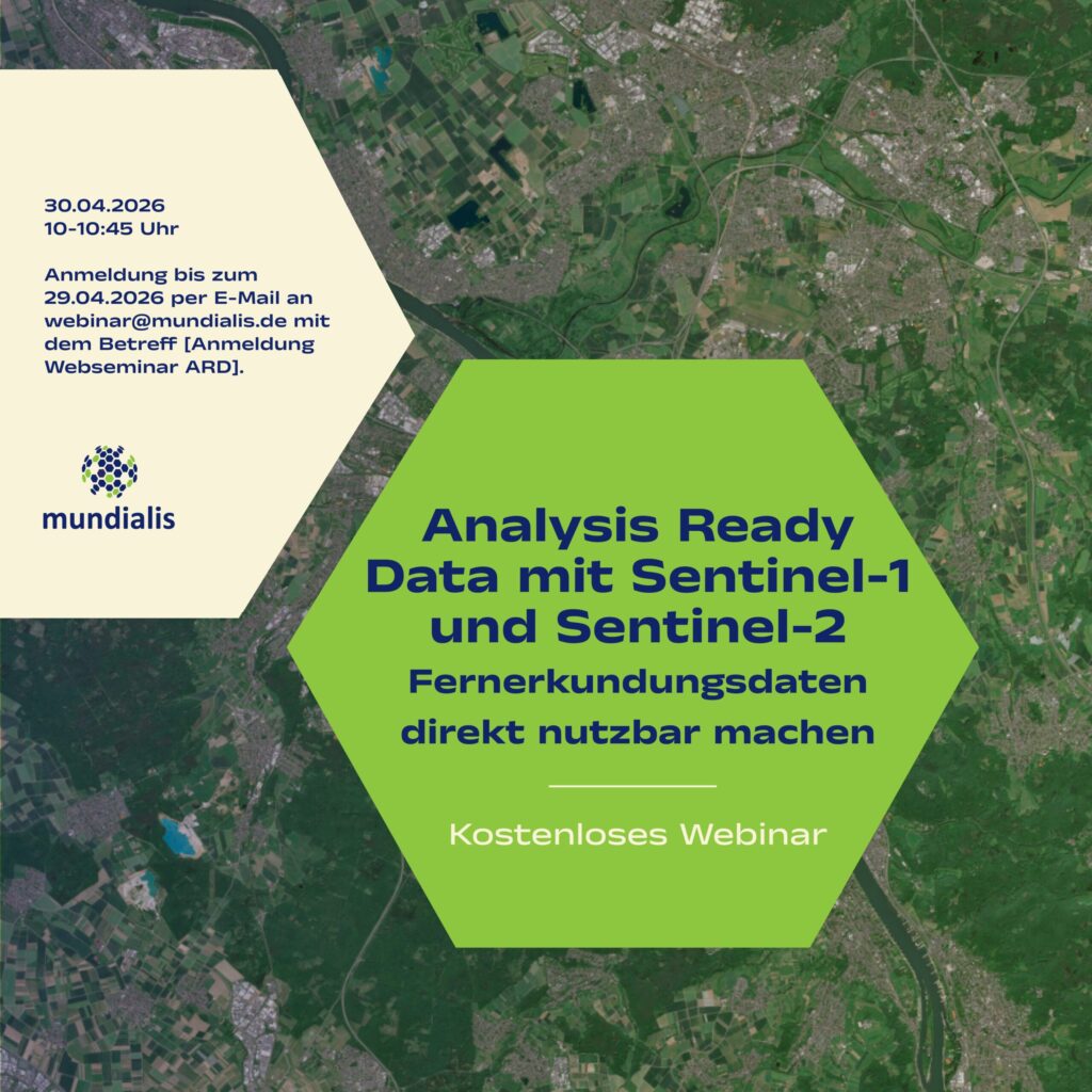
[The Webinar will be held in German]On 30 April 2026, in our webinar, we will show how remote sensing data can be made directly usable with Analysis Ready Data – we warmly invite you to join us. What it’s about: Sentinel-1 and Sentinel-2 data offer enormous potential for environmental monitoring, land cover analysis, and municipal […]
High-resolution surface classification with AI and open geodata – Webinar recording
In the second part of our impervious surface series, we demonstrate how freely available true orthophotos can be transformed into a detailed, high-resolution land cover classification using modern AI architectures. Building on our flexible AI framework, we provide an overview of current AI developments and demonstrate their added value in the semantic segmentation of urban […]
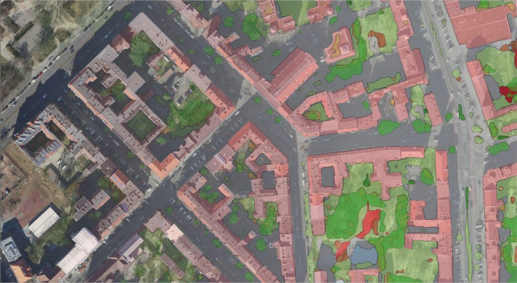
High-Resolution Surface Classification with AI and Open Geospatial Data – Webinar Invitatio
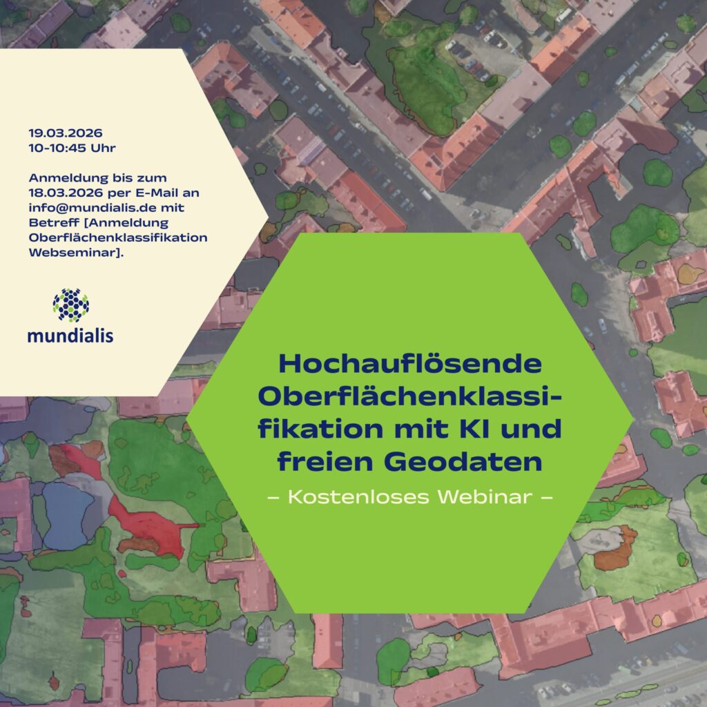
(The webinar will be held in german)We invite you to our webinar, “High-Resolution Surface Classification with AI and Open Geospatial Data – Technology and Application Examples,” on March 19, 2026, from 10:00 to 10:45 AM. What it’s about: In the second part of our impervious surface series, we demonstrate how freely available true orthophotos can […]
Satellite image of the month – February – Lower Saxony (Germany)
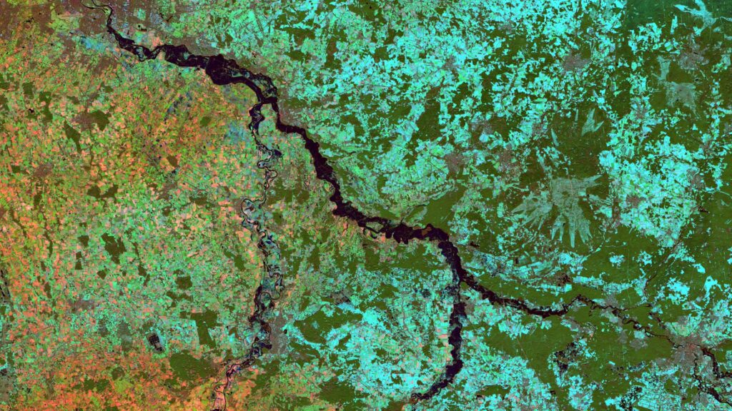
Lower Saxony – Germany, recordedby the Sentinel-2B satellite on December 15, 2022 and January 09, 2024 The satellite image of the month February is the second part of our twelve-part visual journey. It continues the theme of “Acute hazards – visible from space”, dealing with natural hazards, their visible effects and the possibilities of satellite-based analysis. The image shows […]
Heat Stress Maps – Webinar-recording now online
Extreme heat is becoming an increasing challenge for cities and regions worldwide. In this webinar, we demonstrate how Earth observation (EO) and remote sensing data can be used to systematically assess heat-related risks. Participants will receive a concise overview of relevant data sources, remote sensing methods, and commonly used heat and heat stress indices. Using […]
Projektabschluss: Transformationspotenziale großflächiger Parkplätze

Das vom Bundesinstitut für Bau-, Stadt- und Raumforschung (BBSR) initiierte Forschungsprojekt„Transformationspotenziale großflächiger Parkplätze für den nachhaltigen Stadtumbau“ist abgeschlossen und das Team trifft sich zum Nachklapp. Ziel war es, bislang wenig beachtete Parkplatzflächen systematisch zu erfassen und ihr Potenzial für eine nachhaltige Weiterentwicklung sichtbar zu machen – nicht durch pauschalen Stellplatzabbau, sondern durch qualitative Aufwertung in funktionaler, städtebaulicher […]
A Look Back on 2025
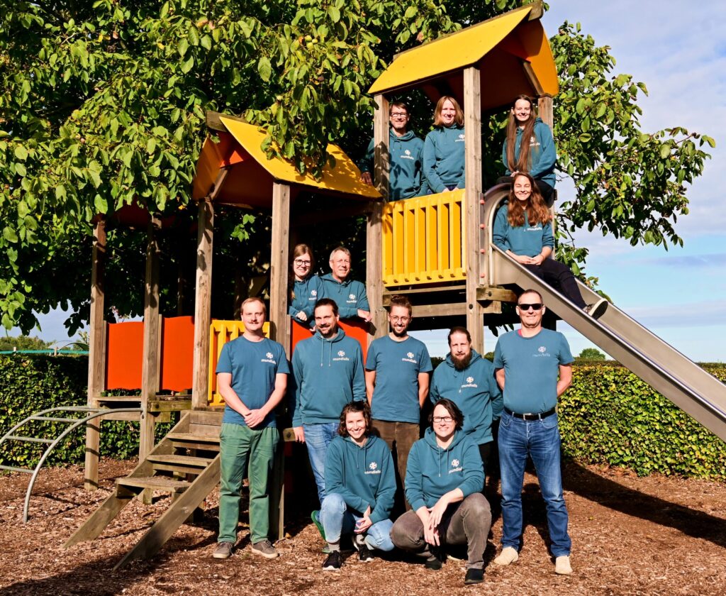
2025 has been a special year for us in many ways—not least because we are celebrating our 10th anniversary. Over this time, our team has grown considerably. Our group photo was taken in September during our retreat in Slenaken—on a playground. And that suits us well: play fosters creativity, collaboration, and well-being, all of which […]
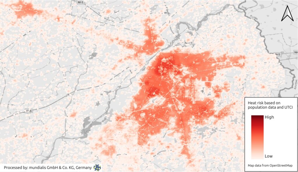
Heat Stress Maps – Webinar Invitation
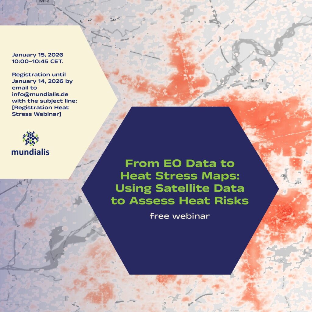
We are pleased to invite you to the online webinar “From EO Data to Heat Stress Maps: Using Satellite Data to Assess Heat Risks” on 15 January 2026, 10:00–10:45 CET. What the webinar is about Extreme heat is becoming an increasing challenge for cities and regions worldwide. In this webinar, we demonstrate how Earth observation (EO) and […]
mundialis is now a member of the Open Source Business Alliance!
We are pleased to announce that mundialis is now a member of the Open Source Business Alliance (OSBA). The OSBA is Germany’s largest network of companies and organizations committed to Free and Open Source Software (FOSS). As a company specializing in Earth observation, we work daily with satellite and geospatial data and consistently rely on open-source technologies—out of […]