
Analysis Ready Data – Webinar-recording now online
Sentinel-1 and Sentinel-2 data offer enormous potential for environmental monitoring, land cover analysis, and municipal applications. However, getting started can often seem complex—especially due to preprocessing steps and the variety of data products. In this webinar, we show how Analysis Ready Data (ARD) significantly simplifies access. We provide a practical overview of available ARD offerings […]
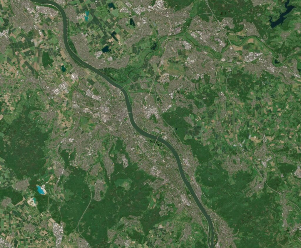
Satellite Image of the Month – May – Franconia (Germany)
Franconia – Germany, recorded by the Sentinel-2A and -2B satellites on August 14, 2021 and August 14, 2022 The satellite image of the month for May is the fifth image in our twelve-part visual journey. It continues the series ‘Traces of Time – Landscapes and Cities in Transition’, in which we show satellite images to […]
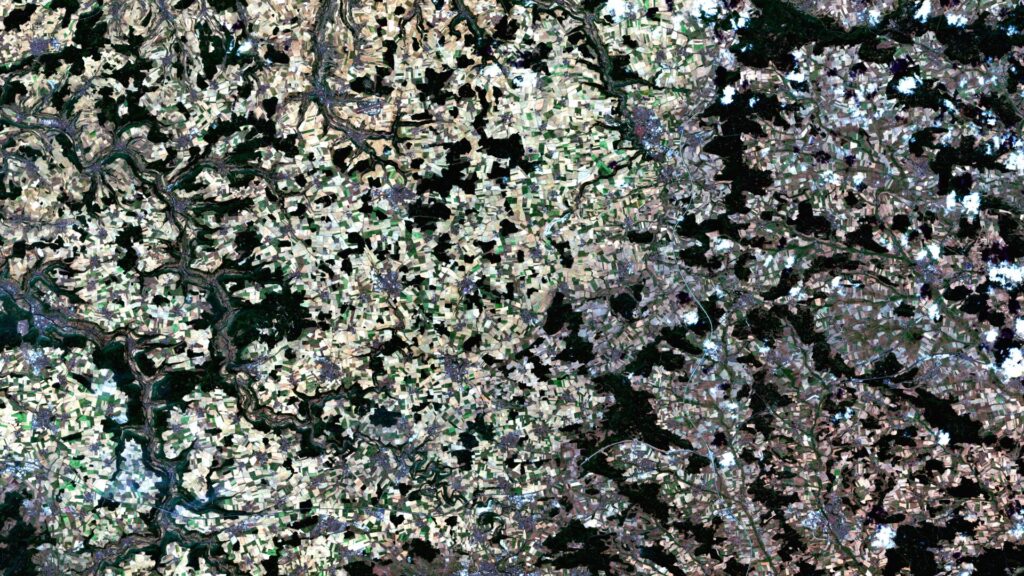
Satellite Image of the Month – April – Harz National Park (Germany)
Harz National Park (Lower Saxony/Saxony-Anhalt) – Germany, recorded by the Sentinel-2A and -2C satellites on August 9, 2015 and August 13, 2025 The satellite image of the month April is the fourth image in our twelve-part visual journey and opens the thematic series ‘Traces of Time – Landscapes and Cities in Transition’. Using satellite images, we document and illustrate slower, more gradual changes to the […]
Historical Satellite Data for the Protection of Cultural Heritage
As part of the online lecture series “Spotlight KulturGutSchutz” organized by the Deutsche Gesellschaft für Kulturgutschutz e.V. and Blue Shield Deutschland, we gave a presentation on the use of satellite data in the protection of cultural heritage. The focus was on the question of how historical imagery from U.S. spy satellites from the 1960s can […]
High-resolution surface classification with AI and open geodata – Webinar recording
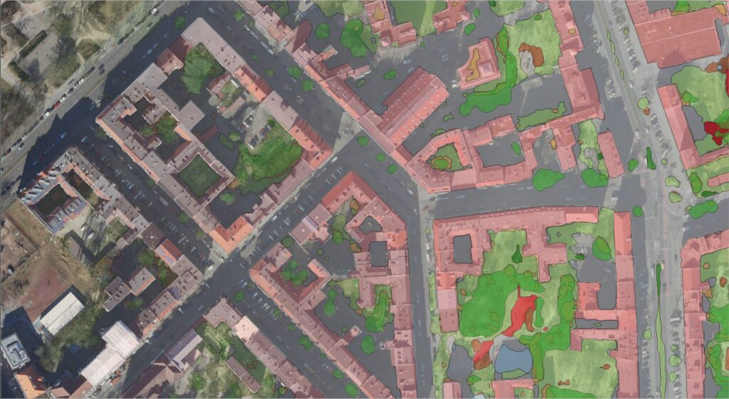
In the second part of our impervious surface series, we demonstrate how freely available true orthophotos can be transformed into a detailed, high-resolution land cover classification using modern AI architectures. Building on our flexible AI framework, we provide an overview of current AI developments and demonstrate their added value in the semantic segmentation of urban […]
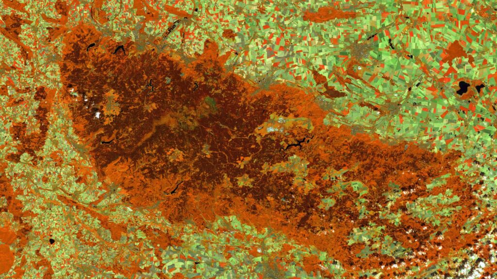
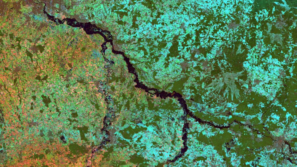
Satellite Image of the Month – March – Rio Grande do Sul (Brazil)
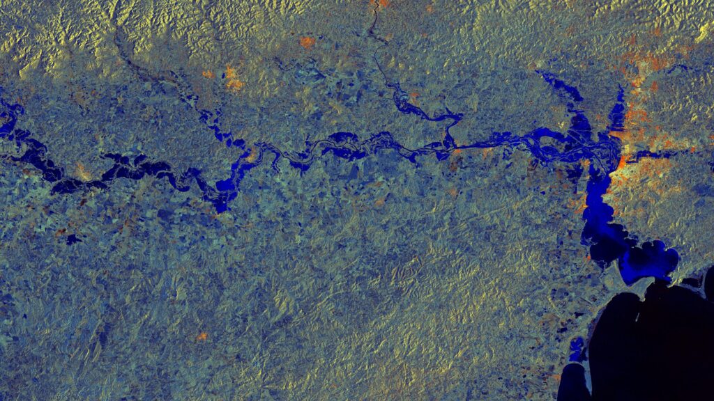
Rio Grande do Sul – Brazil, captured by the Sentinel-1A satellite on May 11, 2024, and June 4, 2024. The satellite image of the month March is the third part of our twelve-part visual journey. It concludes the thematic block “Acute hazards – visible from space”, which deals with natural hazards, their visible impacts and […]
High-Resolution Surface Classification with AI and Open Geospatial Data – Webinar Invitatio
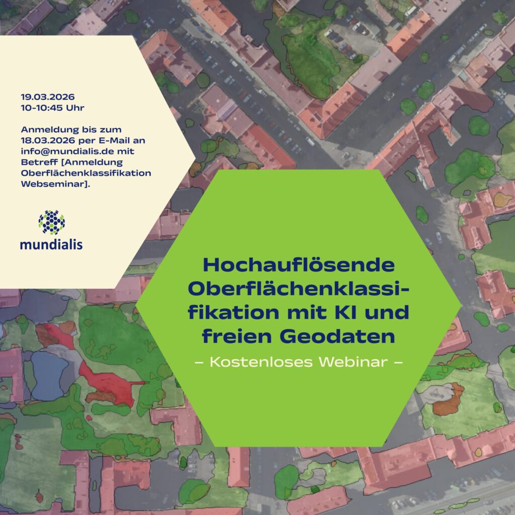
(The webinar will be held in german)We invite you to our webinar, “High-Resolution Surface Classification with AI and Open Geospatial Data – Technology and Application Examples,” on March 19, 2026, from 10:00 to 10:45 AM. What it’s about: In the second part of our impervious surface series, we demonstrate how freely available true orthophotos can […]
Our contributions at the FOSSGIS Conference 2026
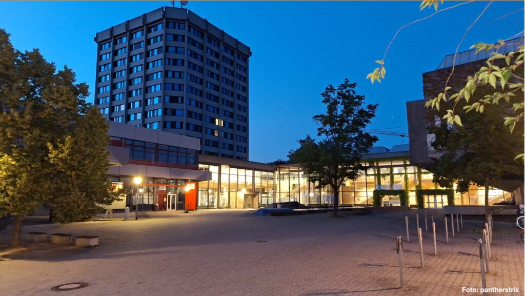
Photo: pantherstrix It’s almost that time again: From March 25 to 28, 2026, the FOSSGIS Conference will take place in Göttingen. For us, this community event is something very special: we’re looking forward to exciting presentations, inspiring discussions, and connecting with like-minded people. Of course, we’ll also be actively involved: with several contributions of our […]
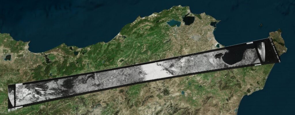
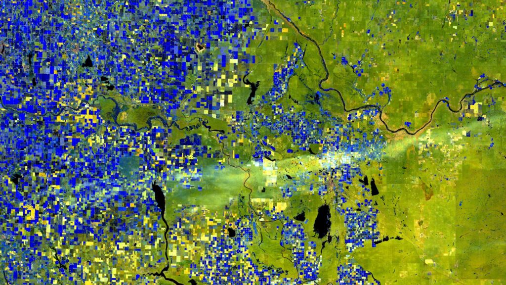
Satellite image of the month – February – Lower Saxony (Germany)
Lower Saxony – Germany, recordedby the Sentinel-2B satellite on December 15, 2022 and January 09, 2024 The satellite image of the month February is the second part of our twelve-part visual journey. It continues the theme of “Acute hazards – visible from space”, dealing with natural hazards, their visible effects and the possibilities of satellite-based analysis. The image shows […]
Satellite Image of the month – January – Alberta (Canada)
World in Transition — Signs, Traces, Solutions. This year we invite you on a 12-part visual journey: from acute natural events to urban adaptation and on to long-term landscape change. Each image reveals not only a phenomenon but also the data techniques and analyses that make solutions possible — in the spirit of Earth. Data. Solutions. […]