
Knowledge about the location of individual trees forms an important basis for various issues related to green infrastructure, spatial observation and climate. The mundialis GmbH & Co. KG developed a method for the automatic derivation of single tree locations from remote sensing data on behalf of the Regionalverband Ruhr (RVR). In the future, this will make it possible to obtain area-wide information on the spatial location of trees, the crown diameter or the tree height, among other things.
The procedure enables the recording of trunk position, tree height, crown diameter, crown volume, crown area, NDVI per individual tree, distance to buildings and trees in the vicinity as well as the distinction between coniferous and deciduous trees. For the latter, Sentinel-2 data are used. However, these only allow a classification at tree group level due to a spatial resolution of 10 m. At the same time, the method allows for accuracy assessment and calculates quality measures such as completeness and correctness based on ground truth data.
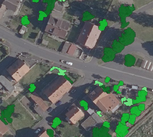
Einzelbäume in Größenklassen
The images show the detected individual trees as well as the further classification of the trees into size classes.
If you have any questions, please contact mundialis or our employees at any time – we will also help your municipality, association or company to use this technology profitably!
This project was supported by the District Government of Münster with funds from the Ministry of Environment, Nature Conservation and Transport of the State of NRW.
Comments