
– Change detection map of Germany for 2019-2020 now available –
The series of land cover classification and land cover change maps of Germany based on Sentinel-2 data has been extended. Based on the new land cover map of Germany for 2020 and the land cover map for 2019 already produced at the end of 2020, a change detection was performed. Change maps were calculated for the six classes built-up area, grassland, forest, agriculture, vegetation-free soil and water.
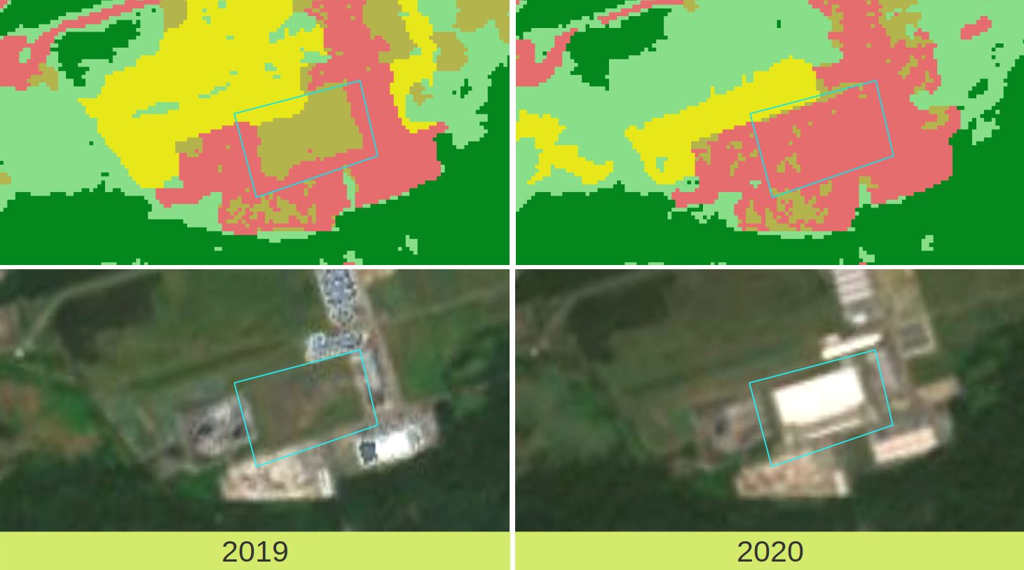
The change maps contain all possible combinations of land cover change.
For quality assurance, several steps have been implemented: Isolated change pixels and edge effects were eliminated by applying a 3×3 moving window mode filter. In addition, a selection of the detected changes was performed by calculating the information gain within a 4×4 moving window between the two input classifications. This measure analyses the statistical distribution of pixel values within the window instead of pixel-wise changes. With the help of a threshold, supposed changes, that can most likely be attributed to classification noise due to spectral ambiguity, can thus be avoided. Additionally, all changes smaller than 0.5 ha were not included in the final map.
The spatial resolution of the change maps is the same as the land cover maps, 10m x 10m (pixel size).
The method to classify land cover on national scale, developed by mundialis, can be applied perspectively over the entire lifetime of the Sentinel-2 satellite mission. Thus, as time goes by, it enables the automatic processing of further annual classifications as well as the detection and monitoring of changes in Germany’s land cover on both small and large spatial and temporal scales. This is valuable as, for example, changes in settlements and infrastructure oftentimes occur much faster than can be monitored by cadastral services.
We have published the result of the change detection for 2019-2020 here:
Change Detection map of Germany 2019-2020 based on Sentinel-2 data, 10m resolution
- download:
- https://data.mundialis.de/geodata/lulc-germany/change_detection_2019_2020/germany_2019_2020_MAJA_cd_total_v02.tif
- https://data.mundialis.de/geodata/lulc-germany/change_detection_2019_2020/germany_2019_2020_MAJA_cd_water_v02.tif
- https://data.mundialis.de/geodata/lulc-germany/change_detection_2019_2020/germany_2019_2020_MAJA_cd_lowvegetation_v02.tif
- https://data.mundialis.de/geodata/lulc-germany/change_detection_2019_2020/germany_2019_2020_MAJA_cd_forest_v02.tif
- https://data.mundialis.de/geodata/lulc-germany/change_detection_2019_2020/germany_2019_2020_MAJA_cd_builtup_v02.tif
- https://data.mundialis.de/geodata/lulc-germany/change_detection_2019_2020/germany_2019_2020_MAJA_cd_baresoil_v02.tif
- https://data.mundialis.de/geodata/lulc-germany/change_detection_2019_2020/germany_2019_2020_MAJA_cd_agriculture_v02.tif
- metadata: https://data.mundialis.de/geonetwork/srv/eng/catalog.search#/metadata/5ef8565b-ea72-4f34-985b-71ab41959230
Data license (open data):
- Data licence Germany – attribution – version 2.0, or later
https://data.mundialis.de/geodata/lulc-germany/classification_2020/LICENSE.html
Method description:
- Riembauer, G., Weinmann, A., Xu, S., Eichfuss, S., Eberz, C., Neteler, M. (2021): Germany-wide Sentinel-2 based Land Cover Classification and Change Detection for Settlement and Infrastructure Monitoring. Submitted to 2021 conference on Big Data from Space (BiDS’2021). https://www.bigdatafromspace2021.org/
- Riembauer, G., Weinmann, A., Tawalika, C., Andreo, V., Delucchi, L., Fagandini, R., Neteler, M. (2021): Sentinel processing in GRASS GIS: A growing toolset for downloading, preprocessing and multitemporal analysis of Copernicus Sentinel data. Submitted to FOSS4G 2021, Buenos Aires, Argentina. https://2021.foss4g.org/, Abstract: https://callforpapers.2021.foss4g.org/foss4g2021/talk/P9HVGY/
Your contact person
We are at your disposal:
Guido Riembauer <info@mundialis.de> | phone: +49 (0)228 / 387 580 80
About incora
Within the framework of the sustainability goals, the economical use of land as a resource has been the subject of planning interventions and political measures by the German Government for many years. The conflicting demands for land use require data bases for monitoring settlement and transport area development. The incora project uses the data basis of the Copernicus Sentinel satellites to supplement existing indicators of settlement and transport area development for nationwide area monitoring and to increase the quality and significance of existing indicators. The results will be made publicly available in spatial observation portals.
The project incora (duration: 12/2018 – 11/2021, FKZ: 19F20579C) is coordinated by the Institut für Landes- und Stadtentwicklungsforschung (ILS), and will be carried out jointly with the Bundesinstitut für Bau-, Stadt- und Raumforschung (BBSR) and mundialis GmbH & Co. KG.