Menu
  • About us
    • Company
    • Team
    • Career
    • References
    • Partners
    • Contact
  • Products
    • Earth Observation metadata enhancer
    • Temperaturdaten
    • LST-Data Client
    • Trainings
  • Services
    • actinia – geoprocessing in the cloud
    • Geospatial and EO data analysis
    • CORONA spy satellite data
    • maps.mundialis
    • Web Map Services
    • GIS Development
    • Open Source GIS
  • Markets
    • Remote Sensing for Agriculture
    • Satellite Images for Forest and Land Cover Restoration
    • Glass fibre route planning – FTTH
    • Copernicus and Sentinel
  • News & Blog
    • News
    • Blog
    • Satellite image of the month
  • English English
  • Deutsch Deutsch

HERMOSA Bulletin: UN Decade on Ecosystem Restoration SPECIAL


6. April 2021 | Category General

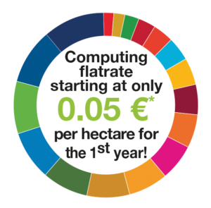
5 users per SDG get HERMOSA professional level for unbelievably low prices – hurry up, a one time offer!
HERMOSA is an internet based platform accessible via https://hermosa.earth which supports the ecosystem restoration process through the use of geo and satellite data. It is the first of its kind to combine matchmaking between stakeholders, supporting the implementation process through web mapping, monitoring with satellite data and sharing of knowledge all rolled into one.

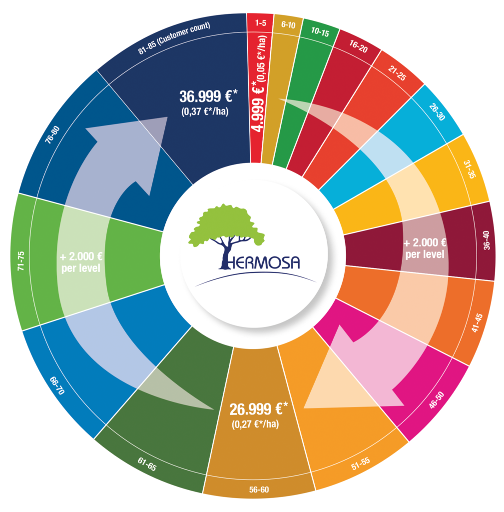
HERMOSA Commercial Offer


Check availability at https://hermosa.mundialis.de

* If you can prove that you are a company in terms of VAT (e.g. by presenting a VAT ID number or a certificate from the tax authorities of your country of residence, if you are not resident in the EU), the reverse charge procedure applies and no VAT (19%) will be added. Payable in advance for 1 year; contracts renew themselves for 1 year if notice is not given at least 3 months before the end of the term.

HERMOSA professional level includes:
✓ 100,000 discontiguous hectares anywhere in the world
✓ access to common GIS and Earth Observation analytical methods
✓ generation of maps & reports
✓ invite collaborators to work online together
✓ personal workspace after self-registration
✓ flat-rate computing in the modules „Organize & Implement“ & „Monitor & Report“
✓ 1 CPU guaranteed, usually 2+ CPU
✓ 250 GB storage capacity
✓ daily backup (mirroring)
✓ hosted service
✓ e-mail support

Additional services on demand, for example

✓ very high resolution satellite data (sub-meter spatial resolution)
✓ enhanced algorithms (multi-temporal analysis, data fusion, …)
✓ implementation of customer provided algorithms
✓ automated content translation to German, French, Spanish, Portuguese, Italian, Dutch, Polish, Russian, Japanese and Chinese (simplified) using artificial intelligence (AI)
✓ extra storage
✓ larger area
✓ faster computing
✓ remote sensing data analysis and geodata management support
are easily accessible by purchasing credit points on the contract at any time.

Contact sales@hermosa.earth today to get started!

For further information please visit https://hermosa.mundialis.de

We gratefully acknowledge the support by ESA business applications.

reposted from https://hermosa.mundialis.de/news/bulletin-kw-14/

Comments are currently closed.

Follow Us

Contact

mundialis GmbH & Co. KG
Kölnstrasse 99
53111 Bonn

Phone: +49 (0)228 / 387 580 80
Fax: +49 (0)228 / 962 899 57

E-Mail: info [at] mundialis [dot] de

Latest News

  • ++ Eine neue Heimat für Actinia ++

    Tuesday January 24th, 2023
  • Positive towards the future – Management changes at mundialis

    Tuesday October 4th, 2022
  • Recap of FOSS4G 2022 in Florence

    Friday September 16th, 2022
  • FOSS4G 2022 in “La Bella” – Greetings from Florence!

    Thursday July 14th, 2022
  • VALE project successfully completed

    Tuesday June 21st, 2022
View all News

Blog

  • Satellite image of the month – January – Yalu River (People’s Republic of China and Democratic People’s Republic of Korea) 2. January 2023
    Yalu River – People’s Republic of China and Democratic People’s ...
  • Satellite image of the month – December – Super Pit gold mine (Australia) 1. December 2022
    Super Pit gold mine – Australia, recorded by the Sentinel-2A ...
  • Satellite image of the month – November – Kufra-Oases (Libya) 1. November 2022
    Kufra-Oases – Libya, recorded by the Sentinel-2A satellite on March ...
View all Blog Posts

Copyright © 2015-2021 mundialis GmbH & Co. KG

Imprint Privacy

Theme created by PWT. Powered by WordPress.org