Menu
  • About us
    • Company
    • Team
    • Career
    • References
    • Partners
    • Contact
  • Products
    • Earth Observation metadata enhancer
    • Temperaturdaten
    • LST-Data Client
    • Trainings
  • Services
    • actinia – geoprocessing in the cloud
    • Geospatial and EO data analysis
    • CORONA spy satellite data
    • maps.mundialis
    • Web Map Services
    • GIS Development
    • Open Source GIS
  • Markets
    • Remote Sensing for Agriculture
    • Satellite Images for Forest and Land Cover Restoration
    • Glass fibre route planning – FTTH
    • Copernicus and Sentinel
  • News & Blog
    • News
    • Blog
    • Satellite image of the month
  • English English
  • Deutsch Deutsch

HERMOSA Bulletin: Who needs HERMOSA ?


30. March 2021 | Category General

The answer to the question “Who needs HERMOSA?” is simple: Everyone involved in ecosystem restoration. And while the general public will not need the platform itself, the results from HERMOSA are of interest to it too. Let’s take a closer look.

Ecosystem restoration is a multi-sectorial and multi-stakeholder effort taking place in a spatial context where one organisation alone will not be successful in the endeavour. First of all the ecosystem to be restored usually features a local population exhibiting all sorts of socio-economic activities. The governments at local, regional and national level provide the administrative and legal context, while businesses and non-governmental organisations (NGO) provide goods and services. International organisations and financiers have a vested interest in ecosystem restoration as do academia and civil society around the globe.

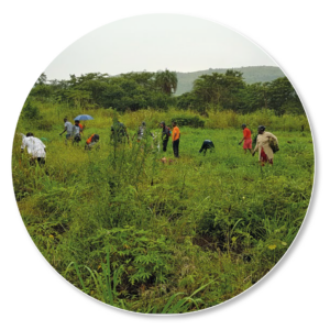
Since the location is the connecting element, all stakeholders require up-to-date and accurate maps. From a fundamental point of view these maps can represent dynamic (e.g. crops in a field) to static (e.g.  administrative boundaries) information with all nuances in between. Due to the geographic reference the different topics can be combined and viewed in context and so form the basis for any informed decision. One use case is a non-governmental organisation dedicated to planting trees on degraded land in combination with the growing of food and providing jobs for the local community. Since the NGO has local expertise it  knows the areas where an agro-forestry system can be implemented. However, once these locations have been taken care of, the question arises where to go next. And since the problem of degraded ecosystems is so large all organisations want to and need to scale up. This is when up-to-date maps of the region are required which is one of the strong assets of HERMOSA.

For a long time organisations would turn to maps provided by large corporations to have their most basic spatial questions answered but also found out that this data was updated irregularly and dynamic processes were often not appropriately represented. Also, amongst stakeholders it is widely known that Earth observation data is available, but for many organisations the information contained in this data was notoriously  difficult to extract and to insert into the own decision making process. Another plus for HERMOSA where you just need to provide the time and area of interest and the system takes care of the rest.

Please contact sales@hermosa.earth to get started today!

reposted from https://hermosa.mundialis.de/news/bulletin-kw-13/

Comments are currently closed.

Follow Us

Contact

mundialis GmbH & Co. KG
Kölnstrasse 99
53111 Bonn

Phone: +49 (0)228 / 387 580 80
Fax: +49 (0)228 / 962 899 57

E-Mail: info [at] mundialis [dot] de

Latest News

  • FOSS4G 2022 in “La Bella” – Greetings from Florence!

    Thursday July 14th, 2022
  • VALE project successfully completed

    Tuesday June 21st, 2022
  • Taking part in ESA’s Earth Observation conference / A look back on the LPS 2022

    Friday June 10th, 2022
  • Presenting at the ESA Living Planet Symposium 2022

    Tuesday April 19th, 2022
  • Le Kollektiv – Meeting in Bonn

    Monday March 28th, 2022
View all News

Blog

  • Satellite image of the month – August – Florence (Italy) 1. August 2022
    Florence – Italy, recorded by the Sentinel-2A satellite on March ...
  • Satellite image of the month – July – Delta du Saloum National Park (Republic of Senegal) 1. July 2022
    Delta du Saloum National Park – Republic of Senegal, recorded ...
  • Satellite image of the month – June – Prague (Czech Republic) 1. June 2022
    Prague – Czech Republic, recorded by the Sentinel-2A satellite on ...
View all Blog Posts

Copyright © 2015-2021 mundialis GmbH & Co. KG

Imprint Privacy

Theme created by PWT. Powered by WordPress.org