
Analysis Ready Data – Webinar-recording now online
Sentinel-1 and Sentinel-2 data offer enormous potential for environmental monitoring, land cover analysis, and municipal applications. However, getting started can often seem complex—especially due to preprocessing steps and the variety of data products. In this webinar, we show how Analysis Ready Data (ARD) significantly simplifies access. We provide a practical overview of available ARD offerings […]
Historical Satellite Data for the Protection of Cultural Heritage
As part of the online lecture series “Spotlight KulturGutSchutz” organized by the Deutsche Gesellschaft für Kulturgutschutz e.V. and Blue Shield Deutschland, we gave a presentation on the use of satellite data in the protection of cultural heritage. The focus was on the question of how historical imagery from U.S. spy satellites from the 1960s can […]
High-resolution surface classification with AI and open geodata – Webinar recording
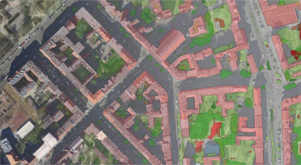
In the second part of our impervious surface series, we demonstrate how freely available true orthophotos can be transformed into a detailed, high-resolution land cover classification using modern AI architectures. Building on our flexible AI framework, we provide an overview of current AI developments and demonstrate their added value in the semantic segmentation of urban […]
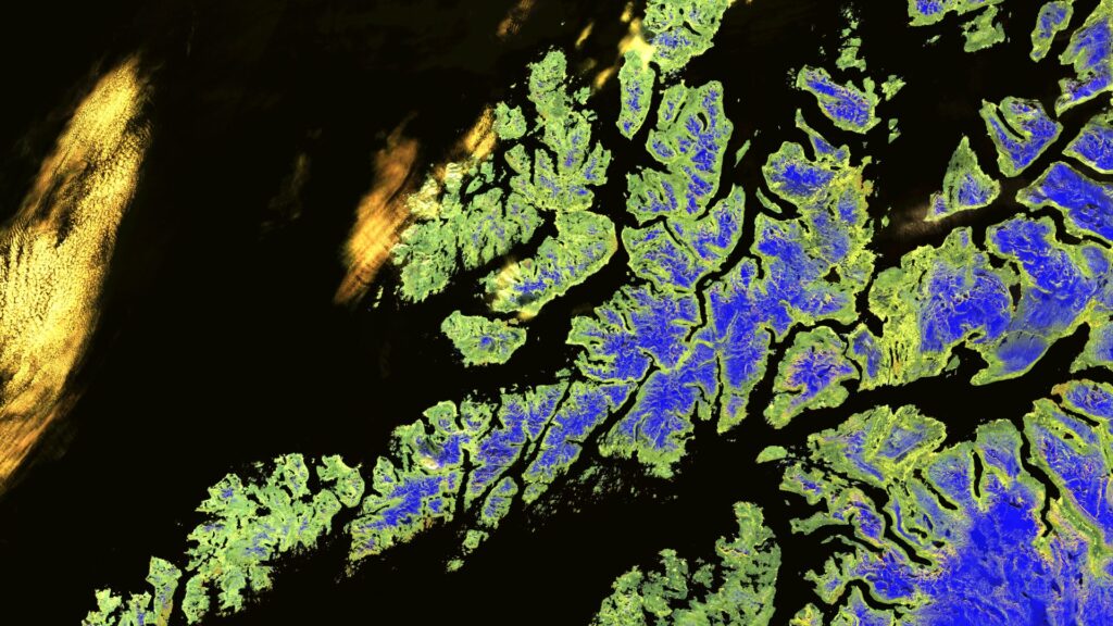
How our Sentinel-1 satellite images are created
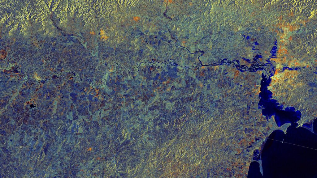
The Sentinel-1 mission is part of the European Copernicus Programme and consists of several satellites for Earth observation. The satellites are equipped with a Synthetic Aperture Radar (SAR) instrument that can provide images of the Earth’s surface regardless of the time of day or weather conditions. For our Sentinel-1 satellite images, we have Level-1 Ground […]
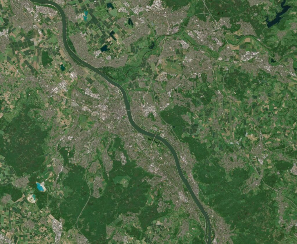
How We Create Our Satellite Images
Our Satellite Images of the Month are based on data from the Sentinel-2 mission of the EU Copernicus programme. The mission began in 2015 with the launch of the first satellite, Sentinel-2A, and was expanded in 2017 and 2024 with the satellites Sentinel-2B and Sentinel-2C. By combining three satellites, a revisit rate of approximately 3 […]
Heat Stress Maps – Webinar-recording now online
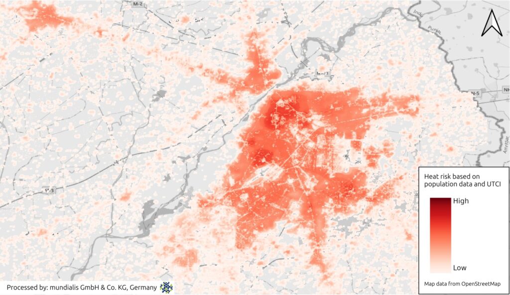
Extreme heat is becoming an increasing challenge for cities and regions worldwide. In this webinar, we demonstrate how Earth observation (EO) and remote sensing data can be used to systematically assess heat-related risks. Participants will receive a concise overview of relevant data sources, remote sensing methods, and commonly used heat and heat stress indices. Using […]
New publication: Geospatial modelling to support Rift Valley fever surveillance in Mauritania
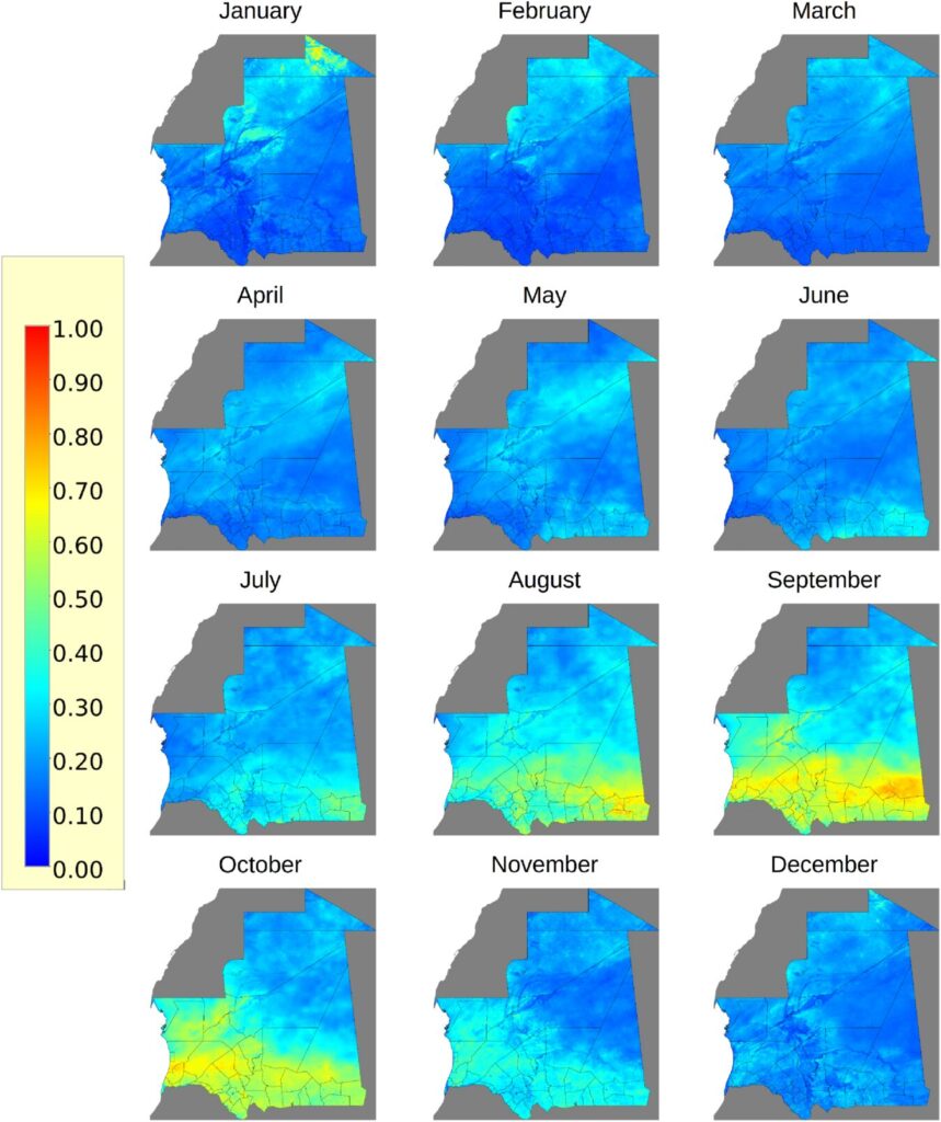
We are pleased to share that mundialis contributed to a newly published article in PLOS Neglected Tropical Diseases, titled: “Local drivers of Rift Valley fever outbreaks in Mauritania: A One Health approach combining ecological, vector, host and livestock movement data”Barry et al., 2025 – PLOS NTDs | DOI: 10.1371/journal.pntd.0013553 The study takes a One Health approach to understand […]
Waldmonitoring mit Sentinel-2 – Webinar-Aufzeichnung
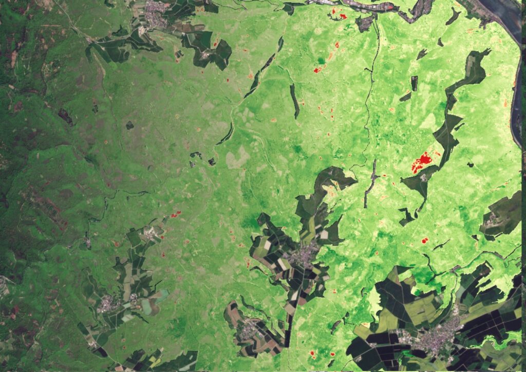
In diesem Webseminar erläutern wir, wie aktuelle Satellitendaten modernes Waldmanagement unterstützen können. Wir zeigen, wie aus Sentinel-2-Daten nutzbare Informationen entstehen, erläutern unsere Analyseverfahren und stellen die eingesetzten Tools vor. Anhand praxisnaher Beispiele erfahren Sie, wie sich Veränderungen erkennen und langfristige Entwicklungen im Wald ableiten lassen. Für alle, die fundierte Einblicke in moderne Monitoring-Methoden und ihre […]
Revealing Overlooked Potential, Rethinking Parking Lots – Webinar Recording
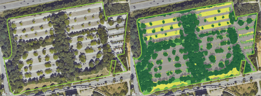
Large-scale parking lots in cities are often overlooked – yet they offer tremendous potential for sustainable urban development, land use, and climate adaptation. In our webinar, we showed how parking areas can be systematically recorded, assessed, and documented – based on open geodata and with the help of open-source software. Thank you all for attending! […]
Better Assessment of Heavy Rainfall Risks: First Training on the GRASS GIS Tool r.sim.water

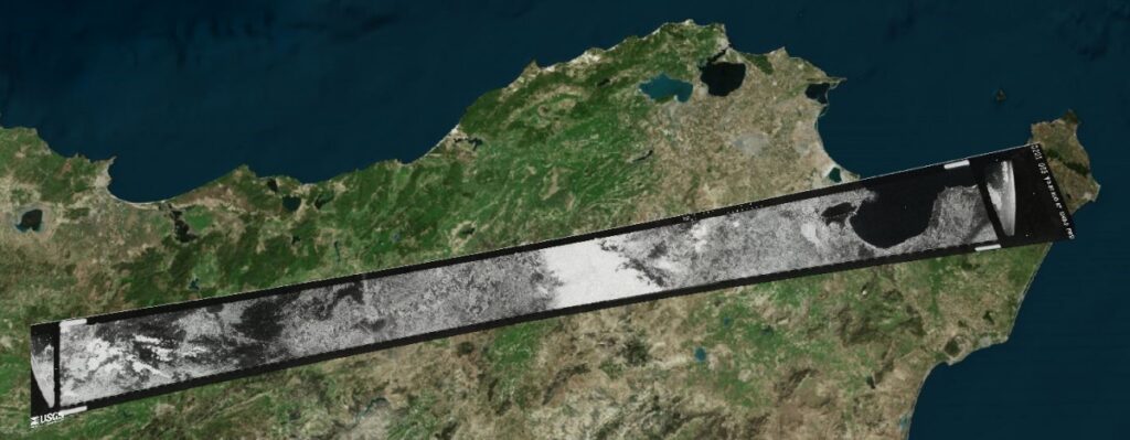
Unlock Historical Satellite Imagery for Archaeological Research Our team has developed an innovative solution for processing declassified CORONA spy satellite imagery (1960-1972), providing unprecedented access to high-resolution historical landscape data with up to 60cm pixel resolution. This technology is particularly valuable for archaeological site identification and landscape change analysis. Key features of our service include: These […]