
Adelaide River – Australia, recorded by the Sentinel-2B satellite on October 26, 2023
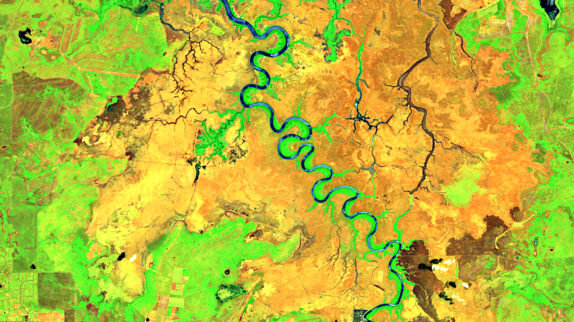
Our satellite image of the month January shows a part of the Adelaide River in the Northern Territory in northern Australia.
The image is based on Sentinel-2 data from the EU’s Copernicus programme. Sentinel-2 data consists of freely available multispectral satellite images. After the download, the scene was atmospherically corrected using free software, and then a color composition was calculated using three different bands.
Structure of the image
The depicted band combination is a false color composite, which is useful for carrying out vegetation analysis. In this composite, the bands 11 (short wave infrared), 8A (visible and near infrared) and 3 (visible green) were used, providing a spatial resolution of 20 meters. In this composite, healthy vegetation appears in vibrant shades of green and is very easy to distinguish from soil, which appears in a variety of brownish colours. Clouds are white, while water is dark blue to black. Cities are coloured from light grey to light pink.
The image section is located about 50 kilometers east of Darwin, the largest city in the Northern Territory. The Adelaide River originates on the western slopes of Mount Smith and flows about 180 kilometers north before it emptying into the Van Diemen Gulf or the Indian Ocean. The region around the river is characterised by lush vegetation, swampland, and tropical rainforest, making it a habitat for a variety of species. The Adelaide River is particularly well known for its large population of saltwater crocodiles. Boat trips provide the opportunity to observe these reptiles in their natural habitat.
The Adelaide River, located in the centre of the image, and smaller tributaries are represented in shades of blue. In the immediate vicinity of the rivers, especially in the inner bends of the river meanders, intense green tones indicate healthy vegetation due to sufficient water supply. A larger part of the image is colored in shades of brown, indicating little to no vegetation. In these areas, some likely dried-up or seasonal river courses are depicted in dark brown to black instead of blue.
About the river meanders
The image shows the almost perfect meanders of the Adelaide River. These bends or loops in a river’s course result from the natural interaction of water with the surrounding landscape. While the water causes erosion and sediment removal at the outer bends, the slower flow at the inner bends leads to sediment deposition. These processes create characteristic curves in the course of the river, which can change over time. River meanders create ecologically important floodplains and are simultaneously influenced by human intervention such as river regulation.
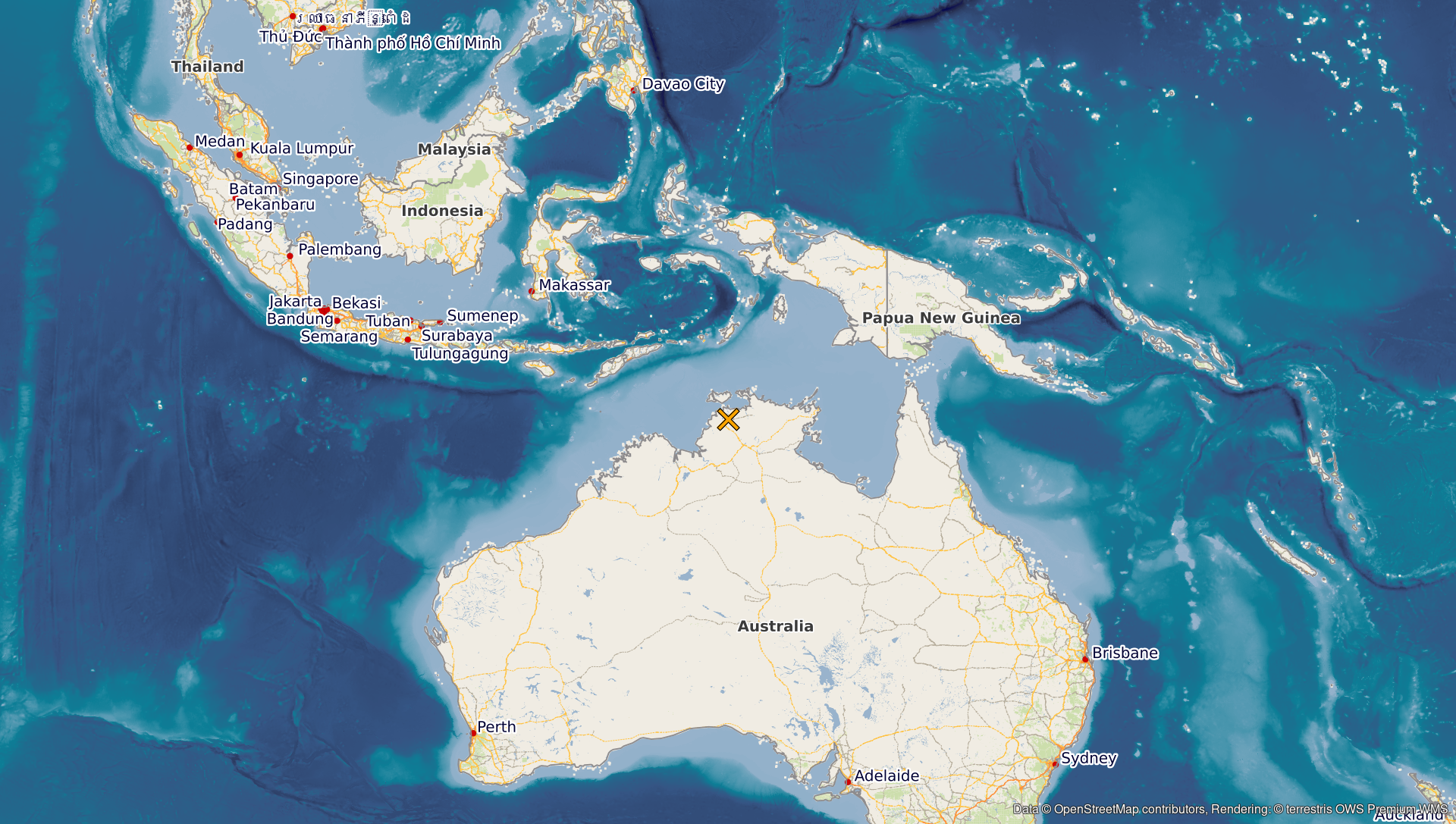
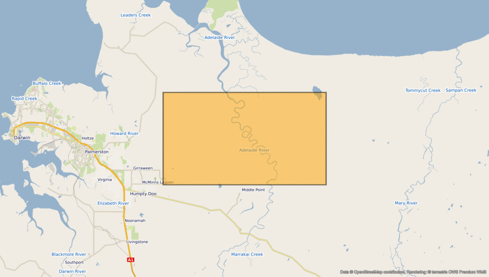
A different view of the region
The following illustrations help to place the satellite image geographically. The orange-coloured markers (rectangle or ×) help to put the region shown into context, providing a different view of the area along the Adelaide River. The maps were created using the extremely useful OpenStreetMap Premium service provided by our sister company terrestris.
Contains modified Copernicus Sentinel data (2023)/ESA – created by mundialis
More satellite images are available at https://maps.mundialis.de