
The Satellite Image of the Month for July is the seventh part of our twelve-part visual journey. It opens the thematic block “Cities – Urban Green.” The focus is on urban measures as a response to global environmental change: we show how green roofs, trees and urban vegetation can be made visible and analysed using satellite imagery and high-resolution orthophotos.
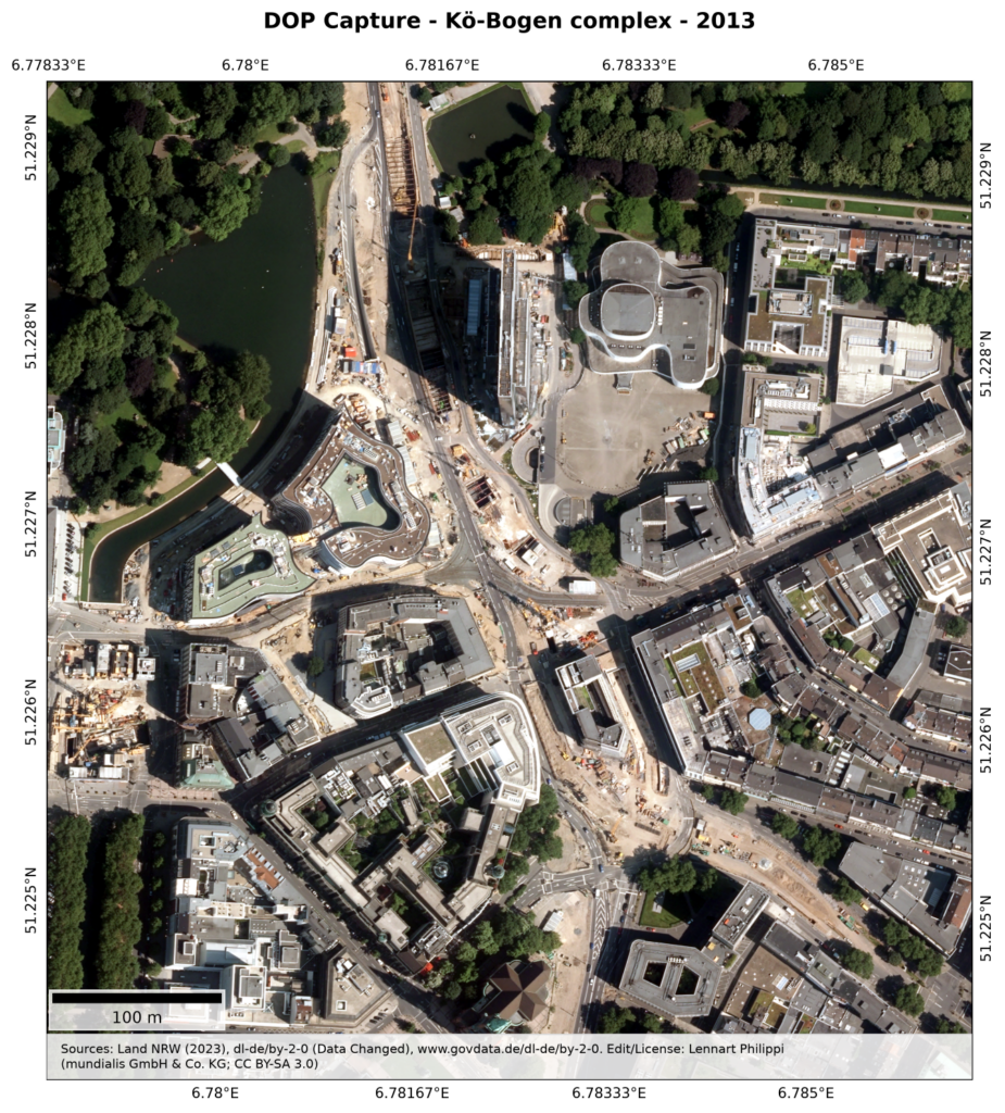
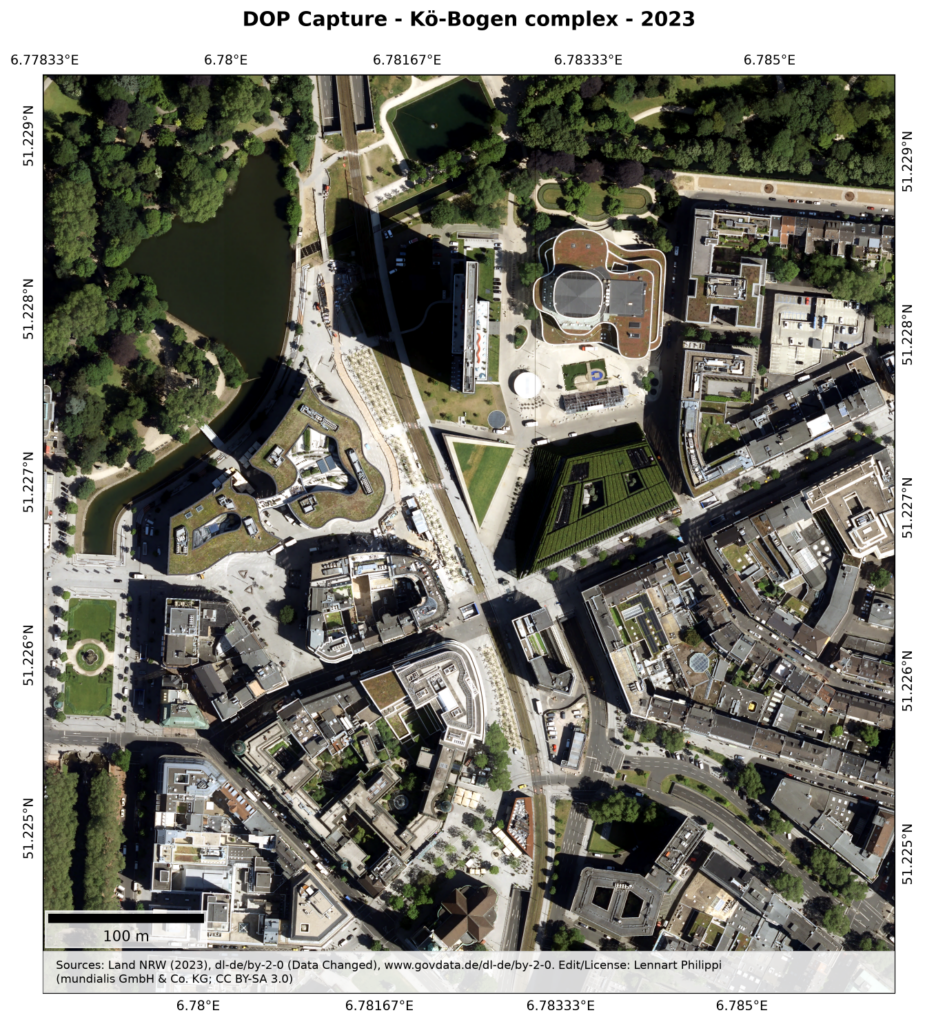
The images show a section of Düsseldorf, the capital of North Rhine-Westphalia. On this occasion, however, these are not classic satellite images, but two digital orthophotos (DOP) from the annual aerial surveys carried out by the State of North Rhine-Westphalia. With a ground resolution of 20 centimetres per pixel, the true-colour representation (RGB) offers a detailed view of the city’s structures – exactly ten years apart.
Image Composition
Both images show the Kö-Bogen complex in the heart of Düsseldorf’s city centre. The first image, from 2013, is dominated by a large, sand-coloured construction site that runs as a broad swathe from north to south through the inner city, along the route of the former “Tausendfüßler” (“Millipede”). Along the upper edge of the image, the excavation pits of newly emerging tunnels are visible. To the west, a two-part, curved building structure (Kö-Bogen I) borders directly on the water features of the Hofgarten (top left in the image).
In the second image, from 2023, the construction site has completely disappeared. In place of the sandy areas, there are now light-coloured paved surfaces and newly created pedestrian zones, with finished, asphalted tunnel entrances and exits along the edges of the image. East of the central axis, two striking buildings with triangular, angled forms (Kö-Bogen II) stand out, their roof and façade surfaces coloured deep green: the right-hand one bears Europe’s largest green façade, while the roof of the left-hand one can be used as a lawn. Directly above, the Düsseldorf Schauspielhaus (theatre) is visible, with its characteristic white wave-shaped structure and a newly added dark green vegetated roof.
Urban Transformation
The images document the shift away from the car-centred city of the post-war era towards a revitalised inner city. The trigger for this comprehensive revitalisation programme was the demolition of the “Tausendfüßler” – an elevated road in need of renovation that had cut through the cityscape for decades. By relocating the traffic axes into underground tunnels, planners gained an enormous amount of space at street level: prestigious architectural projects arose on the newly created open areas, and formerly asphalted zones were turned into traffic-calmed pedestrian areas.
The project shows that not only new buildings such as Kö-Bogen II, but also historic structures like the Schauspielhaus, can be functionally upgraded through targeted greening. This transformation goes beyond a purely aesthetic enhancement: by storing rainwater and releasing it again through evaporation, the roofs and façades produce a noticeable cooling effect. They counteract local heat islands and thus make a direct contribution to the public health of the urban population. The area is a prime example of how ambitious inner-city development and modern climate adaptation can go hand in hand. With regard to global climate goals, however, much remains to be done: noticeable effects on the city-wide climate can only be expected with considerably greater de-sealing and greening.
Recognising green roofs from a bird’s-eye view
At mundialis, we use orthophotos like the ones shown above for the aerial-imagery-based identification of green roofs. Drawing on current DOP and 2.5D point clouds, we survey large areas comprehensively and in a short time – precisely, cost-effectively and without the need for elaborate on-site inspections.
The result: comprehensive green-roof cadastres that also indicate the exact area of the greened roof surface. They provide a valuable data basis for municipalities, urban planning and climate adaptation.
Satellite images for your wall are available from Art from Space und ama walls.