
Satellite image of the month – November – Kufra-Oases (Libya)
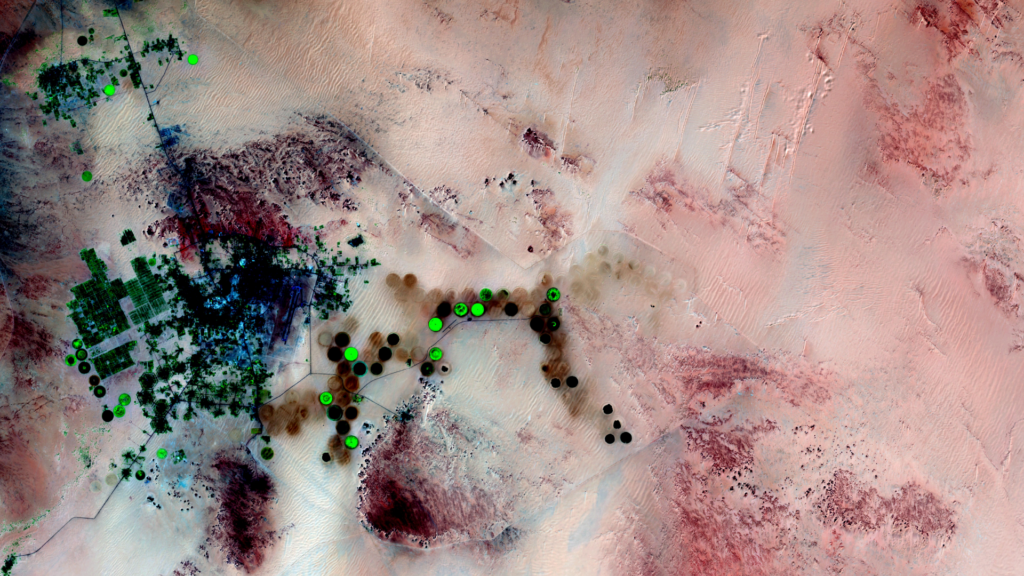
Kufra-Oases – Libya, recorded by the Sentinel-2A satellite on March 23, 2022 Our satellite image of the month November shows the Kufra oases in southeastern Libya. The image is based on Sentinel-2 data from the EU Copernicus program. After downloading the freely available multispectral satellite image, the scene was atmospherically corrected with free software and […]
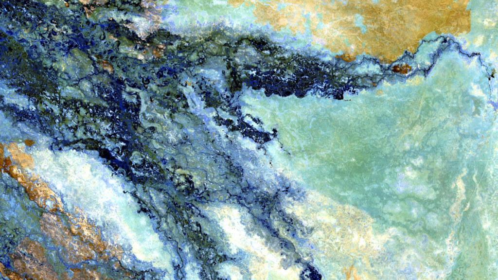
Satellite image of the month – October – Durrat Al Bahrain (Kingdom of Bahrain)
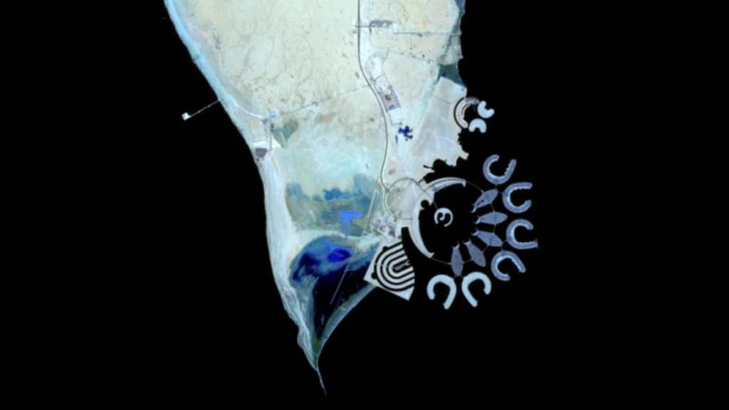
Durrat Al Bahrain – Kingdom of Bahrain, recorded by the Sentinel-2A satellite on October 16, 2021 The satellite image of the month October shows the artificial island Durrat Al Bahrain in the Kingdom of Bahrain. The Sentinel-2A image shows a color-infrared composite created from different bands, with a spatial resolution of 10 meters. Sentinel-2 data […]
Satellite image of the month – September – Kansas and Colorado (USA)
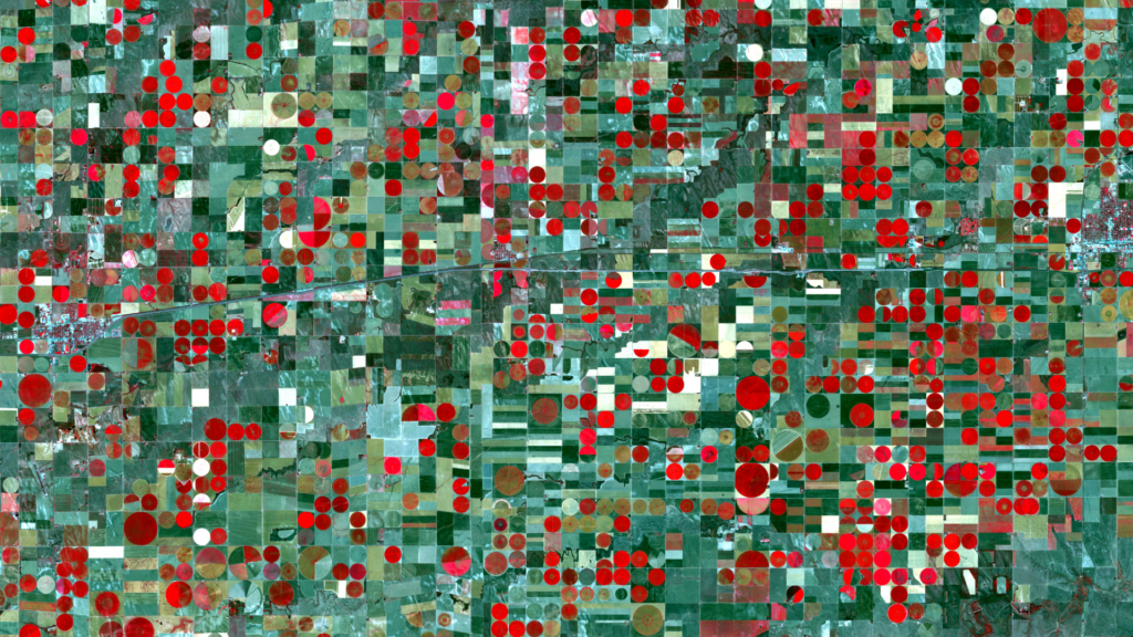
Kansas and Colorado – USA, recorded by the Sentinel-2A satellite on September 22, 2021 Our satellite image of the month September depicts an agricultural area at the border between Colorado and Kansas, USA. The image is based on Sentinel-2A data from the EU Copernicus Programme. Sentinel-2 data are freely available multispectral satellite images. After the […]
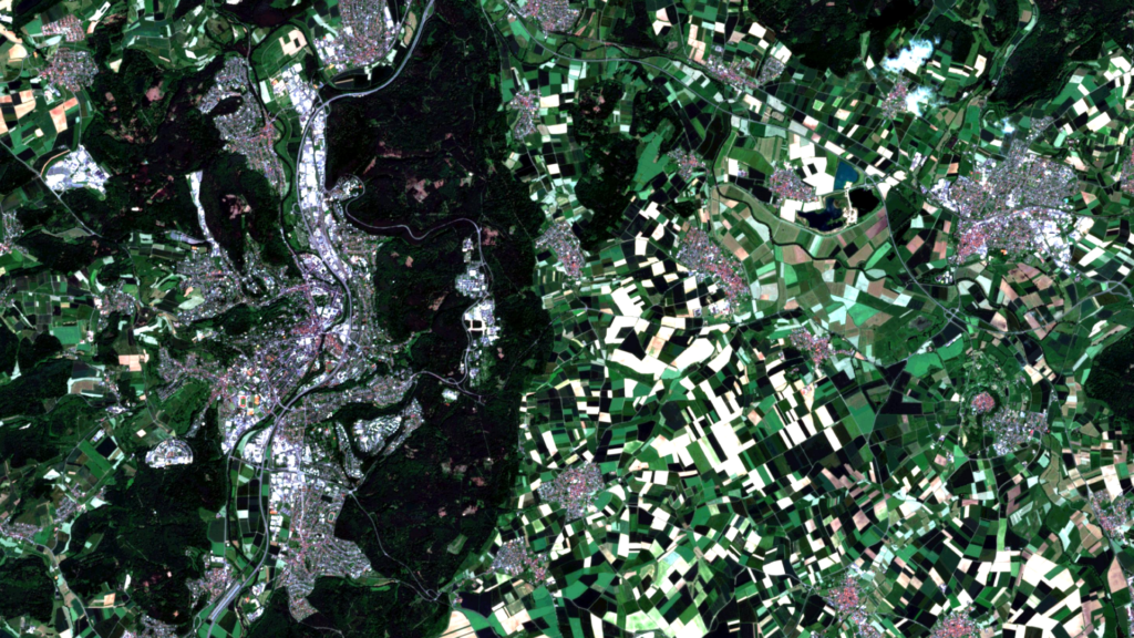
Satellite image of the month – August – Florence (Italy)
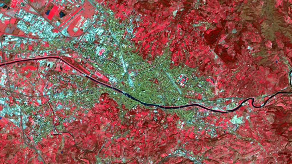
Florence – Italy, recorded by the Sentinel-2A satellite on March 09, 2022 The satellite image of the month August shows the Italian city of Florence, which is the venue of the FOSS4G conference 2022. The image shown is based on multispectral freely available satellite data from the Sentinel-2 satellite of the EU Copernicus program. After […]
Satellite image of the month – July – Delta du Saloum National Park (Republic of Senegal)
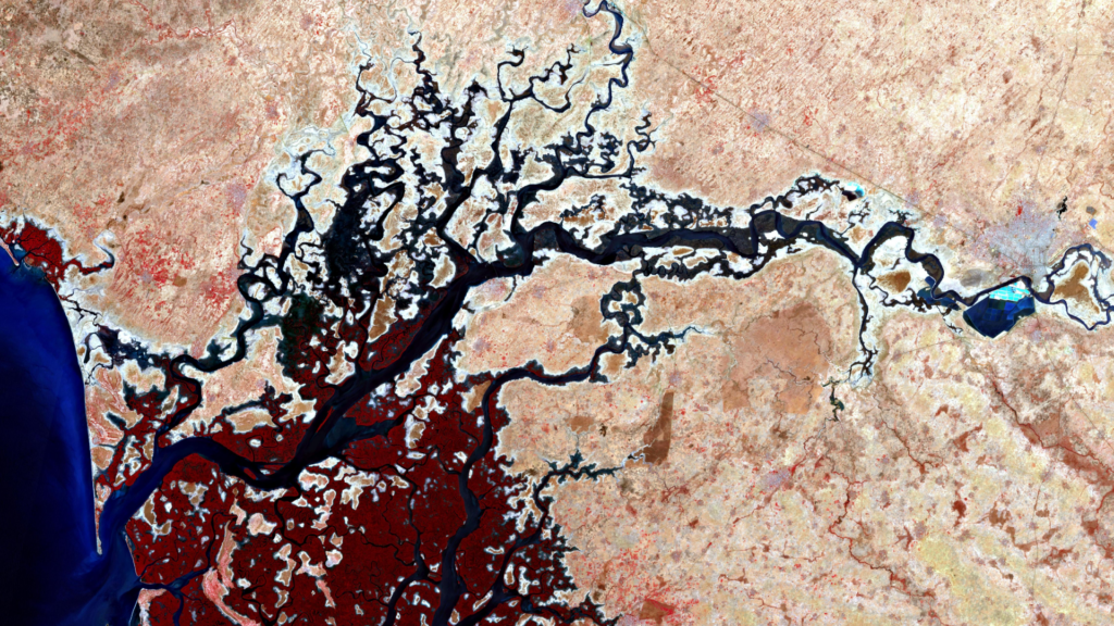
Delta du Saloum National Park – Republic of Senegal, recorded by the Sentinel-2B satellite on March 18, 2022 The satellite image of the month July shows the Delta du Saloum National Park in the Republic of Senegal. The image shown is based on multispectral data from the Sentinel-2B satellite of the EU Copernicus program. These […]
Satellite image of the month – June – Prague (Czech Republic)
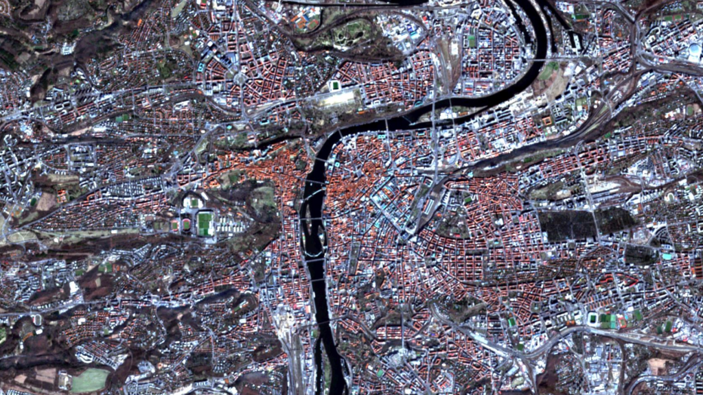
Prague – Czech Republic, recorded by the Sentinel-2A satellite on March 09, 2022 The satellite image of the month June shows the city of Prague (Czech Republic), which is the venue of the OpenDataScience Europe Workshop 2022 “Connecting Europe through Earth Observation and Open Data Missions”. The image shown is based on multispectral satellite data […]
Satellite image of the month – May – Bonn (Germany)
[:en]Bonn – Germany, recorded by the Sentinel-2A satellite on March 28, 2022 The satellite image of the month May shows the city of Bonn in western Germany. The image is based on multispectral images from the Sentinel-2 satellite of ESA’s Copernicus program. After downloading the freely available data, the scene was atmospherically corrected using free […]
Satellite image of the month – April – Grand Canyon (USA)
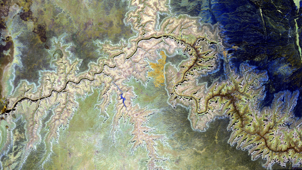
Grand Canyon – USA, recorded by the Sentinel-2B satellite on September 24, 2020 The satellite image of the month april shows a section of the Grand Canyon in Arizona, USA. The image is based on Sentinel-2 data from the EU Copernicus programme. Sentinel-2 data are freely available, multispectral satellite images. After downloading the scene, an […]
Satellite image of the month – March – Marburg (Germany)
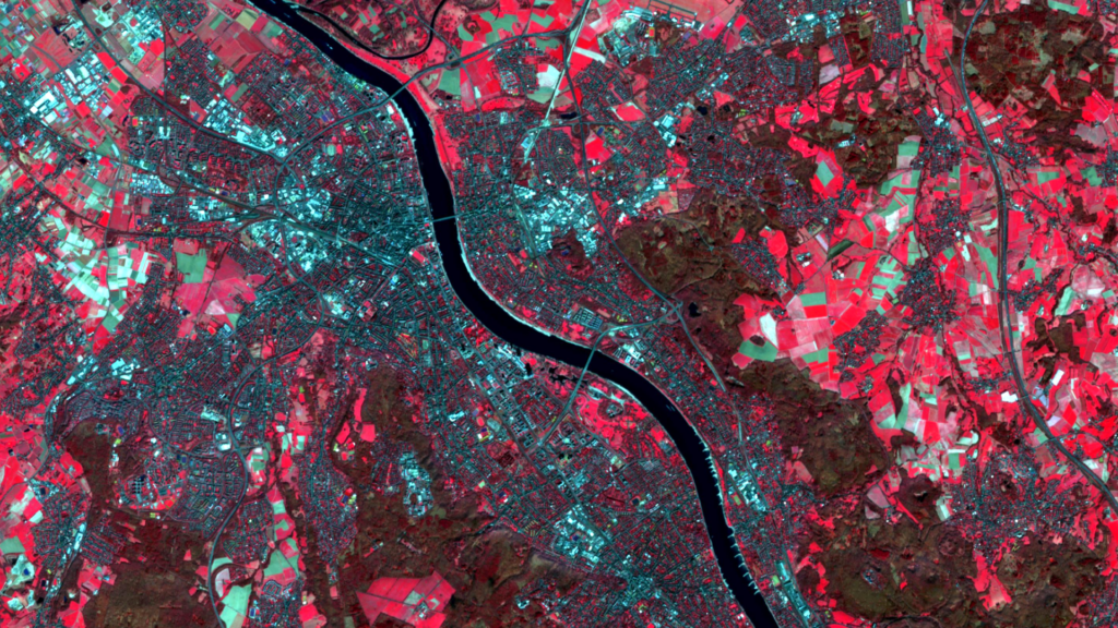
Marburg – Germany, recorded by the Sentinel-2B satellite on June 13, 2021 The satellite image of the month March shows the city of Marburg, location of the FOSSGIS conference 2022, in central Germany. The image shows a composite of three different spectral bands based on freely available Sentinel-2 data from the Copernicus programme. After downloading […]
Satellite image of the month – February – Okavango Delta (Republic of Botswana)
Okavango Delta – Republic of Botswana, recorded by the Sentinel-2B satellite on October 12, 2021 In the light of the World Wetlands Day our satellite image of the month February shows a part of the Okavango Delta in the Republic of Botswana. The image is based on freely available, multispectral Sentinel-2 data from the EU […]