
GIM International presents: Our Contribution to Climate Adaptation in Cities
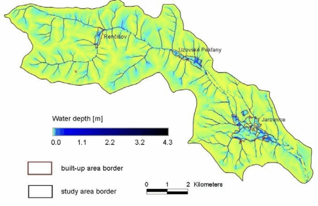
We are pleased that our work has been featured in a recent article by our colleague Markus Metz. The article highlights the growing importance of open-source tools for enhancing climate adaptation — with a focus on our GRASS GIS module r.sim.water. The article explains how climate change is intensifying extreme rainfall events, making cities increasingly vulnerable […]
mundialis at the 26th Bonn Economic Talks
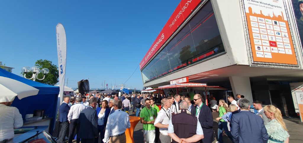
Yesterday, mundialis had the pleasure of participating in the 26th Bonn Economic Talks – an inspiring event under the motto “Shaping the Future Together.” As a company in the field of satellite remote sensing, we contribute to innovation in the region. The Economic Talks provided us with a great opportunity to network with other leaders […]
Satellite image of the month – June – Dalhart (Texas, USA)
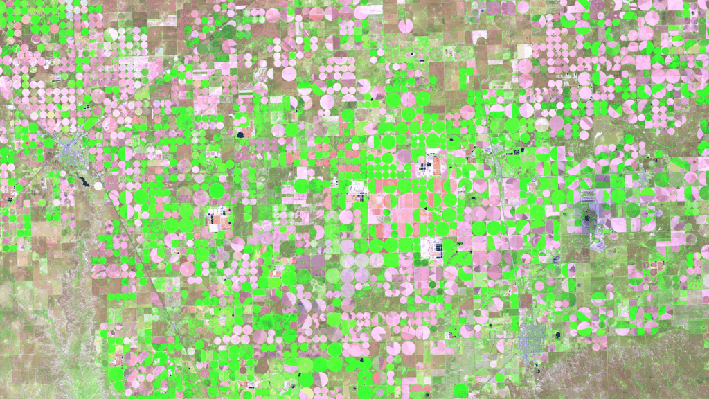
Dalhart – Texas, USA, captured by the Sentinel-2A satellite on May 16, 2025. Our satellite image of the month of June shows the area surrounding Dalhart in Texas, which is characterised by agriculture and a special irrigation technique. Structure of the image The image is based on Sentinel-2 data from the EU Copernicus Programme. Sentinel-2 […]
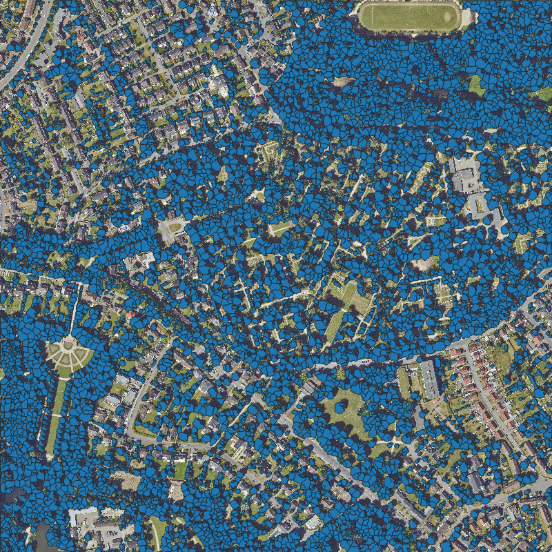
Parking Lots as a Resource for Sustainable Urban Transformation – Initial Findings
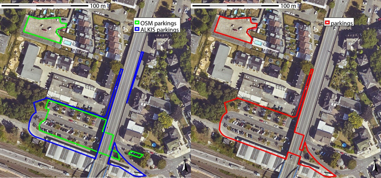
The Federal Office for Building and Regional Planning (BBSR) has published initial results on the transformation of large-scale parking lots – with model cities Dortmund, Görlitz and Ulm. Together with GGR, we have created a data and methodological basis for systematically recording and evaluating parking spaces – with the help of remote sensing, geodata and […]
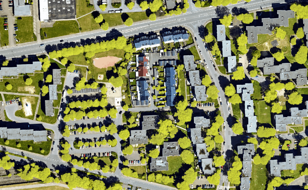
Einzelbaumerkennung mit offenen Daten der Bundesländer – Webinar-Aufzeichnung
Wie lassen sich offene Geodaten für Umwelt- und Stadtplanung nutzen? Wir zeigen, wie Einzelbäume flächendeckend erfasst werden können – mit Open Source Ansatz und einer Live-Demo. Hier gehts zum Video.
Satellite image of the month – May – Banks Peninsula (New Zealand)
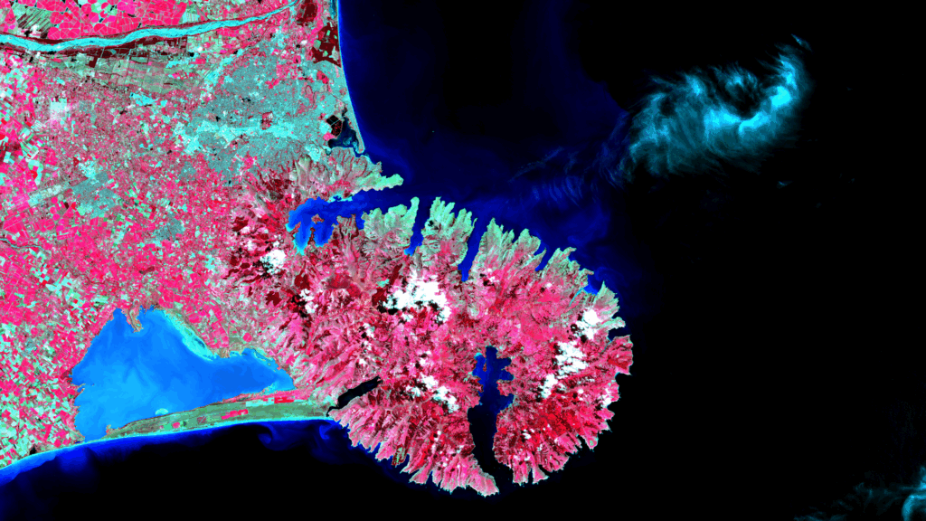
Banks Peninsula – New Zealand, imaged by the Sentinel-2C satellite on 22.01.2025 Our satellite image of the month of May shows the Banks Peninsula and the city of Christchurch on the east coast of New Zealand’s South Island. Structure of the Image The image is based on Sentinel-2 data from the EU’s Copernicus program. Sentinel-2 […]
New project completed: Using thermal data to reduce energy loss
In many cities, buildings are already supplied with heating energy via decentralized district heating networks. The expansion of district heating is considered a key component of a sustainable energy and heating transition and for achieving climate protection targets. Waste heat – for example from combined heat and power plants or waste incineration plants – is […]
Webinar “Offene Geodaten der Bundesländer: Verfügbarkeit und Anwendung in der Einzelbaumerkennung”
[Dieses Webinar hat bereits stattgefunden. Eine Aufzeichnung finden Sie hier.] Wir laden Sie und Euch herzlich zum Webseminar „Offene Geodaten der Bundesländer: Verfügbarkeit und Anwendung in der Einzelbaumerkennung“ am 08.05.2025 von 10-11 Uhr ein! Darum geht’s: Die Bundesländer Deutschlands stellen die von ihnen erhobenen und verwalteten Geobasisdaten mittlerweile zum Großteil als Open Data zur Verfügung. Vor allem […]
FOSSGIS 2025 – a review of the largest conference to date
With 727 participants on site and over 350 online, 87 presentations, 30 lightning talks as well as demo sessions, BoF meetings, an expert Q&A session and poster sessions, this year’s FOSSGIS was the largest in its history. The workshops were also very well attended with almost 200 participants, and the evening event was attended by […]
Climate Resilience Forum NRW’25
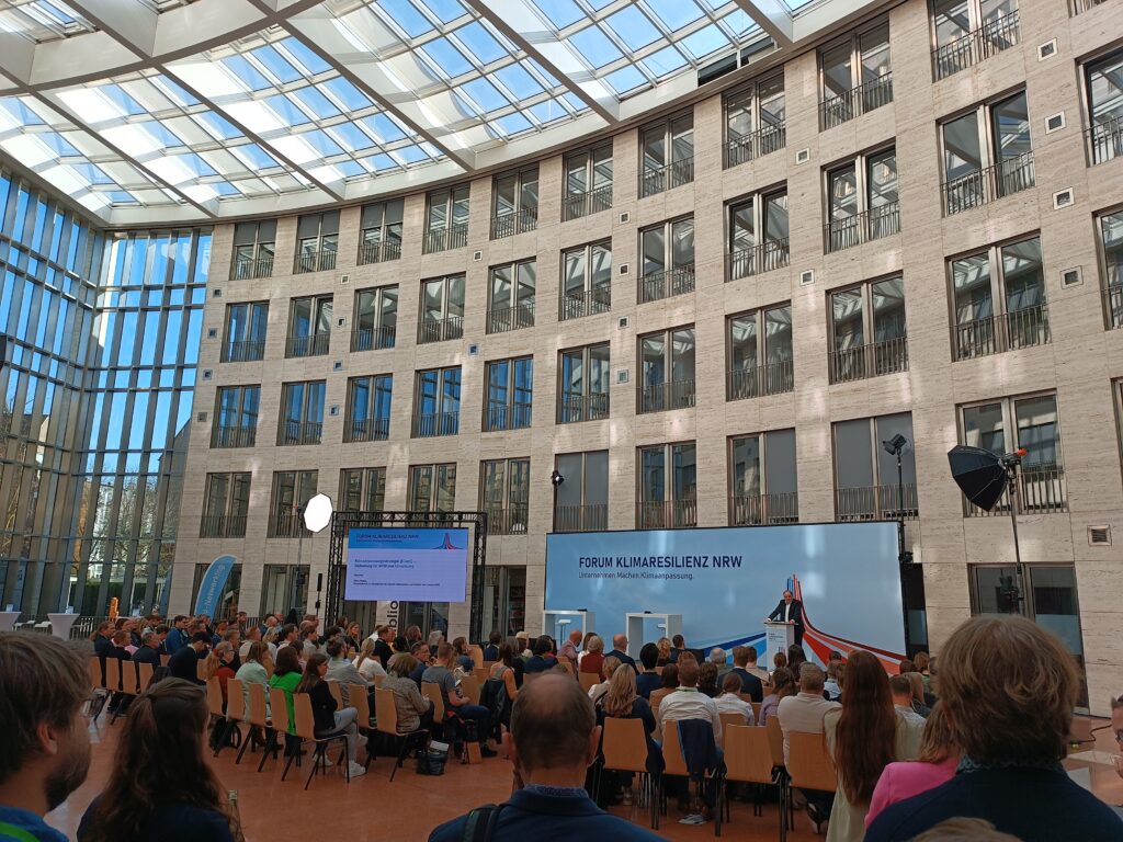
Climate change is not a distant threat – the effects are also being felt here in NRW. To make society more resilient to the consequences of climate change, the Netzwerk Klimaanpassung und Unternehmen.NRW organized the FORUM KLIMARESILIENZ NRW’25. We were able to introduce ourselves to interested visitors in 5-minute pitches. There was also the opportunity […]