
Satellite image of the month – December – Mahalangur Himal (Nepal/China)
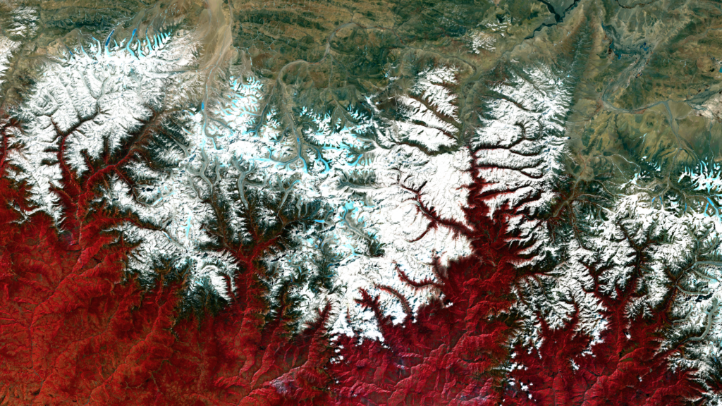
Mahalangur Himal– Nepal/China – recorded by the Sentinel-2B satellite on March 17, 2024 Our satellite image of the month December shows the Mahalangur Himal massif, which is part of the Himalayas and home to the world’s highest mountains, including Mount Everest, also known in the region as Sagarmatha or Qomolangma. Structure of the image The […]
Satellite image of the month – November – Baku (Azerbaijan)
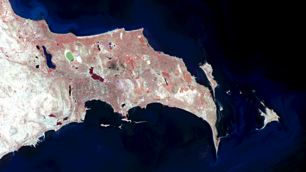
Baku – Azerbaijan, recorded by the Sentinel-2A satellite on September 01, 2024 Our satellite image of the month November shows the city of Baku in Azerbaijan and its surroundings. Structure of the image The image is based on Sentinel-2 data from the EU’s Copernicus programme. Sentinel-2 data are freely available multispectral satellite images. After the download, several scenes were merged and atmospherically corrected using free software. Then a color composition […]
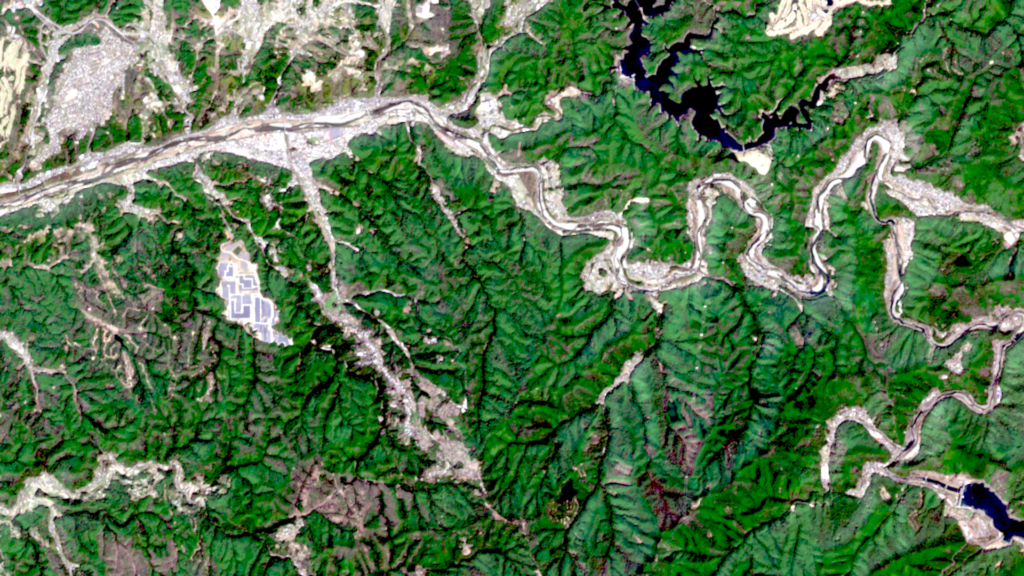
Satellite image of the month – October – Mont Blanc (France & Italy)
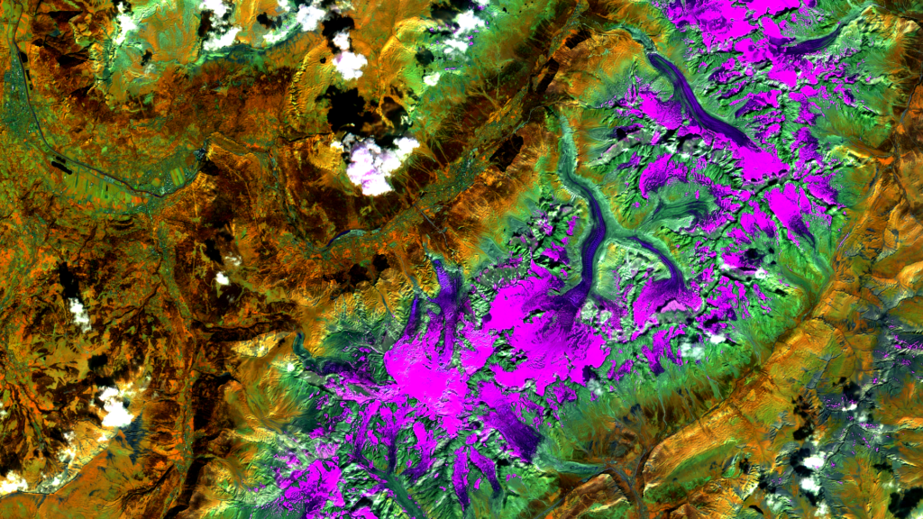
Mont Blanc – France & Italy, recorded by the Sentinel-2A satellite on August 31, 2024 Our satellite image of the month for October shows the Mont Blanc massif in the French and Italian Alps. The image is based on Sentinel-2 data from the EU Copernicus program. Sentinel-2 data are freely available, multispectral satellite images. After […]
Satellite image of the month – September – Northern Aral Sea (Kazakhstan)
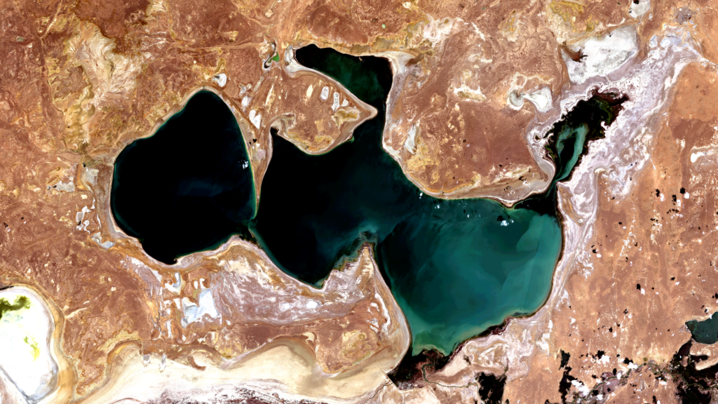
Northern Aral Sea – Kazakhstan, recorded by the Sentinel-2A satellite on July 04, 2024 The satellite image of the month of September shows the northern Aral Sea in Kazakhstan, a remnant of the Aral Sea that has disappeared due to silting up and drying out. The image is based on Sentinel-2 data from the EU […]
Satellite image of the month – August – Harrat Khaybar (Saudi Arabia)
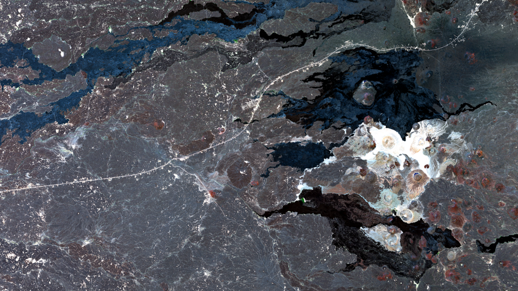
Harrat Khaybar – Saudi-Arabien, aufgenommen vom Sentinel-2A Satelliten am 31.01.2024 Our satellite image of the month of August shows Harrat Khaybar, a volcanic field in Saudi Arabia. Structure of the image Das Bild basiert auf Sentinel-2 Daten des EU Copernicus Programmes. Sentinel-2 Daten sind multispektrale Satellitenaufnahmen, die frei verfügbar sind. Nach dem Download wurde die […]
Satellite image of the month – July – Belize City (Belize)
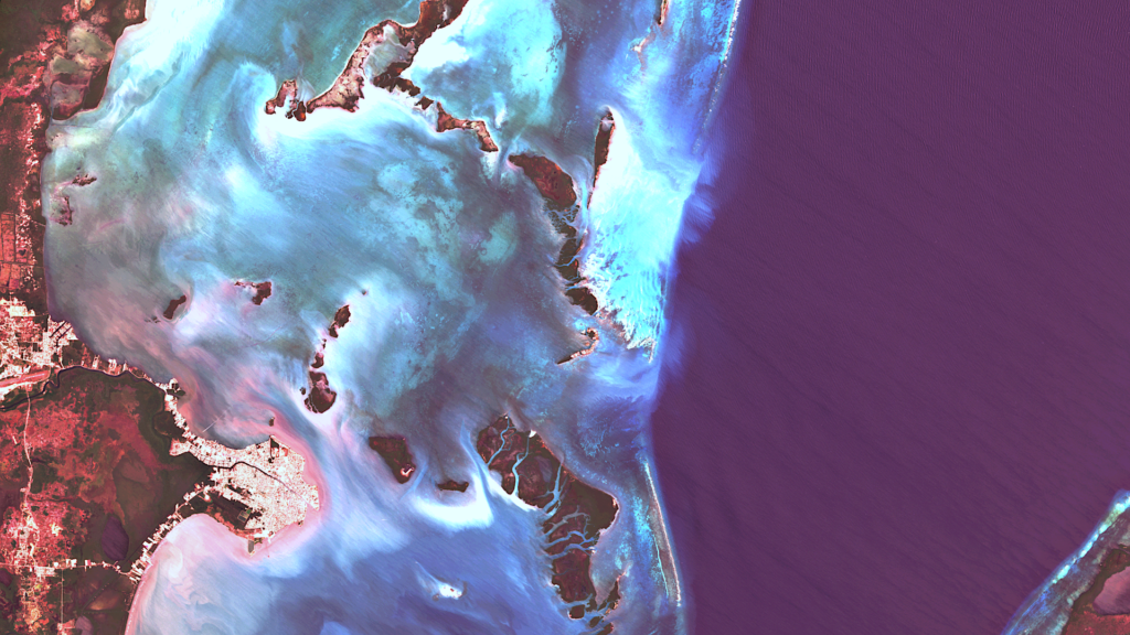
Belize City – Belize, recorded by the Sentinel-2B satellite on April 10, 2024 Our satellite image of the month July shows Belize City, the largest city in the Central American state of Belize, and its surroundings on the Caribbean coast. The image is based on Sentinel-2 data from the EU Copernicus programme. Sentinel-2 data consists […]
Satellite image of the month – June – Sossusvlei (Namibia)
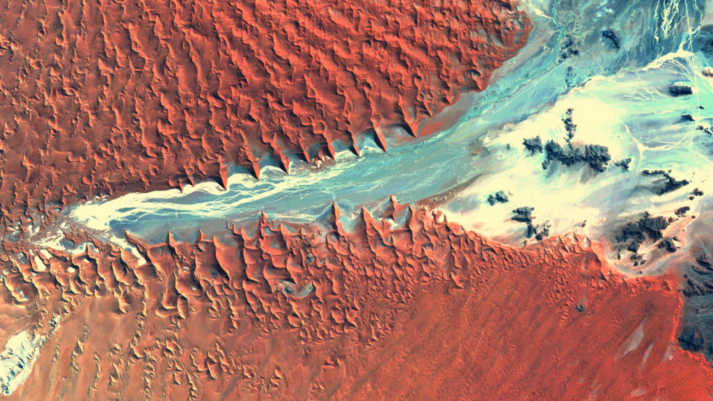
Sossusvlei – Namibia, recorded by the Sentinel-2A satellite on March 31, 2024 Our satellite image of the month June shows Sossusvlei, a salt-clay pan surrounded by sand dunes in the Namib Desert in Namibia. Structure of the image The image is based on Sentinel-2 data from the EU’s Copernicus programme. Sentinel-2 data consists of freely […]
Satellite image of the month – May – Kilimanjaro (Tanzania)
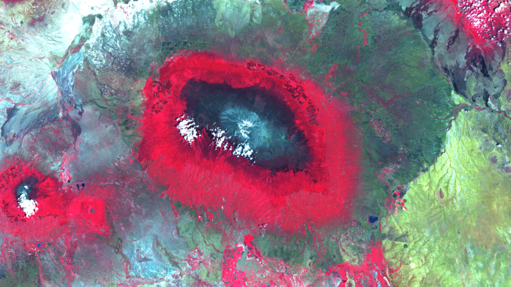
Kilimanjaro – Tanzania – recorded by the Sentinel-2A satellite on January 28, 2023 Our satellite image of the month May shows Mount Kilimanjaro in Tanzania and its surroundings. The image is based on Sentinel-2 data from the EU Copernicus programme. Sentinel-2 data consists of freely available multispectral satellite images. After the download, the scene was […]
Satellite image of the month – April – Yoshino-yama (Japan)
Yoshino-yama – Japan, recorded by the Sentinel-2B satellite on 10 April, 2022 The satellite image of the month April shows the Yoshino-yama mountain region in Japan in the south of Nara Prefecture, south-east of the city of Osaka. The image is based on Sentinel-2 data from the EU’s Copernicus program. Sentinel-2 data are freely available […]
Satellite image of the month – March – Hamburg (Germany)
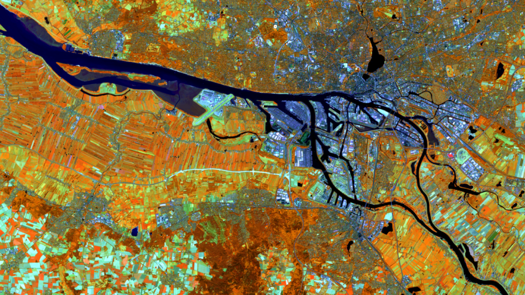
Hamburg – Germany, recorded by the Sentinel-2A satellite on 12 August, 2022 Our satellite image of the month March shows the city of Hamburg in northern Germany and its surroundings. Structure of the image The image is based on Sentinel-2 data from the EU Copernicus programme. Sentinel-2 data consists of freely available multispectral satellite images. […]