
Satellite Image of the Month – May – Franconia (Germany)
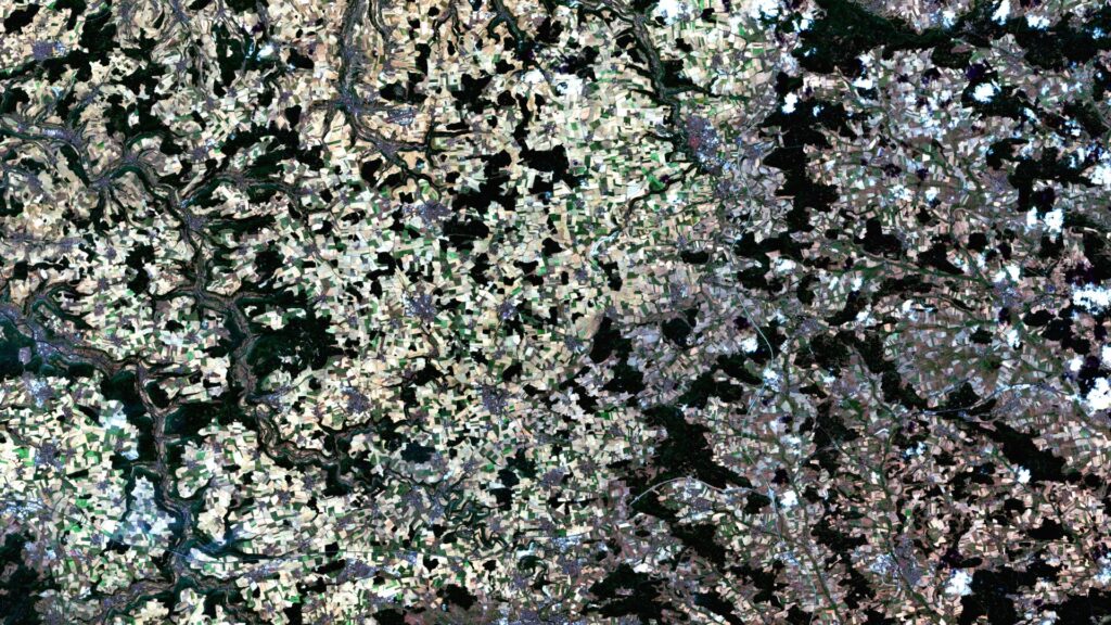
Franconia – Germany, recorded by the Sentinel-2A and -2B satellites on August 14, 2021 and August 14, 2022 The satellite image of the month for May is the fifth image in our twelve-part visual journey. It continues the series ‘Traces of Time – Landscapes and Cities in Transition’, in which we show satellite images to […]
Satellite Image of the Month – April – Harz National Park (Germany)
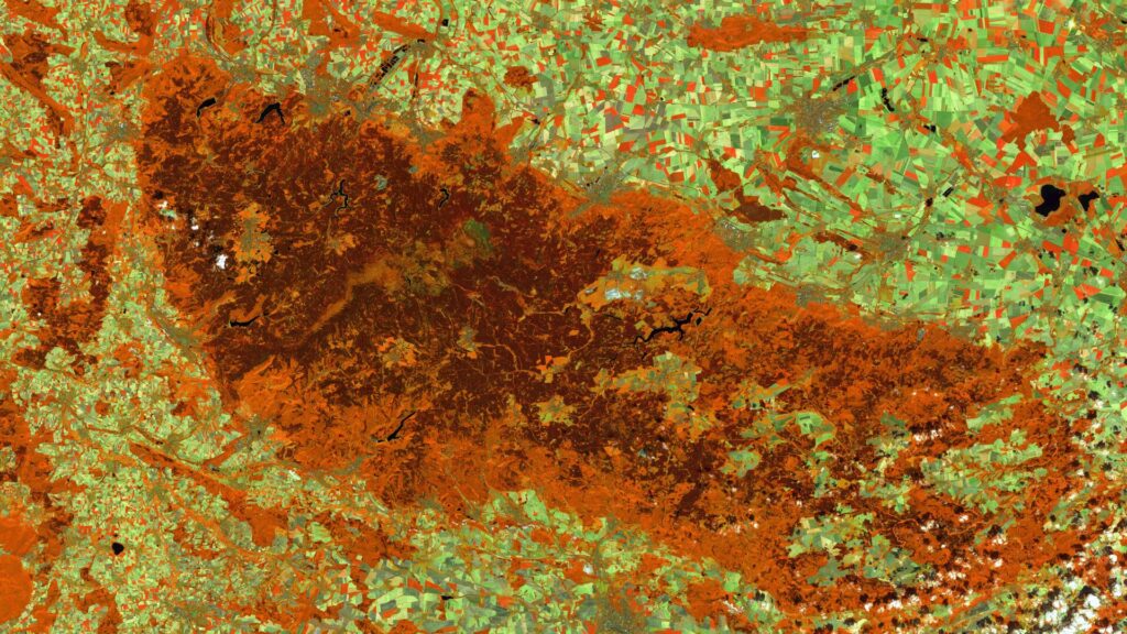
Harz National Park (Lower Saxony/Saxony-Anhalt) – Germany, recorded by the Sentinel-2A and -2C satellites on August 9, 2015 and August 13, 2025 The satellite image of the month April is the fourth image in our twelve-part visual journey and opens the thematic series ‘Traces of Time – Landscapes and Cities in Transition’. Using satellite images, we document and illustrate slower, more gradual changes to the […]
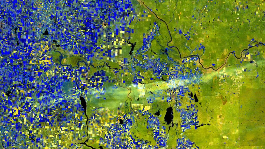
Satellite Image of the Month – March – Rio Grande do Sul (Brazil)
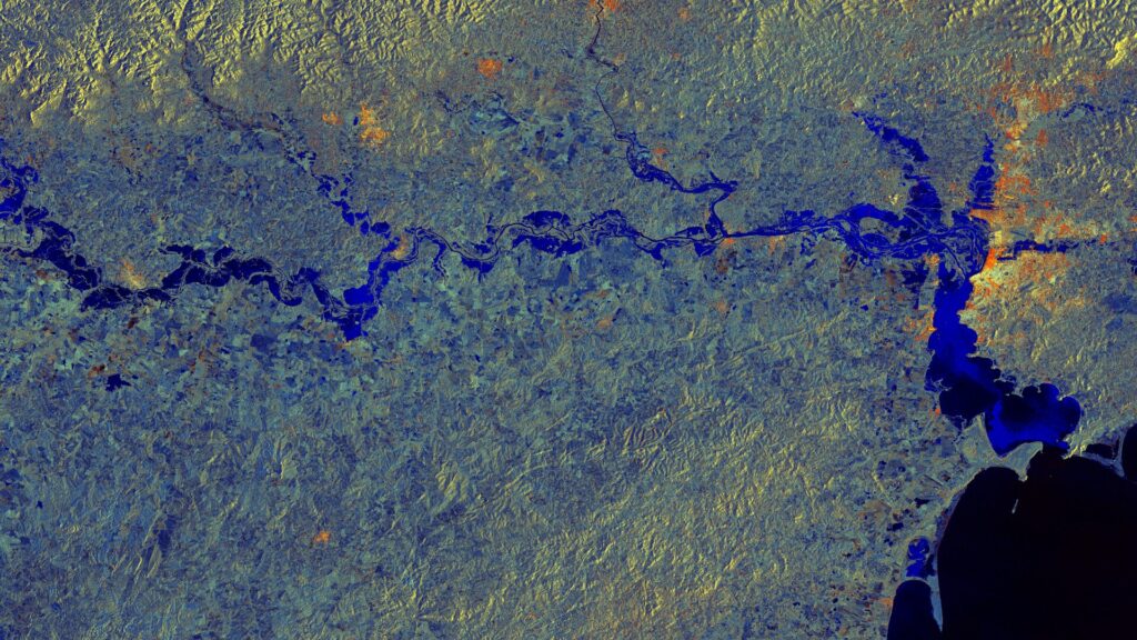
Rio Grande do Sul – Brazil, captured by the Sentinel-1A satellite on May 11, 2024, and June 4, 2024. The satellite image of the month March is the third part of our twelve-part visual journey. It concludes the thematic block “Acute hazards – visible from space”, which deals with natural hazards, their visible impacts and […]
Satellite image of the month – February – Lower Saxony (Germany)
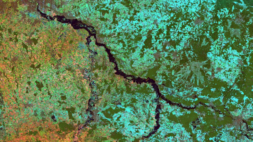
Lower Saxony – Germany, recordedby the Sentinel-2B satellite on December 15, 2022 and January 09, 2024 The satellite image of the month February is the second part of our twelve-part visual journey. It continues the theme of “Acute hazards – visible from space”, dealing with natural hazards, their visible effects and the possibilities of satellite-based analysis. The image shows […]
Satellite Image of the month – January – Alberta (Canada)
World in Transition — Signs, Traces, Solutions. This year we invite you on a 12-part visual journey: from acute natural events to urban adaptation and on to long-term landscape change. Each image reveals not only a phenomenon but also the data techniques and analyses that make solutions possible — in the spirit of Earth. Data. Solutions. […]
10 Years of mundialis – Looking Back on Open Paths
In 2015, we started with the conviction that there are better ways to work with data. Without licensing barriers. Without black boxes. Instead: openness, transparency, and shared learning. We work with data from space, but we keep both feet firmly on the ground.We develop publicly accessible software because we believe that knowledge should be shared. […]
Recap of the Open Day Photogrammetry 2025
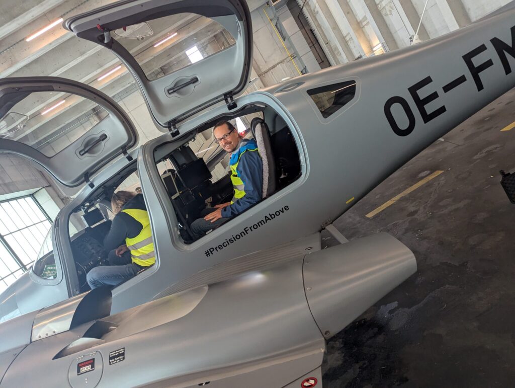
Last week, we had the opportunity to gain fascinating insights into the technology of aerial imaging at this year’s Open Day Photogrammetry at Dortmund Airport – including a close-up look at the specially equipped aircraft regularly used for aerial surveys. As a company that uses aerial imagery as a data foundation, we hosted a workshop […]
Revealing Overlooked Potential, Rethinking Parking Lots – Webinar Recording
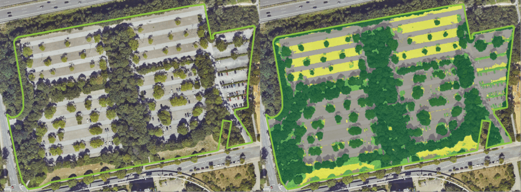
Large-scale parking lots in cities are often overlooked – yet they offer tremendous potential for sustainable urban development, land use, and climate adaptation. In our webinar, we showed how parking areas can be systematically recorded, assessed, and documented – based on open geodata and with the help of open-source software. Thank you all for attending! […]
Back from the 2025 ESA Living Planet Symposium: Three Key Trends for Earth Observation
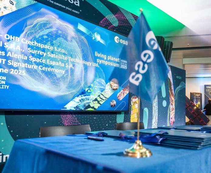
Last week, Vienna became the center of the Earth Observation (EO) world during the ESA Living Planet Symposium 2025, and we at mundialis were proud to be there, contributing and learning alongside global EO leaders. Here are our top three takeaways from the event and how they connect to our daily mission: Copernicus is expanding, […]
Satellite image of the month – July – Vienna (Austria)
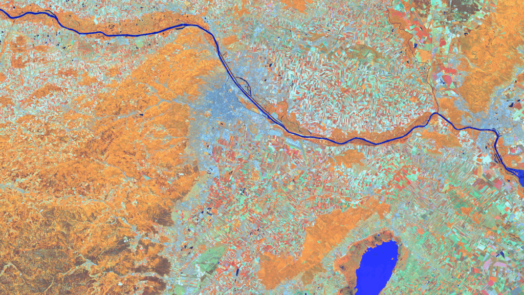
Vienna – Austria – recorded by the Sentinel-2A satellite on June 13, 2025 Our satellite image of the month for July shows the Austrian capital Vienna and the surrounding region. In the last week of June, the Living Planet Symposium 2025, one of the largest conferences on Earth observation, took place there. Structure of the image The image is based on Sentinel-2 data from […]