
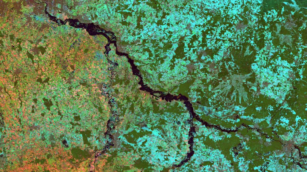
Satellite Image of the Month – May – Franconia (Germany)
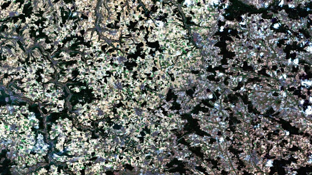
Franconia – Germany, recorded by the Sentinel-2A and -2B satellites on August 14, 2021 and August 14, 2022 The satellite image of the month for May is the fifth image in our twelve-part visual journey. It continues the series ‘Traces of Time – Landscapes and Cities in Transition’, in which we show satellite images to […]
Satellite Image of the Month – April – Harz National Park (Germany)
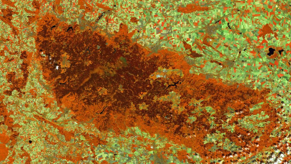
Harz National Park (Lower Saxony/Saxony-Anhalt) – Germany, recorded by the Sentinel-2A and -2C satellites on August 9, 2015 and August 13, 2025 The satellite image of the month April is the fourth image in our twelve-part visual journey and opens the thematic series ‘Traces of Time – Landscapes and Cities in Transition’. Using satellite images, we document and illustrate slower, more gradual changes to the […]
How our Sentinel-1 satellite images are created
The Sentinel-1 mission is part of the European Copernicus Programme and consists of several satellites for Earth observation. The satellites are equipped with a Synthetic Aperture Radar (SAR) instrument that can provide images of the Earth’s surface regardless of the time of day or weather conditions. For our Sentinel-1 satellite images, we have Level-1 Ground […]
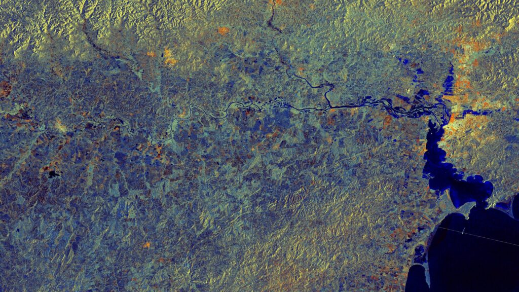
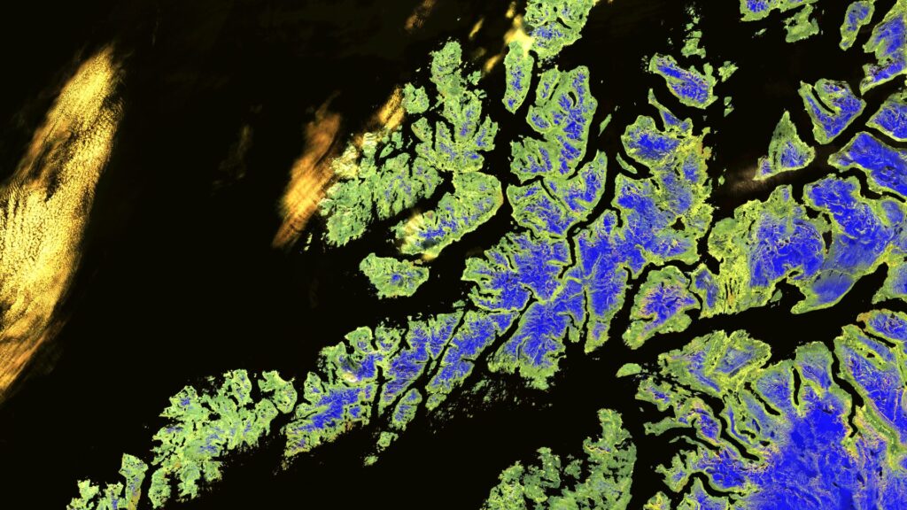
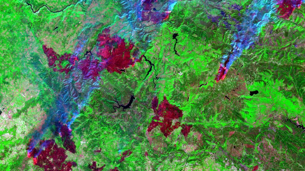
Satellite Image of the Month – March – Rio Grande do Sul (Brazil)
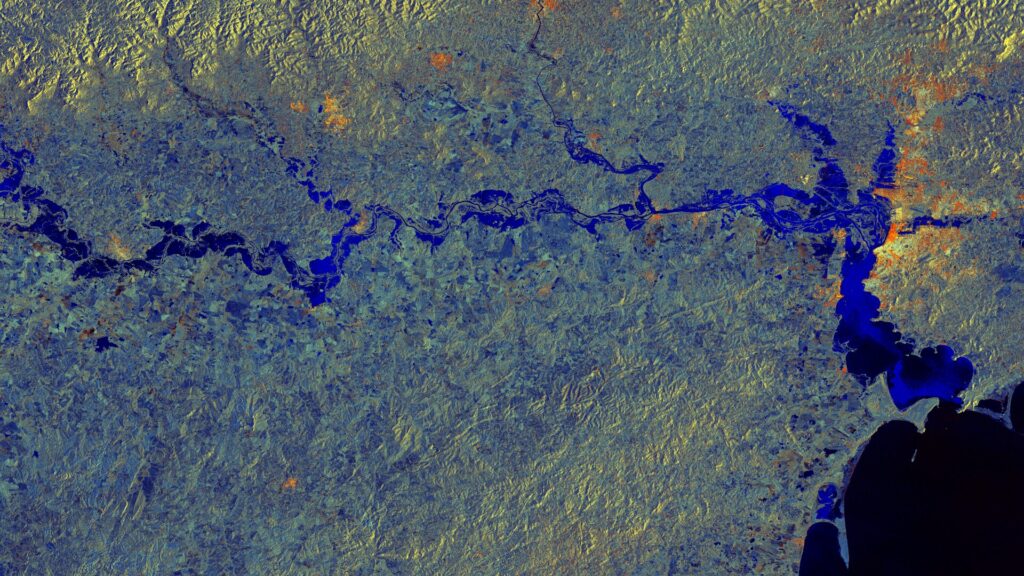
Rio Grande do Sul – Brazil, captured by the Sentinel-1A satellite on May 11, 2024, and June 4, 2024. The satellite image of the month March is the third part of our twelve-part visual journey. It concludes the thematic block “Acute hazards – visible from space”, which deals with natural hazards, their visible impacts and […]
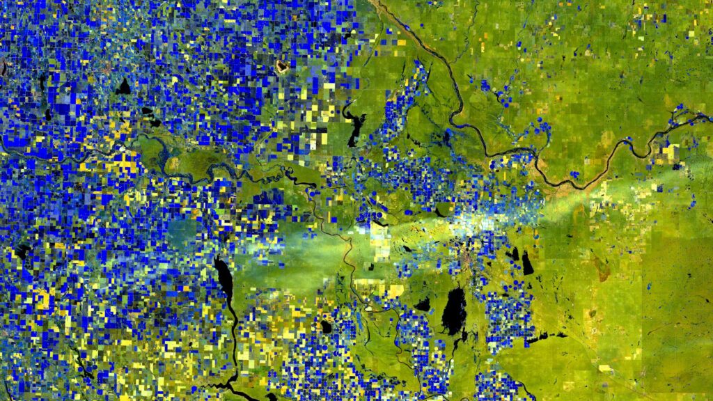
Satellite image of the month – February – Lower Saxony (Germany)
Lower Saxony – Germany, recordedby the Sentinel-2B satellite on December 15, 2022 and January 09, 2024 The satellite image of the month February is the second part of our twelve-part visual journey. It continues the theme of “Acute hazards – visible from space”, dealing with natural hazards, their visible effects and the possibilities of satellite-based analysis. The image shows […]
Satellite Image of the month – January – Alberta (Canada)
World in Transition — Signs, Traces, Solutions. This year we invite you on a 12-part visual journey: from acute natural events to urban adaptation and on to long-term landscape change. Each image reveals not only a phenomenon but also the data techniques and analyses that make solutions possible — in the spirit of Earth. Data. Solutions. […]
How We Create Our Satellite Images
Our Satellite Images of the Month are based on data from the Sentinel-2 mission of the EU Copernicus programme. The mission began in 2015 with the launch of the first satellite, Sentinel-2A, and was expanded in 2017 and 2024 with the satellites Sentinel-2B and Sentinel-2C. By combining three satellites, a revisit rate of approximately 3 […]
Satellite Image of the month – December – Berry Islands (Bahamas)
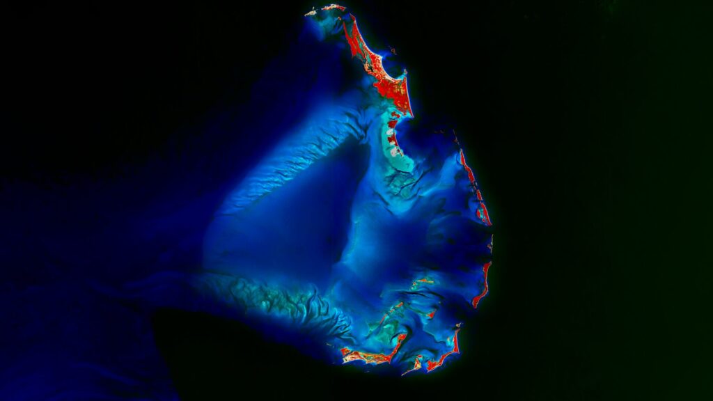
Berry Islands – Bahamas, recorded by the Sentinel-2A satellite on August 1st, 2025 Our Satellite Image of the Month shows the Berry Islands, an island chain belonging to the Bahamas. The chain is located in the northwestern part of the country, specifically north of New Providence Island, which is home to the capital, Nassau. The […]
Satellite Image of the month – November – Macizo Central Orensano (Spain)
Macizo Central Orensano – Spain, recorded by the Sentinel-2B satellite on August 16, 2025 Our satellite image of the month shows the border region between Spain and Portugal in the northwest of the Iberian Peninsula, specifically parts of the Spanish regions of Castile and León as well as Galicia, and parts of the Portuguese district […]
Satellite image of the month – October – Aachen/Maastricht (Germany/Netherlands)
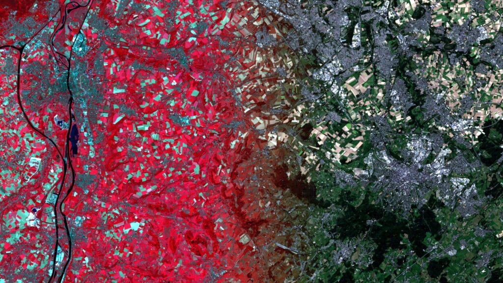
Aachen/Maastricht – Germany/Netherlands– recorded by the Sentinel-2A satellite on August 11, 2025 Our satellite image of the month for October shows the border region between the Netherlands, Germany and Belgium around the cities of Aachen and Maastricht. The image is based on Sentinel-2 data from the EU Copernicus Programme. Sentinel-2 data consists of freely available multispectral satellite images. Multiple scenes were merged […]