
Satellite image of the month – September – Noord-Holland (Netherlands)
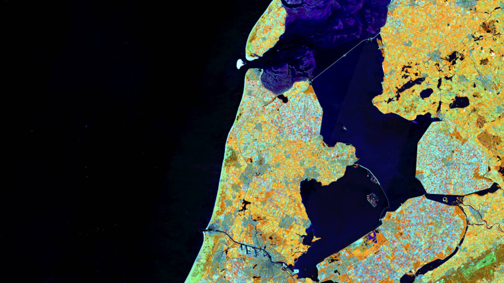
Our satellite image of the month September shows in the center the Dutch province Noord-Holland, which lies as a peninsula between the North Sea and the Ijsselmeer. The image is based on Sentinel-2 data from the EU Copernicus program. Sentinel-2 data are freely available multispectral satellite images. After downloading, two scenes were merged and atmospheric […]
Satellite image of the month – August – Salar de Uyuni (Bolivia)
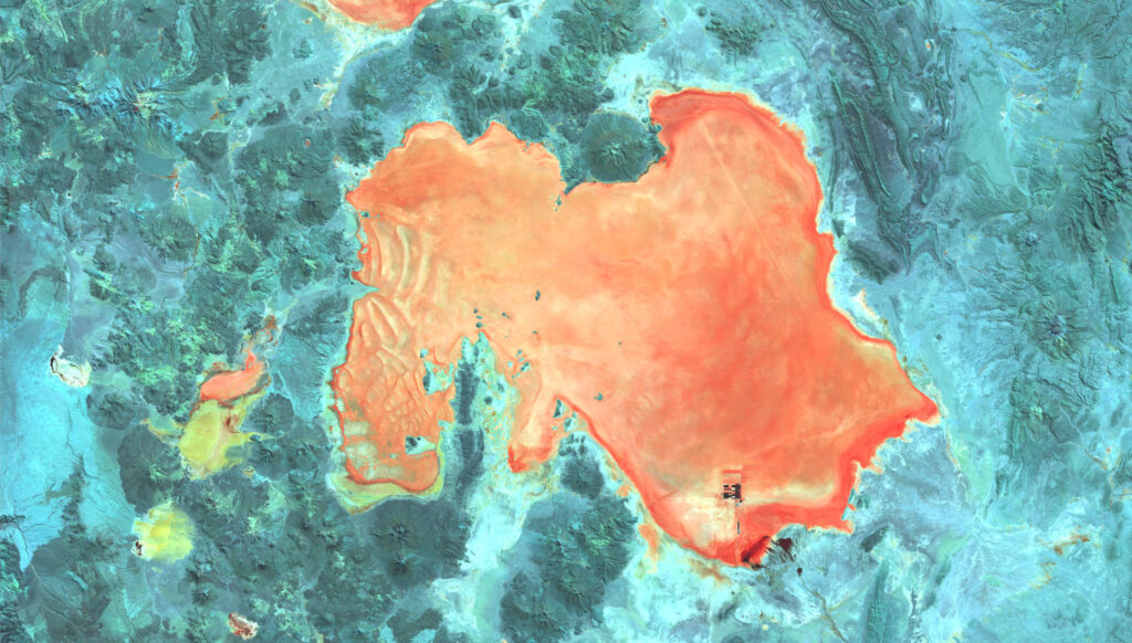
Salar de Uyuni – Bolivia, recorded by the Sentinel-2B satellite on July 22, 2023 Our satellite image of the month August shows the Salar de Uyuni, the largest salt flat on earth, and the surrounding area. The image is based on Sentinel-2 data from the EU Copernicus program. Sentinel-2 data are freely available multispectral satellite […]
Satellite image of the month – July – Helsinki (Finland)
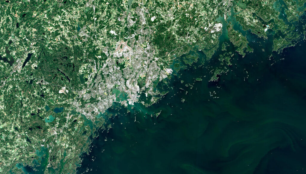
Helsinki – Finland, recorded by the Sentinel-2A satellite on June 23, 2023 Our satellite image of the month July shows Helsinki, the capital of Finland, and its surroundings. The image is based on Sentinel-2 data from the EU Copernicus program. Sentinel-2 data are freely available multispectral satellite images. After the download, the scene was atmospherically […]
Satellite image of the month – June – Prizren (Republic of Kosovo)
Prizren – Republic of Kosovo, recorded by the Sentinel-2B satellite on May 06, 2023 Our satellite image of the month June shows the city of Prizren and its surroundings in Kosovo. The image is based on Sentinel-2 data of the EU Copernicus program. Sentinel-2 data are freely available multispectral satellite images. After downloading, the scene […]
Satellite image of the month – May – Eleuthera (The Bahamas)
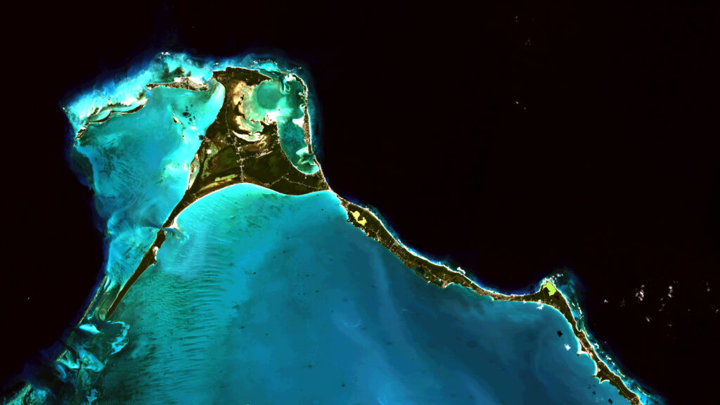
Eleuthera – The Bahamas, recorded by the Sentinel-2B satellite on January 17, 2023 Our satellite image of the month May shows the northern end of Eleuthera, an island of The Bahamas. The image is based on freely available multispectral Sentinel-2 data from the Copernicus program. After the download, the satellite scene was atmospherically corrected using […]
Satellite image of the month – April – Khartoum (Sudan)
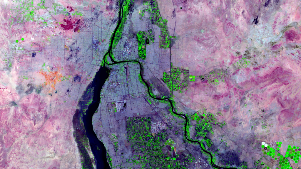
Khartoum – Sudan, recorded by the Sentinel-2A satellite on May 17, 2021 Our satellite image of the month April shows the city of Khartoum and its surroundings. The image shows a color composite created from Sentinel-2 data from the EU Copernicus program. Sentinel-2 data are multispectral satellite images which are free to obtain. After downloading, […]
Satellite image of the month – March – Berlin (Germany)
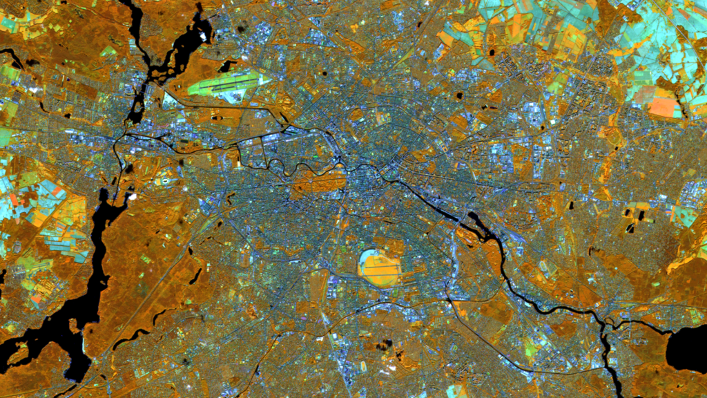
Berlin – Germany, recorded by the Sentinel-2B satellite on September 30, 2022 The satellite image of the month March shows the German city of Berlin. The image is based on freely available multispectral satellite images from the Sentinel-2 satellite of the Copernicus Programme. After downloading the scene an atmospheric correction was carried out using free […]
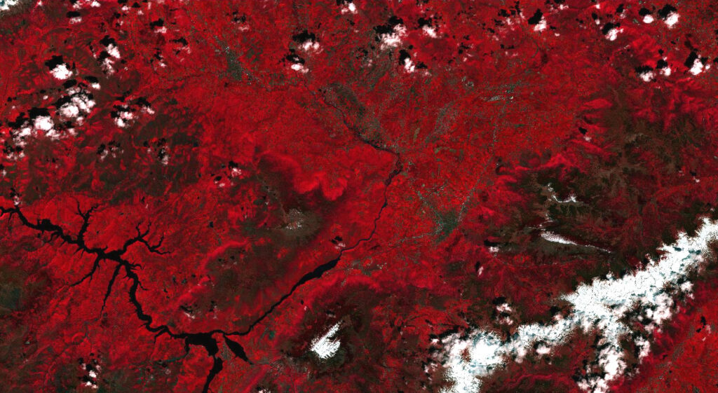
Satellite image of the month – February – Amazon Rainforest (Brazil and Bolivia)
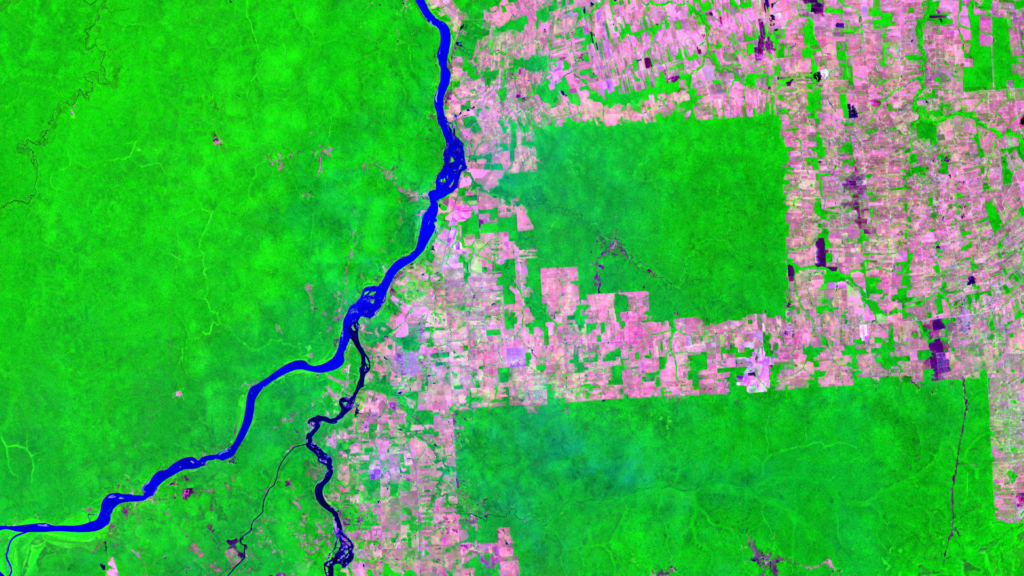
Amazon Rainforest – Brazil and Bolivia, recorded by the Sentinel-2A satellite on September 20, 2022 Our satellite image of the month February shows part of the South American rainforest in the Brazilian-Bolivian border region. The image shows a color composite based on Sentinel-2 data from the Copernicus program. Sentinel-2 data are multispectral satellite images which […]
Satellite image of the month – January – Yalu River (People’s Republic of China and Democratic People’s Republic of Korea)
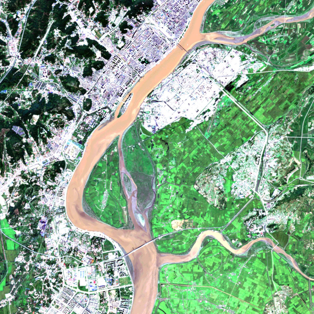
Yalu River – People’s Republic of China and Democratic People’s Republic of Korea, recorded by the Sentinel-2A and 2B satellites on September 18, 2019 and on September 12, 2021 Our satellite image of the month January shows a part of the China-North Korea border. The two images show a composition of different bands based on […]
Satellite image of the month – December – Super Pit gold mine (Australia)
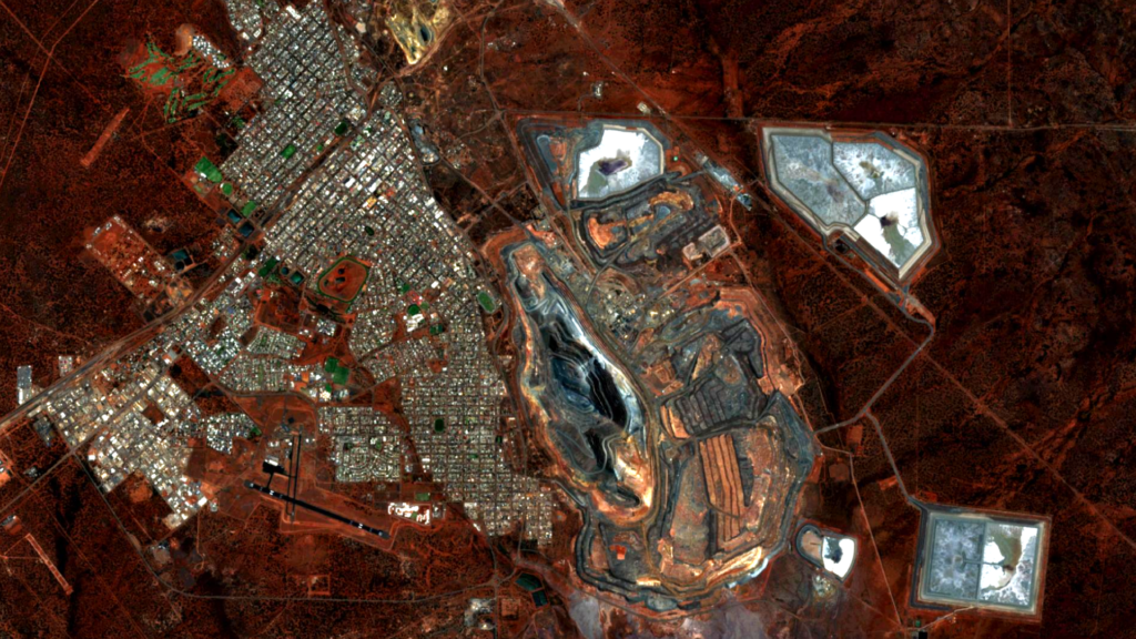
Super Pit gold mine – Australia, recorded by the Sentinel-2A satellite on November 21, 2022 This month’s satellite image shows Australia’s largest gold mine in terms of area: the Super Pit gold mine. The image shown is based on multispectral satellite data from the Sentinel-2 satellite of the EU Copernicus program. These data are available […]